Eagle Walk Stage 8, © Tirol Werbung/Jens Schwarz
Eagle Walk Stage 8: Achensee, © Tirol Werbung/Jens Schwarz

Eagle Walk Stage 08: Erfurter Hütte - Lamsenjochhütte

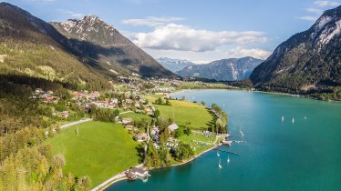
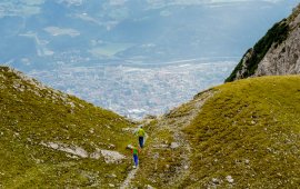
This day, the Eagle Walk starts gently. Take the Rofan gondola for an effortless and scenic downhill ride from the Erfurter Hütte hut to Maurach and enjoy magnificent views of emerald Lake Achensee. Walk along the southern and south-western lake shore to Pertisau, where you take the paved road into the Falzthurntal Valley, bringing you to the Gasthaus Falzthurn inn and Sennhütte hut. Then, continue along a gravel road to the Gramaialm hut and further on into the valley towards the Lamsenjochhütte hut. The steep gradient will keep you warm as you follow narrow switchbacks up, up, up to reach this hut, which is also the destination of this stage. When you break out onto a col, catch your breath and call it a day: the Lamsenjochhütte hut is the perfect respite for those who have braved the character-building climb leading up to it.

Interesting Facts

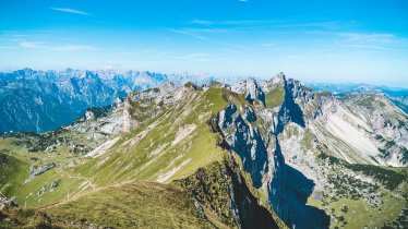
Eagle View ·On your way to the Lamsenjochhütte hut across the Falzthurntal Valley you will enter the lofty Karwendel Mountain Range. Look around at the many cirques. These are concave, circular basins below peaks and ridges that were carved by the base of a glacier. The name “Karwendel” probably comes from the Germani Kérwentil, who owned a farm in the Upper Inntal Valley, somewhere around Scharnitz. The area was called “Kerwéndelau”, the alpine pasture belonging to the farm was named “Karwéndl”.

Eagle Kick ·The use of Tirolean shale oil, which can be bought at the “Vitalberg” (literally “Mountain of Vitality”) in Pertisau, quickly revitalises tired feet again. Its intensive smell is, however, not to everyone's taste. This kind of “doping” has helped experienced hikers to climb to the top of 2,508-metre Lamsenspitze peak – using plenty of fixed cable as support in exposed places.

Interesting Facts Eagle View ·On your way to the Lamsenjochhütte hut across the Falzthurntal Valley you will enter the lofty Karwendel…

Read moreShow less
Open interactive map

Starting point  

Erfurter Hütte

Finishing point

Lamsenjochhütte

Mountain chain

Karwendel Mountains

Length

17 km

Total hiking time

5h

Features

  • Wheelchair-accessible Hiking Route
  • Circular hike

Difficulty rating

intermediate (red mountain trails)

Altitude

1,950m 930m

Elevation uphill 1,030m
Vertical metres downhill 70m

Fitness level

Technique

Best time of year

Jan
Feb
Mar
Apr
May
Jun

Jul
Aug
Sep
Oct
Nov
Dec

* These are approximate values and recommendations. Please take your personal fitness level, technical ability and the current weather conditions into account. Tirol Werbung cannot guarantee that the information provided is correct and accepts no liability.

Eagle Walk

This is a stage of the Eagle Walk, Tirol's most famous long-distance hiking trail.

Downloads

Trail description

Starting point: Erfurter Hütte

Hikers who have stayed the night at the Erfurter Hütte hut can take the Rofan gondola down to Maurach. Others can simply travel to Maurach to start the hike ther. The trail takes you along the southern or rather south-western shores of Lake Achensee to Pertisau and further on to the beginning of the toll road leading to the Karwendel Valleys (in Pertisau follow signage to “Karwendeltäler”). Having passed the tollgate, bear left and follow the trail towards “Gramaialm” into the Falzthurntal Valley. Continue through the forest on the wide, paved footpath leading gradually uphill until you reach the Falzthurnalm with its alpine pasture hut and the Alpengasthof Falzthurn inn, which is a nice place to pause for a rest.

Food & drink: Falzthurnalm

Keep on walking further into the valley along the gently climbing footpath (do not climb the slope to your left). From time to time you will have to cross the gravel stream bed until you reach Gramaialm. From here, the trail continues along a dirt road leading further into the valley towards “Lamsenjochhütte”. Stick to your left crossing the dry stream bed, along the valley floor and pass the fork leading to Gramai-Hochleger. Follow the footpath through Gramaier Grund towards the steep slope at the south end of the valley, where you can see prominent Lamsenspitze peak rising to the right. Here the trail climbs the slope to the left before crossing the talus slopes into the valley. The final section of the trail continues upward the steep slope with many switchbacks. Once you have reached the col you are just a few steps away from Lamsenjochhütte hut, which can already be seen to your left. The hut is surrounded by the spectacular rock faces of the rugged 1,953-metre Lamsenspitze peak.

Finishing point: Lamsenjochhütte

Information on place

Arrival date

How to get here by plane, train, bus or car.

Ihr Ziel: Eagle Walk Stage 08: Erfurter Hütte - Lamsenjochhütte (47.441317,11.7635382)

powered by Rome2Rio

Search accommodation

Number of travelers

Hiking trails in this region

show more +

How did you like this article?

Want to receive an answer? If so, please get in touch using the contact form.

Go up

Is your inbox in need of a holiday?

Then subscribe to our weekly newsletter full of exclusive holiday tips from Tirol!