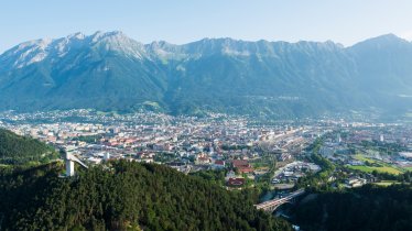
Eagle Walk Stage 14: Solsteinhaus, © Tirol Werbung/Johne Katleen
Eagle Walk Stage 14, © Tirol Werbung/Wiedenhofer Martina

Eagle Walk Stage 14: Innsbruck - Solsteinhaus

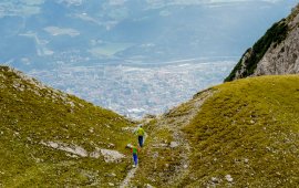
Today starts rather swiftly with a train ride on the Karwendelbahn/Mittenwaldbahn railway line from Innsbruck to Hochzirl. From there, follow the signs to Solsteinhaus. While presenting nothing in the way of technical challenges, the gradient is steep in places. It is a beautiful walk along gravel roads, small paths and dirt roads through forests and across gentle pastures. The idyllic Solnalm reveals the lodge that is your destination. The Solsteinhaus is located at 1,805 metres above sea level and boasts modern creature comforts. You can look forward to delicious and hearty local specialties and a hot shower. For those who still haven’t had enough there is even a climbing wall at the hut!

Interesting Facts

Eagle View ·Marvel at the array of geological diversity at the dramatic mountainous terrain that stretches off in every direction. The Scharnitz Learning Trail is a great opportunity to experience the great outdoors, appreciate nature at its finest and to get information about the region, its wildlife and geology. Have fun hiking while learning!

Eagle Kick ·How about a quick quiz question about the Solsteinhaus? Why is the smaller mountain called “Big Solstein” (Großer Solstein) and its 100-metre-taller brother “Little Solstein” (Kleiner Solstein)? The answer is the following: In the past, the importance of the smaller mountain was greater as it was used to raise cattle on its meadows. The Kleiner Solstein (elev. 2,637 m) is the highest peak in the Nordkette Mountains. It boasts an extremely sharp eastern ridge, while its north face is expert rock climbing terrain.

Interesting Facts Eagle View ·Marvel at the array of geological diversity at the dramatic mountainous terrain that stretches off in every…

Read moreShow less
Open interactive map

Starting point  

Innsbruck

Finishing point

Solsteinhaus

Mountain chain

Karwendel Mountains

Length

7 km

Total hiking time

3h

Features

  • Wheelchair-accessible Hiking Route
  • Circular hike

Difficulty rating

intermediate (red mountain trails)

Altitude

1,800m 920m

Elevation uphill 940m
Vertical metres downhill 70m

Fitness level

Technique

Best time of year

Jan
Feb
Mar
Apr
May
Jun

Jul
Aug
Sep
Oct
Nov
Dec

* These are approximate values and recommendations. Please take your personal fitness level, technical ability and the current weather conditions into account. Tirol Werbung cannot guarantee that the information provided is correct and accepts no liability.

Eagle Walk

This is a stage of the Eagle Walk, Tirol's most famous long-distance hiking trail.

Downloads

Trail description

Starting point: Innsbruck

Take the train along the Mittenwald railway line from Innsbruck to Hochzirl. Those who want to walk the whole route should start at Innsbruck main railway station and head westwards to Salurnerstraße road until they reach the Triumphbogen (Triumphal Arch). Then turn right into Maria-Theresien-Straße and head down to the oldtown. Pass the Golden Roof on your right, entering the Domgasse alley. As you approach the cathedral, follow the Jakobsweg ("Route of St. James") leading from Innsbruck via Kranebitten and Völs to Kematen. Take the hiking path across the Innbrücke bridge heading towards Zirl and continue through the Ehnbachklamm gorge in the direction of “Pleiner” until you reach the Hochzirl railway station. From here, follow signage to “Solsteinhaus”. North of the rail tracks, a well-maintained singletrack trail soon starts to run through deep woods. Shortly after, the singletrack trail leads into a fairly steep dirt road that goes straight upwards. Soon, the path from Hochzirl hospital joins in from the left. Continue upward and in north-eastern direction on the steep path leading through the woods. After crossing the little stream that flows down from Brunnenschrofen, the terrain is almost level or only gently inclining for a while. Then, the route is almost similar to a roadway and becomes steeper again. At an elevation of some 1,350 metres above sea level, the route merges with a broad forest road that takes you further up, passing a little gorge. After the stream, the singletrack trail leads through thinning forest and across dwarf pines until you can see the wide open alpine meadows of idyllic Solnalm alpine pasture. From there, you can enjoy the first glimpse of Solsteinhaus lodge. Pass Solnalm alpine pasture to your right and hike on in northern direction into the valley towards Höllkar cirque, crossing several scree gullies. Thereafter, the path crosses the offshoots of Höllkar cirque and the stream. Finally, you walk up the hill on a gentle path through dwarf pines and arrive at Solsteinhaus lodge on Erlsattel saddle, 1805 metres above sea level.

Finishing point: Solsteinhaus

Information on place

Arrival date

How to get here by plane, train, bus or car.

Ihr Ziel: Eagle Walk Stage 14: Innsbruck - Solsteinhaus (47.2809903,11.2497316)

powered by Rome2Rio

Search accommodation

Number of travelers

Hiking trails in this region

show more +

How did you like this article?

Want to receive an answer? If so, please get in touch using the contact form.

Go up

Is your inbox in need of a holiday?

Then subscribe to our weekly newsletter full of exclusive holiday tips from Tirol!