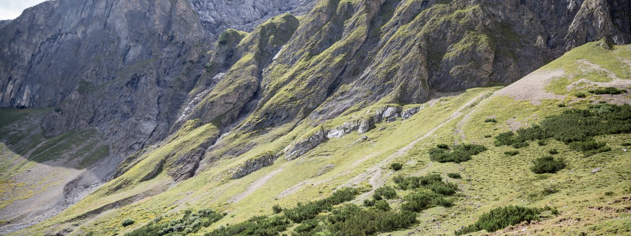
Eagle Walk Stage 18, © Tirol Werbung/Dominik Gigler

Eagle Walk Stage 18: Lorea Hütte - Anhalter Hütte

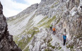
The first section of the hike is fairly easy, gently ascending alpine greenery before making an Achilles-aching ascent to the Loreascharte ridge. Beyond, it’s a knee-jarring descent to the Heimbach Valley, from where you will gain the Schweinsteinjoch col on your way to the Tarrentonalm hut. This is a perfect walk to show intrepid hikers the extraordinary places their feet can take them. However, you’ll need to turn your focus from the scenery to your feet as the steep descent from Hinterberg col can be treacherous and slippery in rain, and you'll have to cross a few snowfields as snow may remain here well into August. Beyond Hinterberg col and Kromsattel saddle, the path winds down meadows and alpine pastures to reach the Anhalter Hütte hut. Call it a day and savour the breathtaking views!

Interesting Facts

Eagle View ·If you opt for the alternative route across the Heiterwand-Nordsteig trail from the Schweinsteinjoch col, running some 100 metres above, the trail takes you through an abandoned mining area. The decayed tunnels and shafts, where once lead and zinc was mined, are connected by a stunning, 25-kilometre-long underground network. Guided tours of the network are offered by the Tarrenz Mining Club. Visit the popular Gurgltal Miner's World in Tarrenz for a look below the surface into local mining history.

Eagle Kick ·You'll work up a sweat on the vigorously steep climb onto the Loreascharte ridge (elev. 2,315m) with lots of talus and scree waiting to be conquered. Beyond the ridge, the trail steeply descends to Heimbachtal Valley. Trail conditions aside, this route requires some serious stamina. The rewards are great - outstanding views of the western Lechtal Alps - but they come at a substantial price in lung and leg pain. Be prepared to work for every view you get.

Interesting Facts Eagle View ·If you opt for the alternative route across the Heiterwand-Nordsteig trail from the Schweinsteinjoch col,…

Read moreShow less
Open interactive map

Starting point  

Lorea Hütte

Finishing point

Anhalter Hütte

Mountain chain

Lechtal Alps

Length

16 km

Total hiking time

6 h 30 min

Features

  • Wheelchair-accessible Hiking Route
  • Circular hike

Difficulty rating

intermediate (red mountain trails)

Altitude

2,310m 1,410m

Elevation uphill 1,180m
Vertical metres downhill 1,200m

Fitness level

Technique

Best time of year

Jan
Feb
Mar
Apr
May
Jun

Jul
Aug
Sep
Oct
Nov
Dec

* These are approximate values and recommendations. Please take your personal fitness level, technical ability and the current weather conditions into account. Tirol Werbung cannot guarantee that the information provided is correct and accepts no liability.

Eagle Walk

This is a stage of the Eagle Walk, Tirol's most famous long-distance hiking trail.

Downloads

Trail description

Starting point: Lorea Hütte

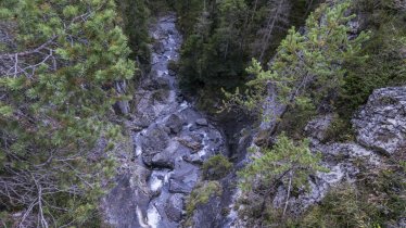
Start off at the Lorea Hütte and follow signage to “Loreakopf” on a trail that gently ascends rolling alpine pastures in the beginning. At the fork, turn left on the signposted “Loreakopf” track and climb up to Loreascharte ridge, mainly across scree and on a steep path in the upper part. On the other side, steeply descend on a singletrack trail through a grass flank down into the Heimbachtal Valley. At the base of the descent, bear left on the valley floor and head towards “Nassereith”. Now, a narrow singletrack trail along the stream (one section leads right along the bed of the stream) gently descends out of the valley. At the point where the valley sharply bends to the right, change to the right bank of the stream; pay attention to the marking on the rock on the right-hand side. From here, the trail enters the woods and descends south-westward into the Tegestal Valley, where it turns onto a forest road (the path joins the road at an altitude of around 1,400 meters above sea level). The forest road gradually climbs into the valley, passing the branch-off to Heiterwand Hütte (to the left). Always stay in the Tegestal Valley, which is very gentle in this section. Walk into the wide open alpine pastures and leisurely ascend to the Schweinsteinjoch ridge (elev. 1,564 m), where the route to Sinnesbrunn branches off. The Eagle Walk, however, proceeds in the same direction across the gentle alpine pastures, descending to Hintere Tarrentonalm hut (elev. 1,519 m).

Food & drink: Hintere Tarrentonalm

Here, follow signage to Anhalter Hütte and climb up leisurely on a wide forest road. Shortly after, turn left at the fork and walk along the creek. The route passes the Schafer Hütte hut and then turns onto a singletrack trail. Now, in open terrain below the Heiterwand rock face, follow the leisurely ascending singletrack trail until you reach Hinterberg (elev. 2,202 m). From there, make your way down across a steep tussock slope ("Schwarze Erde", literally "Black Earth"), traverse the cirque and walk on a plain singletrack trail over to the Kromsattel saddle. From here, gently descend across alpine pastures and meadows to the quaint Anhalter Hütte, situated at an elevation of 2,040 metres at the foot of the jagged Heiterwand rock face.

Finishing point: Anhalter Hütte

Information on place

Arrival date

How to get here by plane, train, bus or car.

Ihr Ziel: Eagle Walk Stage 18: Lorea Hütte - Anhalter Hütte (47.3464434,10.7913704)

powered by Rome2Rio

Search accommodation

Number of travelers

Hiking trails in this region

show more +

How did you like this article?

Want to receive an answer? If so, please get in touch using the contact form.

Go up

Is your inbox in need of a holiday?

Then subscribe to our weekly newsletter full of exclusive holiday tips from Tirol!