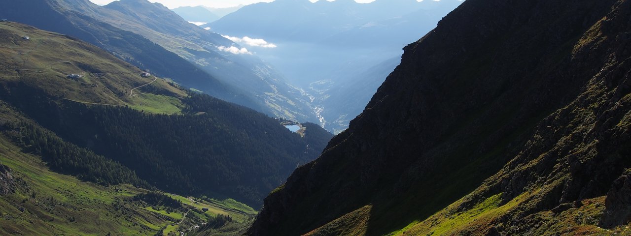
Nine stages, nine days, 11,000 metres of climbing and descending, 120 kilometres, 60 hours – the raw facts of this challenging circular hike give you an idea of just how spectacular it is. Completing the Paznaun High Trail is definitely a must on the bucket list of any true alpinist. Seldom is one given the opportunity to discover Paznaun's diverse alpine landscapes as on this high alpine hike. All stages can also be completed individually.


Long-Distance Hiking Trail
Starting point
Parish church in See
Finishing point
Tourist information centre in See
Mountain chain
Verwall Mountains
Samnaun Mountains
Length
120 km
Duration
9 day(s)
Features
- Wheelchair-accessible Hiking Route
- Circular hike
Difficulty rating
difficult (black trails)
Altitude
Elevation uphill 11,050m
Vertical metres downhill 11,170m
Fitness level
Technique
Best time of year
* These are approximate values and recommendations. Please take your personal fitness level, technical ability and the current weather conditions into account. Tirol Werbung cannot guarantee that the information provided is correct and accepts no liability.
Public transport
- Accessible using public transport
Parking
Parish church, See
Downloads
Trail description
Stage 1: See – Ascherhütte
Uphill/downhill: 1,480/270 vertical metres, walking time: 5.5 hours, distance: 12.5 kilometres
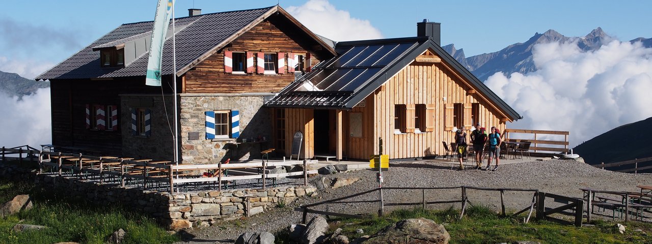
The first stage of the Paznaun High Trail begins at the parish church in See and leads in an easterly direction to Frödenegg, through the so-called "Giggler Tobel" and on to Giggl. From the Giggler Alm hut, the route leads through larch forests and on to the end of this stage, the Ascherhütte at 2,256 metres above sea level.
Stage 2: Ascherhütte – Kappl
Uphill/downhill: 920/2,000 vertical metres, walking time: 8 hours, distance: 21.5 kilometres
Starting from the Ascherhütte, this stage leads into the Furglertal Valley and on to Bergli. After passing the Fisser Jagshütte hunting lodge, the route leads on to Stial Alm and down to Flathtal, where the ascent to the Gamperthun Alm begins. Walk along the “Almweg” trail to Grübeletal and on to Kappl via the "Panoramaweg" trail.
Stage 3: Kappl – Ischgl
Uphill/downhill: 1,800/1,600 vertical metres, walking time: 7.5 hours, distance: 16 kilometres
This stage starts from Kappl and leads past the Rotwegkapelle chapel and on to the Visnitz Alm hut. At the end of the Visnitztal Valley you will reach the Untere Zollhütte and shortly afterwards the Obere Zollhütte. A narrow trail leads to the Visnitzjoch ridge in Switzerland. Above the Alp Bella, a narrow path below the Mullersattel ridge takes you directly to “the lakes” and Flimjoch ridge. From now on you are back on Austrian soil and the trail guides you down to Upper Velillalpe and then Ischgl.
Stage 4: Ischgl – Galtür
Uphill/downhill: 2,000/1,800 vertical metres, walking time: 9.5 hours, distance: 21 kilometres
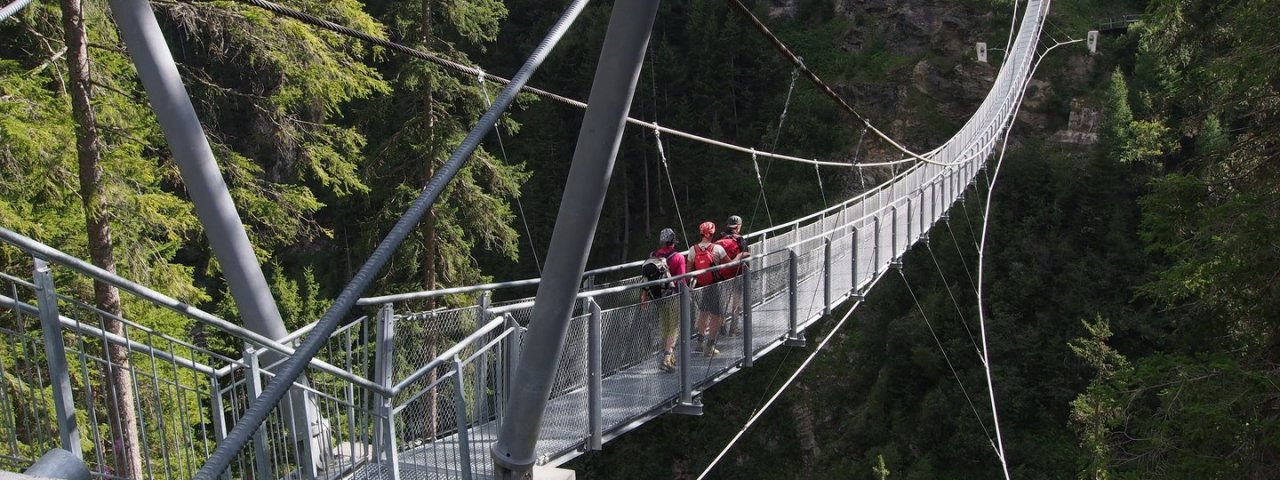
The parish church in Ischgl is the starting point for this stage, which heads over a suspension bridge to the Tschamatschkopf mountain. From there the route carries on to the 2,478-metre-high Rauer Kopf, from where the trail leads along a ridge and into the valley. First you will reach Außerbergli and then Innerbergli, before arriving at the Lorein Alpe. From there it takes around half an hour to get to the "Stafali" pond with a barbecue area. The Galtür High Trail then leads down to Galtür.
Stage 5: Galtür – Friedrichshafener Hütte
Uphill/downhill: 850/250 vertical metres, walking time: 3.5 hours, distance: 7 kilometres
This is the most “leisurely” stage of the Paznaun High Trail and leads from the centre of Galtür village in the direction of Außertschafein and on to the Friedrichshafener Hütte.
Stage 6: Friedrichshafener Hütte – Darmstädter Hütte
Uphill/downhill: 1,150/950 vertical metres, walking time: 6.5 hours, distance: 10 kilometres
This stage takes us from the Friedrichshafener Hütte, along the notorious Ludwig-Dürr-Weg trail and up to Matnaljoch ridge. Continue on the signposted route via the "Schönpleisübergang" on the "Zwischengrat" at 2,770 metres, crossing a few snowy fields and steep sections, before reaching the Rautejoch at 2,750 metres. After crossing the glacial foothills of the Küchelferner you will have the end stage of this section within your sights, the Därmstädter Hütte.
Stage 7: Darmstädter Hütte – Niederelbe Hütte
Uphill/downhill: 1,000/1,100 vertical metres, walking time: 5.5 hours, distance: 9 kilometres
This stage leads from the Darmstädter Hütte and along the "Advokatenweg" trail, through the Hintere Kartell and up over boulders and rocks to the 2,841-metre-high Schneidjöchl. The Hoppe-Seyler-Weg trail begins here, which leads down a narrow path to the Vergrößkar, before heading back up to the Kieler Wetter Hütte. This is followed by a descent to the Niederelbe Hütte.
Stage 8: Niederelbe Hütte – Edmund Graf Hütte
Uphill/downhill: 700/600 vertical metres, walking time: 4.5 hours, distance: 9 kilometres
Stage 8 leads from the Niederelbe Hütte out of the valley and along the beautifully landscaped "Kieler Weg" trail. The ascent to the 2,697-metre-high Schmalzgrubenscharte begins at the rear of the Kappl ski area. The Rifflerweg trail leads from here to the Schmalzgrubenseen lakes, before heading back down to the Edmund Graf Hütte.
Stage 9: Edmund Graf Hütte – See
Uphill/downhill: 1,150/2,600 vertical metres, walking time: 9.5 hours, distance: 22 kilometres
The so-called “crowning stage” of the Paznaun High trail leads from the Edmund Graf Hütte up to the Kappler Joch ridge, before passing the Blankaseen lakes and down to the Durrichalpe. After a climb to the Spidur Alpe, follow signposts for Niederjöchl and you will reach a 2,550-metre-high ridge offering absolutely magnificent views. Climb down to "Falgeneier" via the Kleingfall Alpe and carry on to the finsing point in See.


