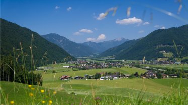
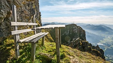
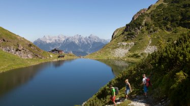
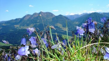
This three-day trek through the lofty Wilder Kaiser Mountains is a fantastic trip filled with verdant pastures, steep climbs, breathtaking ridge walks and jaw-dropping views. Expect narrow and steep paths and rock scramble sections with cables to protect you from a sheer vertical drop. The craggy rock formations around the Schleierfall waterfall offer challenging routes to extreme climbers. Physical fitness, endurance, experience and sure-footedness are needed for this strenuous scramble. Your reward, however, is miles of ridge walking with views among the best in the region. The views of the Predigtstuhl mountain, the prominent Rettenstein peak and the Hohe Tauern Range will keep you entertained while the ups and downs along the ridgeline keep your legs working.

Starting point
Stripsenjochhaus, Gaudeamushütte, Schleierwasserfall
Hike to
Stripsenjochhaus, Gaudeamushütte, Schleierwasserfall
Finishing point
St. Johann in Tirol
Mountain chain
Kaiser Mountains
Length
30.2 km
Duration
3 day(s)
Features
- Wheelchair-accessible Hiking Route
- Circular hike
Difficulty rating
difficult (black trails)
Altitude
Elevation uphill 2,210m
Vertical metres downhill 2,285m
Fitness level
Technique
Best time of year
* These are approximate values and recommendations. Please take your personal fitness level, technical ability and the current weather conditions into account. Tirol Werbung cannot guarantee that the information provided is correct and accepts no liability.
Public transport
- Accessible using public transport
Parking
Car park at the start of the toll road into the Kaiserbachtal Valley
Places serving food & drink
Stage 1:
- Stripsenjochhaus (first half of May until middle of October)
Stage 2:
- Gaudeamus-Hütte (first half of May until end of October)
Stage 3:
- Obere Regalm (early June until early October)
- Ackerlhütte (middle of May until end of October; detour)
- Gasthaus Rummlerhof (April until October, closed on Monday)
- Various locations in St. Johann
Downloads
Trail description
Stage 1: Kaiserbachtal - Feldberg - Stripsenjochhaus
Uphill/downhill: 1,184/345 vertical metres, walking time: 6 hours, distance: 11.1 kilometres, highest point: 1,813 metres, difficulty level: intermediate (red)
Take the car or bus (30 minutes) to the car park at the toll booth marking the start of the road into the Kaiserbachtal Valley. Follow this road for around one kilometre until you reach a junction. Take the right fork onto Almweg Trail to Obere Scheibenbühelalm. Having passed the Obere Scheibenbühelalm alpine pasture hut, the trail emerges onto a narrow path that crosses the long crest of the Scheibenbühelberg ridge up to the 1,813-metre-high Feldberg peak. In some sections there are cables anchored into the rock to protect you from a sheer vertical drop. After all that hard work, take a rest at the summit and admire the fabulous panorama. The walk continues along the ridge, with a steady climb taking you atop the Stripsenkopf mountain with its lookout pavilion at an elevation of 1,807 metres. A steep path brings you down to the Stripsenjochhaus lodge, your home for the night.
Stage 2: Stripsenjochhaus - Ellmauer Tor - Gaudeamushütte
Uphill/downhill: 603/914 vertical metres, walking time: 4.5 hours, distance: 5 kilometres, highest point: 1,981 metres, difficulty level: difficult (black trails)
Day two takes you into the sublime high country! From the Stripsenjochhaus lodge, walk down a few metres to Wildanger until you reach the trailhead of Eggersteig, with nothing but boulders and scree waiting to be conquered. The most difficult part of this hike, this narrow path is an exposed scramble that leads to the Steinerne Rinne, a rocky gully. There, prepare for some serious work. The incline gets steeper while the terrain gets rougher. The steep gradient will keep you warm as you follow narrow switchbacks up to Ellmauer Tor at an elevation of 2,006 metres (some sections have permanently fixed cables for protection). Pause for a well-earned rest. The final section with loose rock and boulders follows an alpine path down to the Gaudeamushütte hut.
Tip! If you would like to scale another, relatively easy mountain, head on from Ellmauer Tor and summit the Hintere Goinger Halt (2,192 metres). The ascent is a rock scramble that takes some 50 minutes to complete. Off-trail experience and sure-footedness are needed.
Stage 3: Gaudeamushütte - Schleierwasserfall - St. Johann
Uphill/downhill: 429/1,035 vertical metres, walking time: 5 hours 15 minutes, distance: 14.1 kilometres, highest point: 1,568 metres, difficulty level: intermediate (red)
As you climb from the Gaudeamushütte hut, the trees thin, first turning to stunted sub-alpine firs then disappearing into open talus slopes and scattered dwarf pine fields. At the same time, breathtaking views open around you as you climb above Baumgartnerköpfl peak, famous for its ‘Mountaineer’s Grave’. The descent to the tiny Stiegenbach waterfall has few switchbacks and winds down across scree and talus slopes. The jagged rock formations around the Schleier waterfall offer challenging routes to extreme climbers. The route continues with a slightly challenging traverse of the Diebsöfen cave. From there, a gentle forest road takes you to the Rummlerhof inn, the end of this wonderful three-day trek.
Tip! A beautiful, optional detour awaits you on the descent to the Stiegenbach waterfall at the Ackerlhütte hut. At the junction, take the upper fork towards Granderalm. Shortly before reaching this alpine hut, a short metal ladder will take you to up to the Schleier waterfall.


