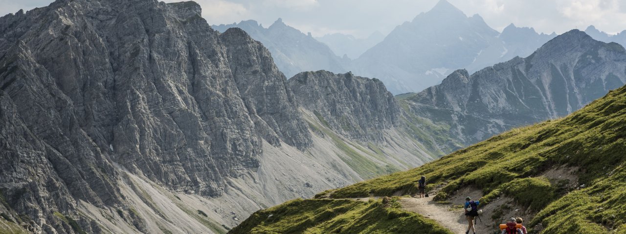
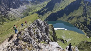
This two-day trek in the Allgäu Alps begins in Weißenbach am Lech (885 metres) and leads through a section of the Vilsalpsee Nature Reserve (1,165 metres) with its biotopes and sensitive ecosystem. The ascent to the , Birkental Valley leads past the mighty 2,341-metre-high Thaneller mountain into the Tannheimer Tal, one of the most beautiful high valleys in Europe. Further highlights along the way include the Traualpsee lake (1,631 metres), the Lachenspitze mountain (2,126 metres) and the Schrecksee lake (1,813 metres) with its tiny island as well as majestic views of the Rauhhorn (2,240 metres) and the Gaishorn (2,247 metres). The trek concludes in Tannheim at 1,075 metres above sea level. Accommodation and hearty food is provided at the Landsberger Hütte (1.,810 metres). This trek requires good overall fitness, surefootedness and a good head for heights. Please be careful when completing the traverses, especially if the ground is wet.

Starting point
Weißenbach am Lech
Hike to
Landsberger Hütte
Finishing point
Tannheim
Mountain chain
Allgäu Alps
Length
29.4 km
Duration
2 day(s)
Features
- Wheelchair-accessible Hiking Route
- Circular hike
Difficulty rating
intermediate (red mountain trails)
Altitude
Elevation uphill 1,517m
Vertical metres downhill 1,301m
Fitness level
Technique
Best time of year
* These are approximate values and recommendations. Please take your personal fitness level, technical ability and the current weather conditions into account. Tirol Werbung cannot guarantee that the information provided is correct and accepts no liability.
Public transport
- Accessible using public transport
Parking
Weißenbach, south of the church square
Places serving food & drink
- Stage 1: Landsberger Hütte (May until October)
- Stage 2: Vilsalpe (May until mid-October), s’Höf Bräuhaus, Tannheimer Dorfstube, Restaurant Hotel Schwarzer Adler & Dependance Sonnenheim and other locations in Tannheim
Downloads
Trail description
Stage 1: Weißenbach am Lech – Landsberger Hütte
Uphill/downhill: 1,001/191 vertical metres, walking time: 5.5 hours, distance: 13.8 kilometres, highest point: 1,915 metres, difficulty: intermediate (red)
From the parish church in Weißenbach, walk into the valley for a short distance, cross the Weißenbach stream and continue parallel to it on the right-hand bank all the way to the tennis courts and the “Musikantenstadel”. The trail turns right before reaching the “Musikantenstadel” and continues ahead in the same direction. It soon crosses the Weißenbach stream on a footbridge again and then turns left onto the paved road that climbs the mountainside. Keep following the signs for “Birkental” and “Landsberger Hütte” and pass the gypsum factory that is located on the right-hand side of the trail. From here you climb a series of zigzags through abandoned open pit mining sites. Turn right at the timbered structure onto a forest road that gradually ascends through thin woods until you reach the entrance to the Birkental Valley. From here it is a nice stroll with easy climbs into the Birkental Valley on the tree-covered, southern valley side up to an elevation of 1250 metres. Here, the trail begins a steady descent through wide open terrain and takes you down to the valley floor. At the base of the descent, cross the creek west of the Höflishütte hut and follow a singletrack trail that skirts the slope into the valley. This trail soon leaves the creek and winds through groves up into wide open meadows and onto a plateau (parts of the ascent are rather steep). After passing the plateau, the trail crosses over the Östliches Lachenjoch ridge (1,915 metres), passing a tiny swamp lake to the left on its way to the Landsberger Hütte. This hut can be seen from afar (you have to climb the last few meters to reach the hut).
Tip! After World War Two, archaeologists discovered the remnants of a Roman grave in Weißenbach am Lech. It is located on what would have been an important salt trading route.
Stage 2: Landsberger Hütte - Tannheim
Uphill/downhill: 411/1,110 vertical metres, walking time: 5.5 hours, distance: 15.6 kilometres, highest point: 1,997 metres, difficulty: intermediate (red)
From the Landsberger Hütte, walk towards the “Jubiläumsweg” trail and follow the path that climbs the meadows to the west. At the fork, take the “Jubiläumsweg” trail that gradually ascends to the Kastenjoch ridge, embedded between the Roter Spitze and Steinkarspitze peaks. Climb the ridge in a southern direction for a very short distance and turn right at the first fork (“Saalfelder Weg”). A gradual descent takes you down meadows studded with scree and talus (follow the route in this section and bear right at the junction). When the trail reaches a crest, proceed ahead in the same direction. The trail soon begins a slight ascent through meadows and climbs another ridge that is named Kastenjoch as well. From there, follow signs for “Jubiläumsweg, Vilsalpsee” again. The trail continues ahead through very rugged terrain (tussock slopes with exposed ridges), levelling off high above the valley bottom and slightly descending later. Eventually, a short, gentle climb takes you atop the Kirchendachsattel col. Beyond the col, the trail leaves Tirol for a short while and passes into German territory. Carry on to “Rauhhorn” and traverse the mountainside above the Schrecksee lake (1,813 metres). Bear towards “Rauhhorn” at the next fork, where the trail resumes its ascent and traverses the tussock slope up to an elevation of 2000 metres (in switchbacks here and there and through exposed and rugged terrain at the end). Continue ahead in the same direction and descend a few metres to reach the ridge south of the Rauhhorn peak. Here, turn right onto the “Jubiläumsweg” trail once more and re-enter Tirol. The trail initially descends rather steeply: later you will traverse the rugged tussock slopes below the Rauhhorn mountain on a well-defined trail. Bear right at the junction and descend through scree and talus slopes. Follow the signs to “Vilsalpsee” on the trail that descends to the right through meadows with scrubs (trees grow in its lower section) to Vilsalpe. Pass Vilsalpe (1,713 metres) on your way to the Vilsalpsee lake and skirt its western shore on a level footpath until you reach the north shore. Proceed ahead and turn onto the trail that runs right of the access road. Soon, the trail crosses the road and enters the woods on a slight, gradual ascent. Finally the trail merges with the road on which you walk out of the valley to Tannheim (keeping the same direction).
There is a bus from Tannheim to Weißenbach. The journey takes around 40 minutes.
Tip! Visit the parish church in Tannheim and stand in awe in front of the 3,000-kilogramme bell that was cast in the year 1561 by Father Löffler and his two sons.


