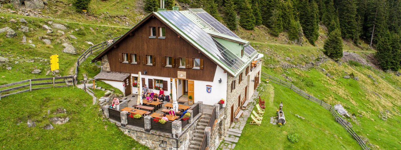
The Ludwigsburger Hütte (1,935 metres) is a mountain hut on the eastern slopes of the Geigenkamm ridge in the Ötztal Alps.
Family-friendly hut high above the Pitztal Valley
German Alpine Club, Ludwigsburg Division
The location of the Ludwigsburger Hütte on the north-eastern side of the Geigenkamm, which separates the Pitztal Valley from the Ötztal Valley, is ideal for long-distance hikes in the Ötztal Alps as well as for summit tours of varying degrees of difficulty. The hut, built in 1930 as the "Lehnerjochhütte", is located just below the tree line on a beautiful forest meadow and offers a fantastic view of the Kaunergrat ridge from its two large terraces. The Ludwigsburger Hütte is extremely family-friendly, which is shown by the playground on the pasture in front of the house and the eight-metre-high climbing rock above the hut. If you want more, there are a number of peaks above the hut that can be reached via climbing paths. There is room for a total of 65 people in the mattress camps and eight room camps. During the cold season there is a winter room (key from Alpine Club).
How to get to the Ludwigsburger Hütte
From Zaunhof-Grüble (settlement on edge of St. Leonhard, car park at small cable car used to transport provisions to the hut) 1.5 hours (forest trail) / 2 hours (forest road)
Walks and hikes in the area (walking time to summit)
Lehnerjoch (2,510 metres), 2 hours, intermediate
Panorama-Rundweg, 2.5 hours, intermediate
Hoher Gemeindekopf (2,771 metres), 3 hours, intermediate
Fundusfeiler (3,079 metres), 4.5 hours, intermediate
Kreuzjöchelspitze (2,908 metres), 4 hours, difficult
Further huts in the area
Erlanger Hütte, 3,5 hours
Hochzeigerhaus, 4,5 hours
Frischmannhütte, 4,5 hours
Hauerseehütte, 9 hours
Family-friendly hut high above the Pitztal Valley German Alpine Club, Ludwigsburg Division The location of the Ludwigsburger Hütte on the…


