Contact
Anna Gstrein Meier
6295 Ginzling
0043 664 164 1933
friesenberghaus@gmx.at
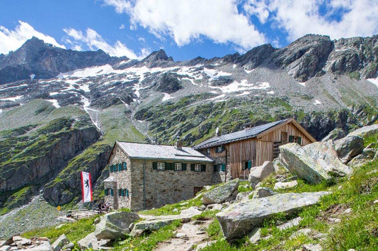
The Friesenberghaus (2,498 metres) is a German Alpine Club mountain shelter and monument to the resistance during the Second World War. It is located in the Zillertal Alps, Tirol.

A place of remembrance and new encounters
German Alpine Club, Berlin Division
The Friesenberghaus above the Schlegeis reservoir is comfortably furnished, although twelve of the wooden chairs are of particular significance: they serve as a reminder of the Donauland Division, a branch which was founded in 1921 in protest against the antisemitic trend within the German and Austrian Alpine Clubs. It consisted of both Jewish and non-Jewish members, who also planned and helped build the Friesenberghaus. After annexation of Austria to the German Reich, Friesenberghaus was impounded by the German forces and looted after 1945. It was taken over by the German Alpine Club, Berlin Division in 1968. Today the Friesenberghaus is a place of new encounters that challenges intolerance as well as being a “normal” mountain refuge hut. Guests can look forward to a pleasant atmosphere and friendly service.
From the Schlegeis reservoir/Dominikushütte (2.5 hours); from Berggasthof Breitlahner/Zemmgrund (4 hours)
Hoher Riffler (3,228 metres) 3 hours, difficult
Petersköpfl (2,677 metres), 45 minutes, difficult
Olperer (3,476 metres), 5.5 hours, difficult
Gamshütte, 8 hours
Olpererhütte, 2 hours
Dominikushütte, 2 hours
Tuxerjochhaus, 4.5 hours
The Friesenberghaus is a stop on the Berlin High Trail (Stage 1/2) and the Peter Habeler Route (Stage 3/4).


