Mountainbike-Tour Kössen via Moserberg to Reit im Winkl No. 9, 18

Kössen / Chiemgauer Alpen
Difficulty ratings: medium
Route length: 12.4 km
Duration: 1:00 h

Path No. 9,18

Tour information

  • Requirement: medium
  • Length: 12.4 km
  • Duration: 1:00 h
  • Elevation uphill:200 hm
  • Elevation downhill:197 hm
Highest point799 m

Starting point

Information office Kössen

Finishing point

information office Kössen
  • Fitness level 3 / 6
  • Technique 3 / 6

Features

  • Circular route

Best time of year

  • January
  • February
  • March
  • April
  • May
  • June
  • July
  • August
  • September
  • October
  • November
  • December

Trail condition

Asphalt, gravel

Equipment

Appropriate clothing, sturdy shoes, backpack, rain gear, mobile phone, sun cream, snack and drinks, possibly a camera.
Source: Kaiserwinkl

Description

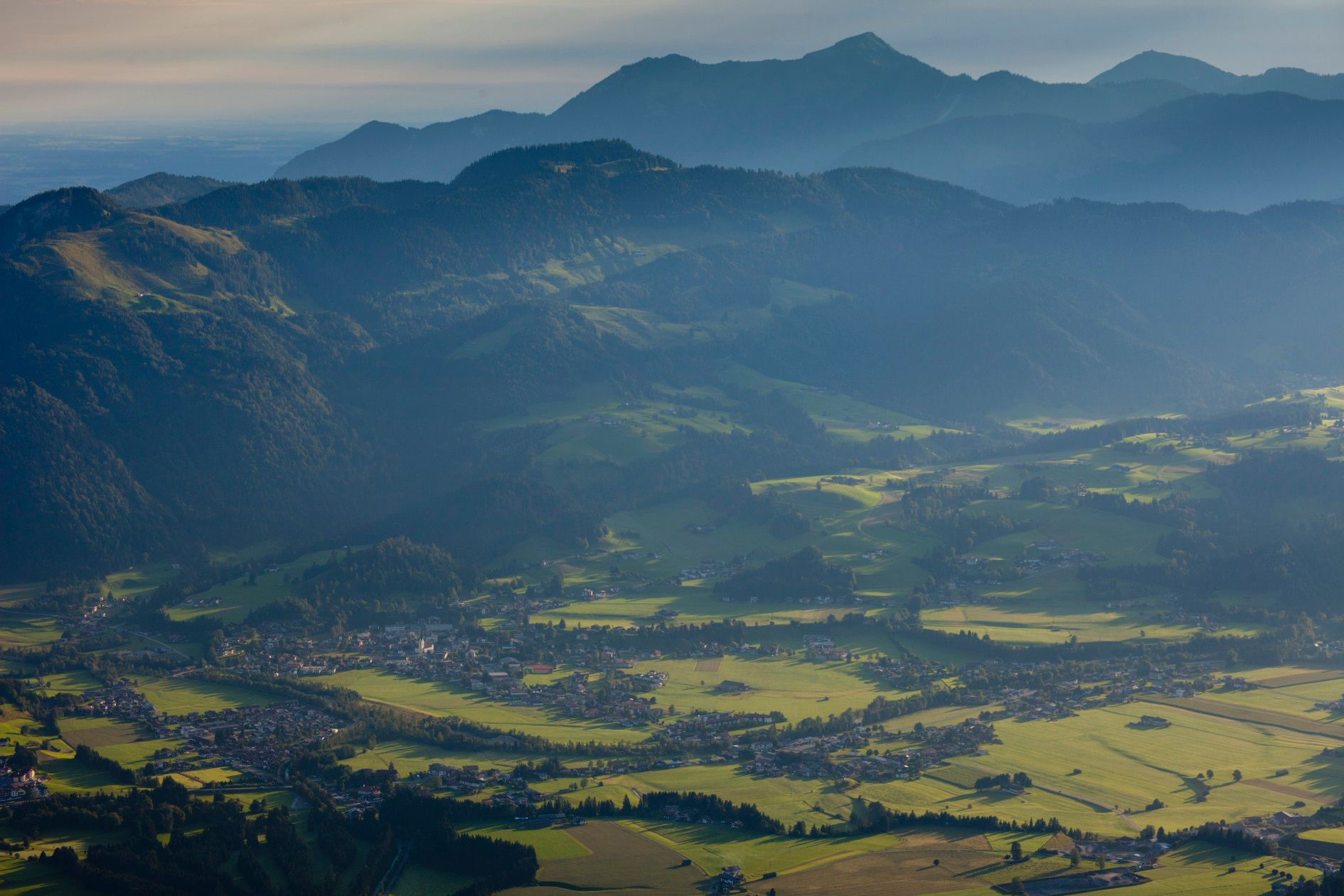
In the center of Kössen after the municipal office turn left, always following the signs Moserbergweg, Peternhof. For the effort of the ascent we are compensated by fantastic views of the Unterberg and the Kaisergebirge. At Peternhof we keep straight on, following the signs "Fußweg Reit im Winkl". At the golf course ahead we cross the border and continue via Oberbichler and the Birnbacher Straße to Reit im Winkl. From Reit im Winkl follow the main road back to Kössen.
 

Getting here

  • Arrival by public transport

    Bicycles are not allowed on public transport. Bicycles are allowed on buses with bicycle trailers.

  • Parking

    Parking spot  at the starting point-  VZ Kaiserwinkl.

Newsletter

The mountain is calling? So does our newsletter!

In our monthly newsletter we reveal the best holiday tips for Tyrol.