Arrival by public transport
Exit bus-stop: Achenkirch Abzw Gufferthütte
The path to the Gufferthütte leads through an impressive gorge. Along the way, 11 panels explain the 110-million-year geological history of the Alps, showing rock layers from the Triassic, Jurassic, and Cretaceous periods.
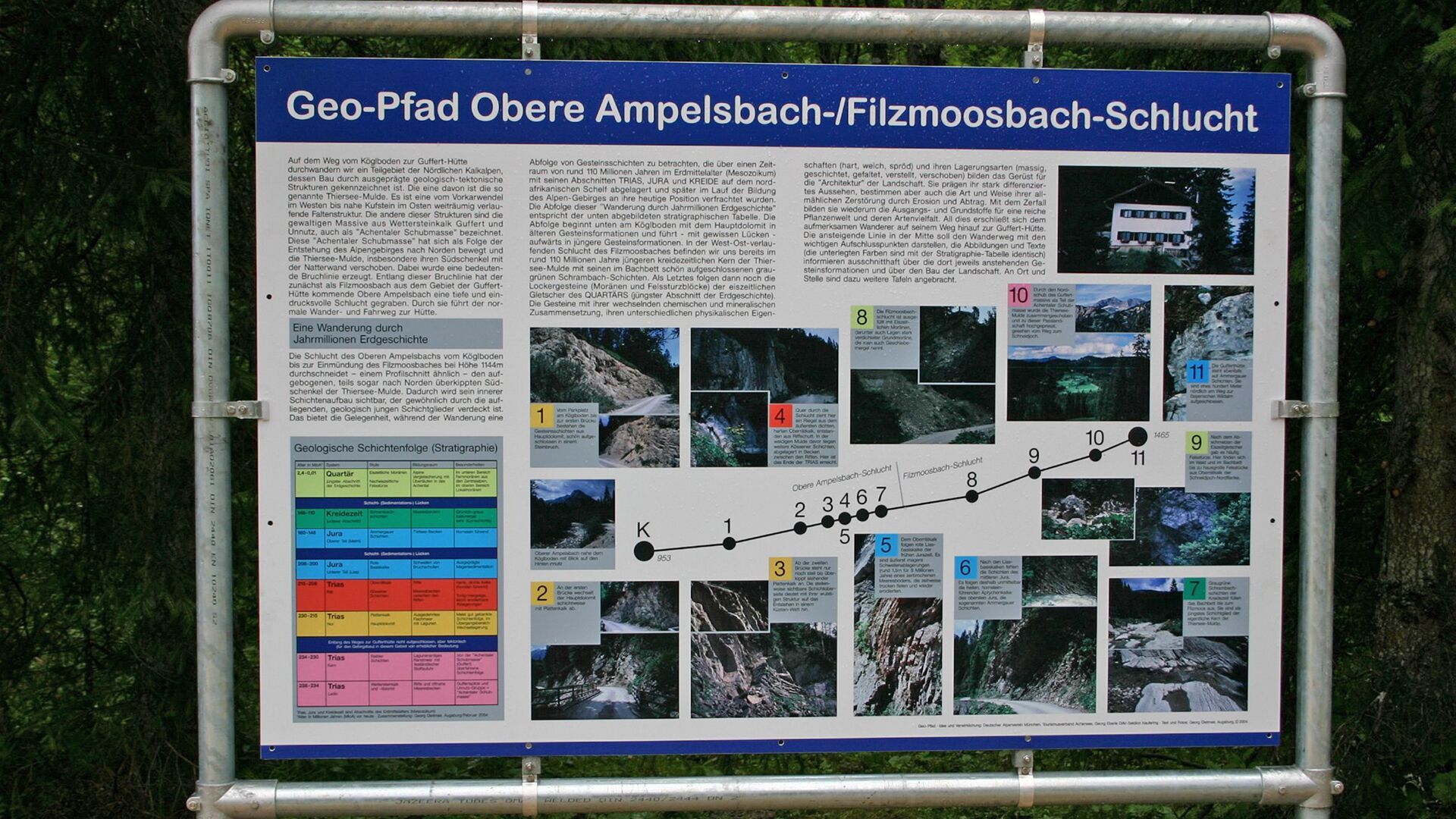
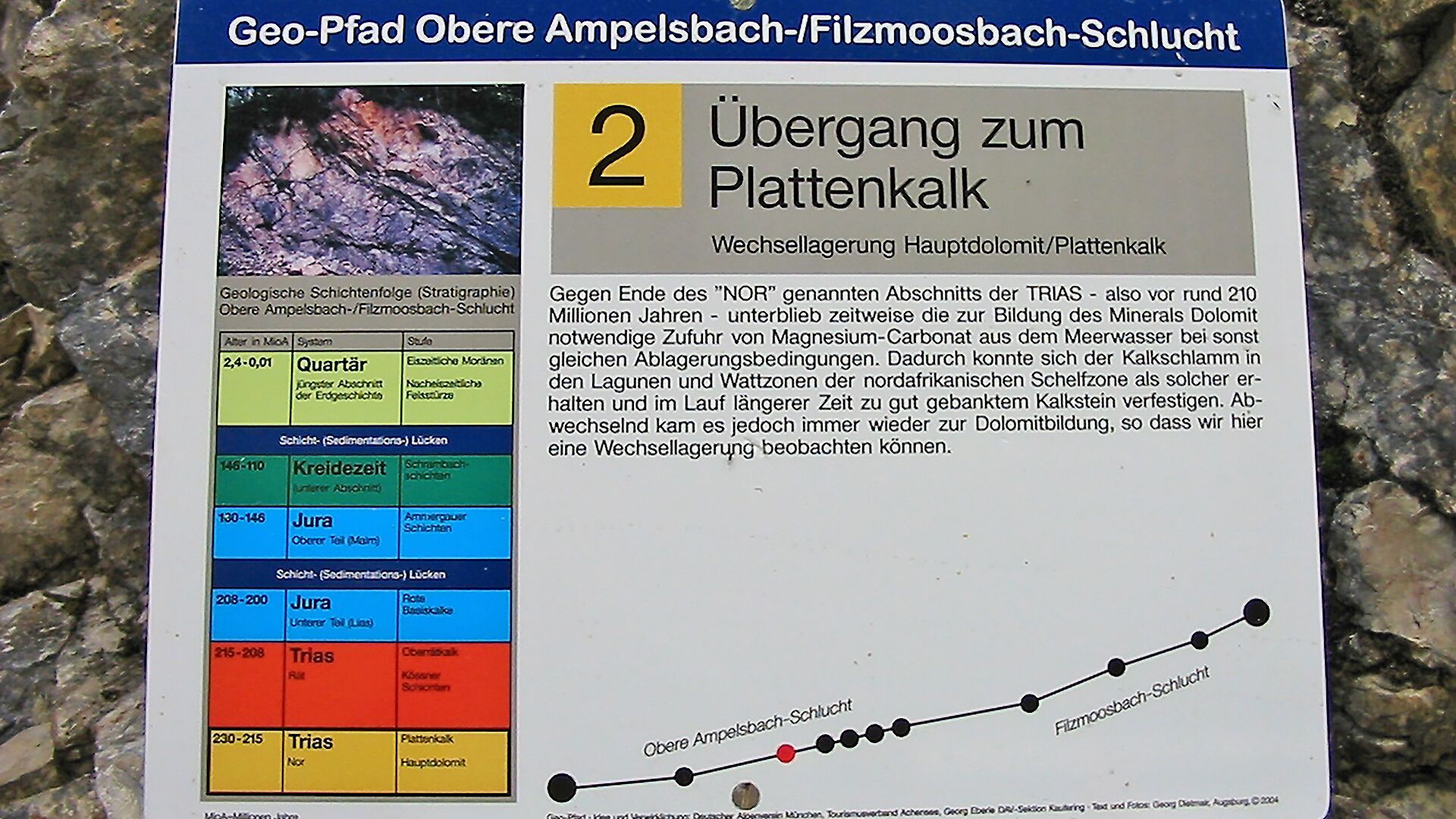
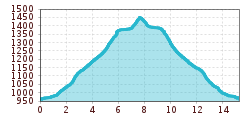
The geological trail begins at the car park Köglboden in Achenkirch and ends at the Gufferthütte mountain hut (not serviced in winter). This themed trail leads through the Obere Ampelsbach/Filzmoosbach gorge with 11 interpretive panels telling the long and exciting history of the Alps. See rock layers that were deposited on the North African continental shelf over a period of about 110 million years in the Mesozoic area with its periods Triassic, Jurassic and Cretaceous. The rock formations on this “excursion through millions of years of geological history” correspond to a stratigraphic table. The return is via the same route.
Notice: Walking time varies depending on snow conditions.
Exit bus-stop: Achenkirch Abzw Gufferthütte
Car park Köglboden in Achenkirch (paid parking lot).
