Mountain hikes Jöchelspitzbahn mountain station - Krottenkopf

Bach-Stockach / Allgäuer Alpen
Difficulty ratings: difficult
Route length: 7.0 km

Panoramic hike to the Krottenkopf.

Tour information

  • Requirement: difficult
  • Length: 7.0 km
  • Elevation uphill:1,126 hm
Highest point2,648 m

Starting point

Mountain railway valley station

Finishing point

Großer Krottenkopf

Best time of year

  • January
  • February
  • March
  • April
  • May
  • June
  • July
  • August
  • September
  • October
  • November
  • December

Trail condition

Gravel path, hiking trail,

Equipment

Good equipment is essential for your hike. The following items should definitely be in your rucksack: - Food and drink - Functional clothing for rain, wind and cold - A change of clothes - Sun protection - First aid kit - Mobile phone with a full battery (Euro emergency number 112) - Hiking map or GPS - Hiking poles Nevertheless, the following applies: light luggage is also easier to carry, so you should not weigh down your rucksack with unnecessary ballast. In addition, your hiking equipment should of course also be adapted to your particular hiking tour.
Source: Lechtal-Reutte

Description

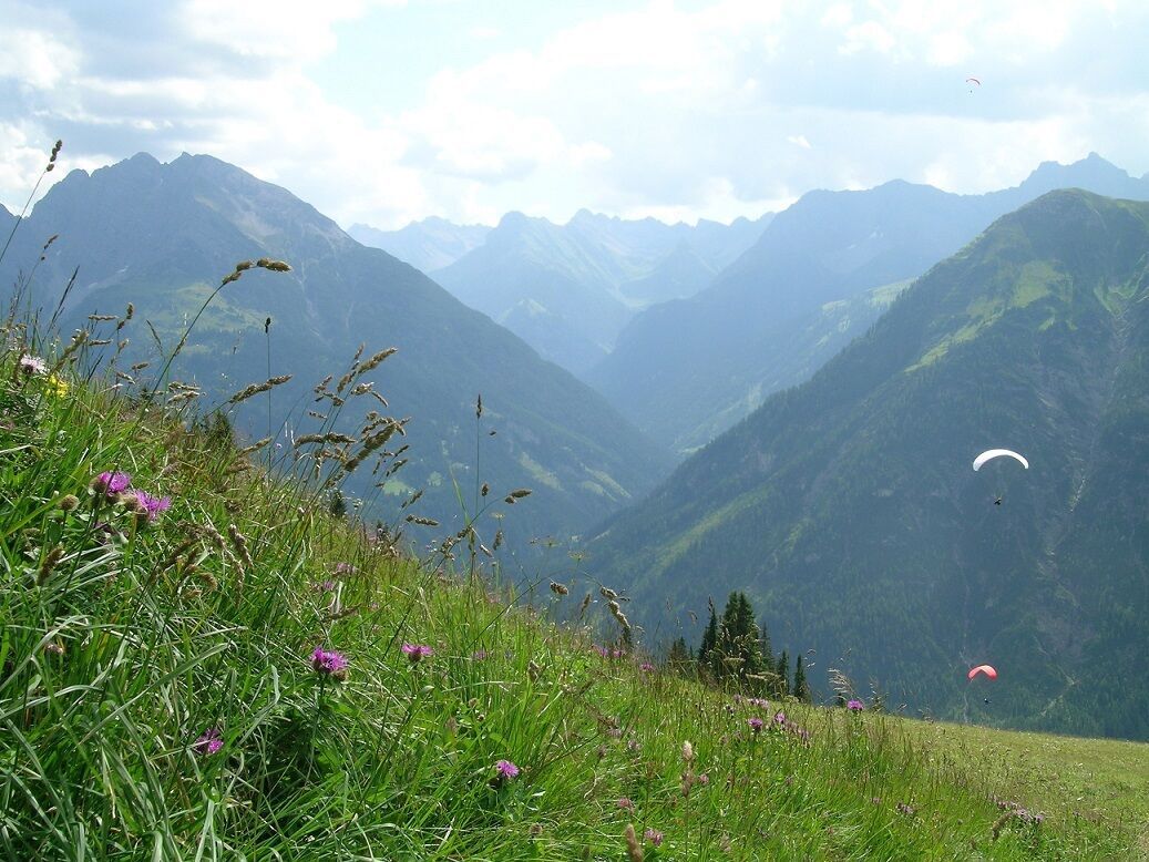
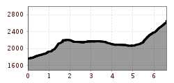
Your hike starts at the valley station of the Jöchelspitzbahn in Bach. Your path leads you in the direction of the Jöchelspitze, following the Lachenkopf and further below the Jöchelspitze to the Rothornjoch. Below the Rothornspitze, the Strahlkopf and the Ramstallspitze the trail leads you to the Krottenkopfscharte and to the summit of the Großer Krottenkopf.

Getting here

  • Arrival by public transport

    Regiobus stop Jöchelspitze

  • Parking

    Mountain railway valley station car parking

More tours in the surrounding area

Newsletter

The mountain is calling? So does our newsletter!

In our monthly newsletter we reveal the best holiday tips for Tyrol.