Winter hike Ködnitz-Glor-Burg-Felsenkapelle

closed
Kals am Großglockner / Glocknergruppe
Difficulty ratings: medium
Route length: 3.5 km
Duration: 2:00 h

Ködnitz-Glor-Burg-Felsenkapelle

Tour information

  • Requirement: medium
  • Length: 3.5 km
  • Duration: 2:00 h
  • Elevation uphill:200 hm
  • Elevation downhill:200 hm
Highest point1,500 m

Starting point

Kals/Ködnitz, Tourismusinformation Kals a. G.

Finishing point

Kals/Ködnitz, Tourismusinformation Kals a. G.
  • Fitness level 3 / 6
  • Technique 3 / 6

Best time of year

  • January
  • February
  • March
  • April
  • May
  • June
  • July
  • August
  • September
  • October
  • November
  • December

Trail condition

snow and a small part paved road

Equipment

winter boots, hiking poles
Source: Nationalparkregion Hohe Tauern Osttirol

Description

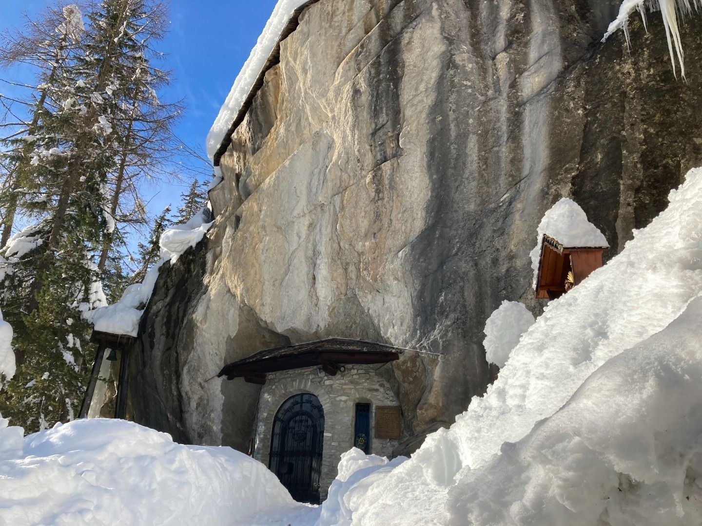
Starting in Kals/Ködnitz towards Kals/Glor, keeping left to Kals/Burg and Felsenkapelle. Afterwards across a field to parking Dorfertal and than taking the paved road to Taurerwirt. Return hikingroute next to the small river of the Dorferbach nr. 35 towards Großdorf, Unterburg and back to Ködnitz.

Nearby huts and mountain restaurants

Getting here

  • Arrival by public transport

    Public busline 952 from Huben, busstop "Gemeindeamt" at Kals/Ködnitz

  • Parking

    in Kals/Ködnitz close to the supermarket MPreis, right and left of the street, unlimited free parking

More tours in the surrounding area

  • Rotenkogel

    Difficulty: difficult
    Length: 3.9 km Duration: 3:00 h Elevation uphill: 383 m
  • Lasörling 3.098m

    Difficulty: difficult
    Length: 21.9 km Duration: 12:00 h Elevation uphill: 1,940 m
  • Hike to the Venedigerhaus Innergschlöß

    Difficulty: easy
    Length: 8.5 km Duration: 2:30 h Elevation uphill: 180 m
  • Hiking tour to Lasörlinghütte 2.350m

    Difficulty: medium
    Length: 14.6 km Duration: 7:10 h Elevation uphill: 1,080 m
  • Hike to Kalser Tauernhaus

    Difficulty: medium
    Length: 12.2 km Duration: 4:00 h Elevation uphill: 244 m
  • Badener Hütte

    Difficulty: difficult
    Length: 23.2 km Duration: 11:30 h Elevation uphill: 1,750 m
  • Venediger altitude trail

    Difficulty: difficult
    Length: 55.5 km Duration: 27:00 h Elevation uphill: 3,915 m
  • Lasörling altitude trail

    Difficulty: medium
    Length: 57.0 km Duration: 25:00 h Elevation uphill: 3,740 m
  • Figerhorn

    Difficulty: difficult
    Length: 6.5 km Duration: 6:00 h Elevation uphill: 807 m
  • Umbal waterfalls nature force trail

    Difficulty: easy
    Length: 5.8 km Duration: 2:30 h Elevation uphill: 250 m
  • Muhs panorama trail

    Difficulty: medium
    Length: 15.2 km Duration: 6:00 h Elevation uphill: 1,090 m
  • Hike to Neuen Reichenberger Hütte

    Difficulty: medium
    Length: 9.1 km Duration: 9:00 h Elevation uphill: 1,210 m
  • Hiking tour to Neue Sajathütte 2.600m

    Difficulty: medium
    Length: 10.3 km Duration: 6:50 h Elevation uphill: 1,080 m
  • Lucknerhaus - Stüdlhütte

    Difficulty: medium
    Length: 9.3 km Duration: 5:30 h Elevation uphill: 862 m
  • Böses Weibl

    Difficulty: difficult
    Length: 14.1 km Duration: 8:00 h Elevation uphill: 1,193 m
Newsletter

The mountain is calling? So does our newsletter!

In our monthly newsletter we reveal the best holiday tips for Tyrol.