Winter hike Rettenschöss - Gasthof Schöne Aussicht - Wandberghütte

Rettenbach / Chiemgauer Alpen
Difficulty ratings: medium
Route length: 4.7 km
Duration: 3:30 h

Trail Nr. 47aSchneeschuhtour Nr. 5

Tour information

  • Requirement: medium
  • Length: 4.7 km
  • Duration: 3:30 h
  • Elevation uphill:510 hm
Highest point1,352 m

Starting point

Parking lot Faistenau in Rettenschöss

Finishing point

Wandberghütte
  • Fitness level 3 / 6
  • Technique 3 / 6

Best time of year

  • January
  • February
  • March
  • April
  • May
  • June
  • July
  • August
  • September
  • October
  • November
  • December

Trail condition

gravel, path

Equipment

Breathable outdoor clothing suitable for the weather, sturdy footwear, food (snacks, drinks),
sun protection (sunglasses, sun cream & cap), rain protection, cash; guest card if using the bus
Source: Kitzbüheler Alpen - St. Johann in Tirol

Description

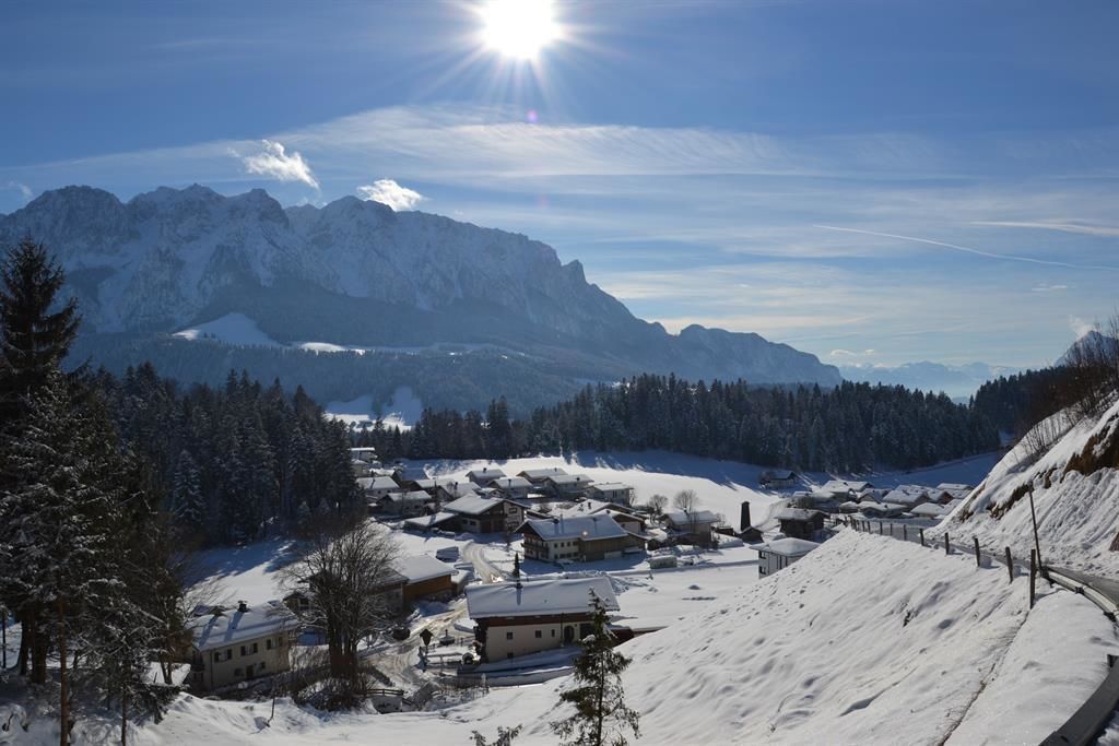
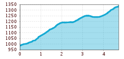
Start is parking lot Feistenau walk on to the Gasthof Schöne Aussicht. From here, follow the winter footpath no. 47a to the Wandberghütte. If there is enough snow, it is a perfect tour for snowshoes.
 

Nearby huts and mountain restaurants

Getting here

More tours in the surrounding area

  • Bichlachrunde

    Difficulty: easy
    Length: 10.5 km Duration: 3:30 h Elevation uphill: 295 m
  • Eifersbacher Wasserfall

    Difficulty: medium
    Length: 5.9 km Duration: 2:30 h Elevation uphill: 241 m
  • Alpine Outdoor Gallery

    Difficulty: easy
    Length: 3.4 km Duration: 1:00 h Elevation uphill: 117 m
  • Scenic River Trail Großache

    Difficulty: easy
    Length: 14.3 km Duration: 3:30 h Elevation uphill: 20 m
  • Kaiserbachtal - Feldberg - Stripsenjoch

    Difficulty: medium
    Length: 21.0 km Duration: 9:00 h Elevation uphill: 1,170 m
  • Eagle Walk Stage 01: St. Johann in Tirol - Gaudeamushütte

    Difficulty: medium
    Length: 13.0 km Duration: 5:00 h Elevation uphill: 1,060 m
  • Wilder-Kaiser-Steig - Detour

    Difficulty: difficult
    Length: 33.0 km Duration: 16:49 h Elevation uphill: 2,311 m
  • Schnackler Adventure Trail

    Difficulty: easy
    Length: 2.0 km Duration: 0:45 h Elevation uphill: 130 m
  • Angerer Alm

    Difficulty: medium
    Length: 5.7 km Duration: 2:45 h Elevation uphill: 652 m
Newsletter

The mountain is calling? So does our newsletter!

In our monthly newsletter we reveal the best holiday tips for Tyrol.