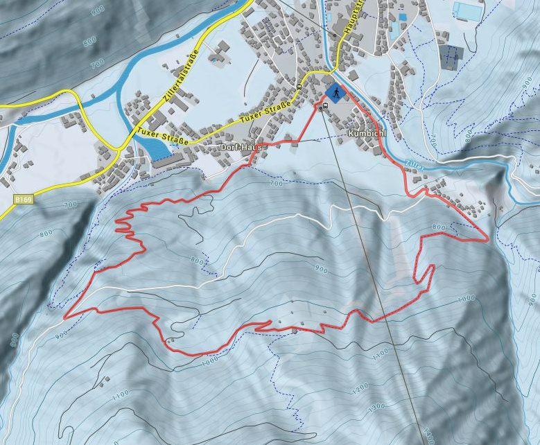
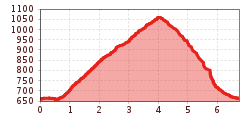
Open interactive mapOpen this POI on the interactive mapElevation profileSnowshoe hike: Wiesenhof.gpx
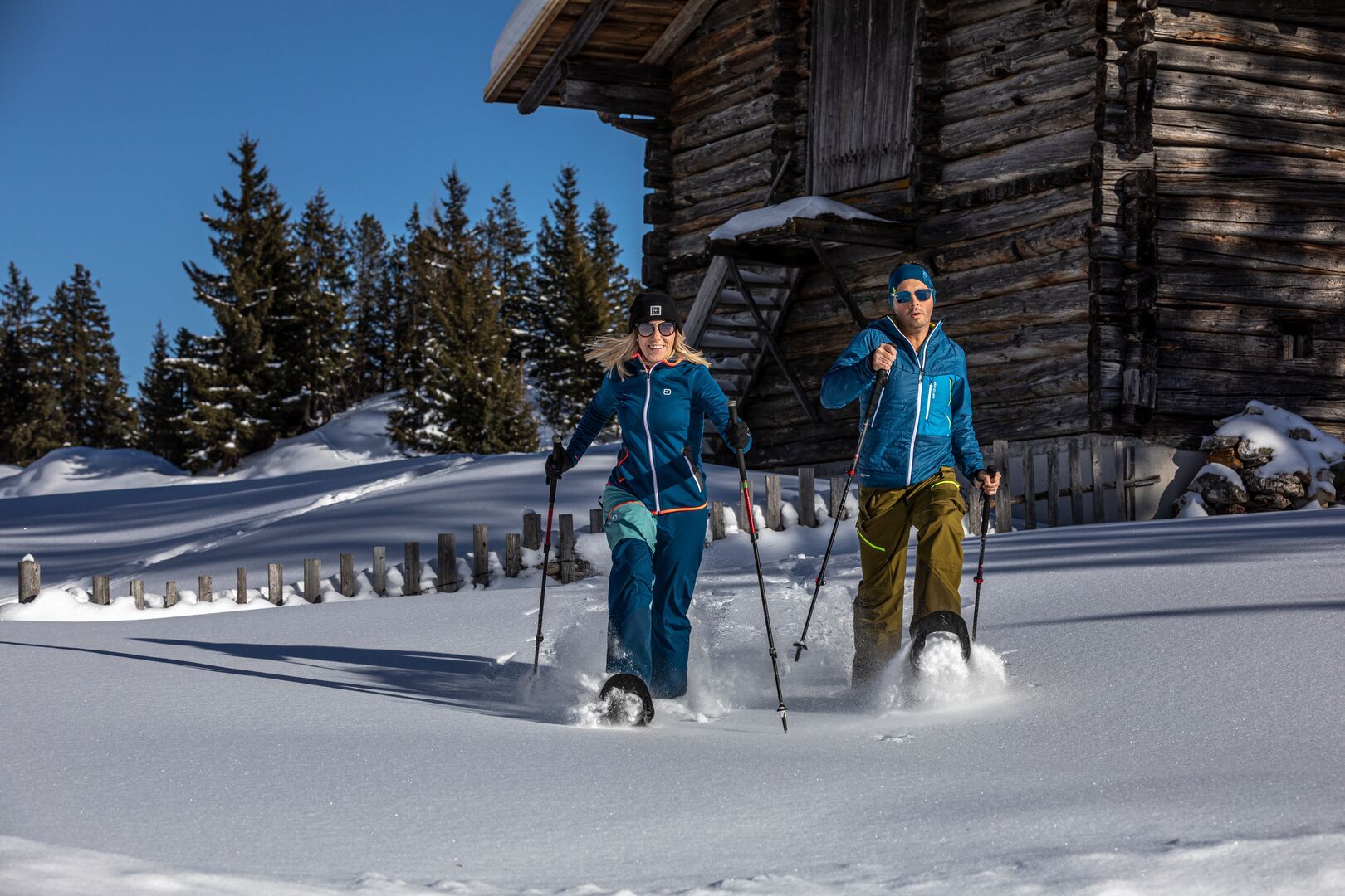
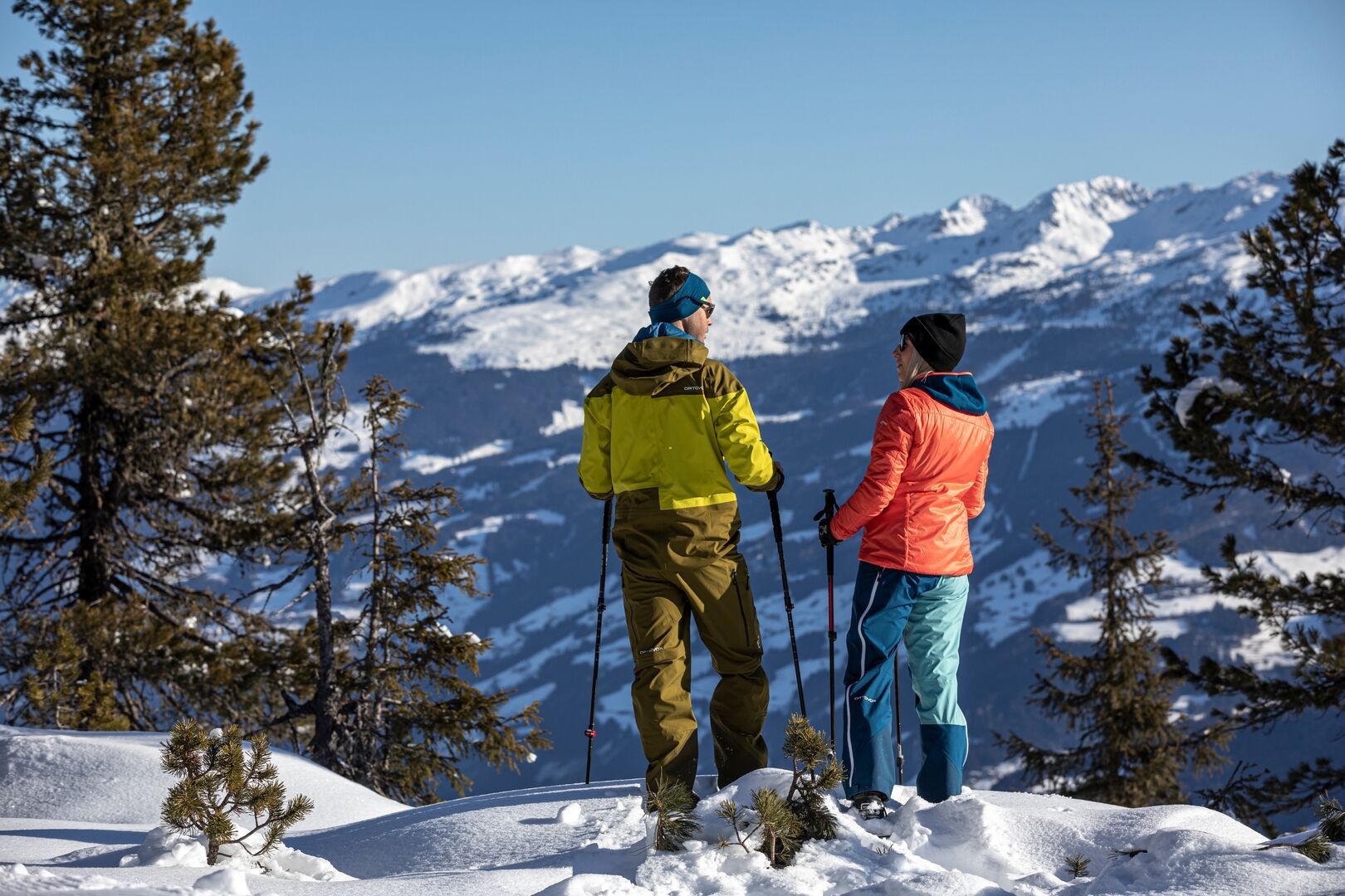
DescriptionEnjoy the winter idyll with a snowshoe hike at Wiesenhof in Mayrhofen. Experience unforgettable moments amid the breathtaking landscape and find tranquility far from the everyday hustle.
Stoaner's BienenhäuslPlace: Mayrhofen : Restaurant see restaurant detailssee restaurant details: Stoaner's Bienenhäusl
Themed hike: Stilluptal "Wasserfallweg"Difficulty: easy Length: 15.3 km Duration: 5:00 h Elevation uphill: 325 m See trailSee trail: Themed hike: Stilluptal "Wasserfallweg"
Filzenkogel winter walk in MayrhofenDifficulty: medium Length: 3.6 km Duration: 1:30 h Elevation uphill: 250 m See trailSee trail: Filzenkogel winter walk in Mayrhofen
Hut hike: Ginzling Nature Park House - MaxhütteDifficulty: medium Length: 5.8 km Duration: 3:00 h Elevation uphill: 460 m See trailSee trail: Hut hike: Ginzling Nature Park House - Maxhütte
Brandberger KolmDifficulty: difficult Length: 13.7 km Duration: 7:30 h Elevation uphill: 1,600 m See trailSee trail: Brandberger Kolm
Hut hike: Ginzling Nature Park House - Greizer HütteDifficulty: medium Length: 22.4 km Duration: 8:30 h Elevation uphill: 1,250 m See trailSee trail: Hut hike: Ginzling Nature Park House - Greizer Hütte
Hut hike: Zillergrund Bärenbadalm - PlauenerhütteDifficulty: medium Length: 14.0 km Duration: 6:00 h Elevation uphill: 980 m See trailSee trail: Hut hike: Zillergrund Bärenbadalm - Plauenerhütte
Stage Berliner Höhenweg (Zillertal Runde): Kasseler Hütte - EdelhütteDifficulty: difficult Length: 13.0 km Duration: 9:00 h Elevation uphill: 800 m See trailSee trail: Stage Berliner Höhenweg (Zillertal Runde): Kasseler Hütte - Edelhütte
Stage of the Berliner Höhenweg (Zillertal Runde): Berliner Hütte - Greizer HütteDifficulty: difficult Length: 10.2 km Duration: 6:30 h Elevation uphill: 1,200 m See trailSee trail: Stage of the Berliner Höhenweg (Zillertal Runde): Berliner Hütte - Greizer Hütte
Stage of the Berliner Höhenweg (Zillertal Runde): Greizer Hütte - Kasseler HütteDifficulty: difficult Length: 9.8 km Duration: 6:00 h Elevation uphill: 650 m See trailSee trail: Stage of the Berliner Höhenweg (Zillertal Runde): Greizer Hütte - Kasseler Hütte
Circular & themed hike: "GenießerRundWeg" at Mount AhornDifficulty: easy Length: 2.0 km Duration: 0:45 h Elevation uphill: 70 m See trailSee trail: Circular & themed hike: "GenießerRundWeg" at Mount Ahorn
Mountain hike: Zillergrund - Valentins KapelleDifficulty: medium Length: 3.2 km Duration: 2:30 h Elevation uphill: 390 m See trailSee trail: Mountain hike: Zillergrund - Valentins Kapelle
Give feedback for a chance to win a special holiday experience!Click here for the surveyClick here for the survey