Snowshoe hike Snowshoe Trail Schaferkreuz 04

Oetz / Stubaier Alpen
Difficulty ratings: difficult
Route length: 5.5 km
Duration: 4:30 h

ACHERKOGELBAHN -> Acherkogelblick viewpoint platform -> Bielefelder Hut -> Schafer Kreuz -> Bielefelder Hut -> ACHERKOGELBAHN

Tour information

  • Requirement: difficult
  • Length: 5.5 km
  • Duration: 4:30 h
  • Elevation uphill:423 hm
  • Elevation downhill:423 hm
Highest point2,187 m

Starting point

Panoramic restaurant Hochoetz

Finishing point

Panoramic restaurant Hochoetz
  • Fitness level 5 / 6

Best time of year

  • January
  • February
  • March
  • April
  • May
  • June
  • July
  • August
  • September
  • October
  • November
  • December

Equipment

Please note the current snow and avalanche report for the coming days: www.oetztal.com/de/winter.html & avalanche.report/albina-web/bulletin/2019-01-07

Appropriate equipment such as breathable and weather-adapted outdoor clothing, wind, rain, snow and sun protection, hat and gloves is required for all hikes and routes. Bringing a first aid kit, a mobile phone and possibly a tour map, as well as sufficient provisions for tours without refreshment options, is necessary.

Source: Ötztal

Description

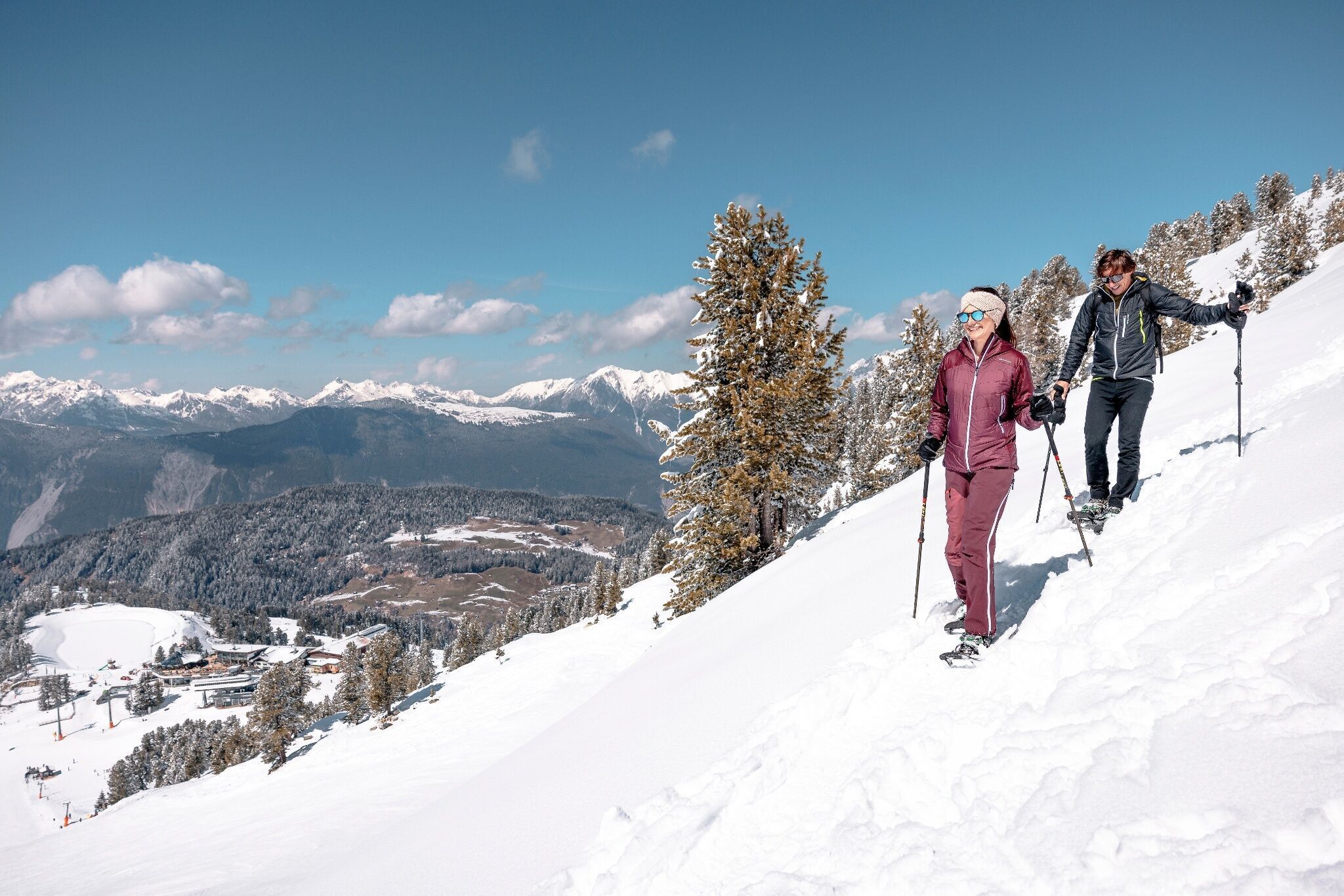
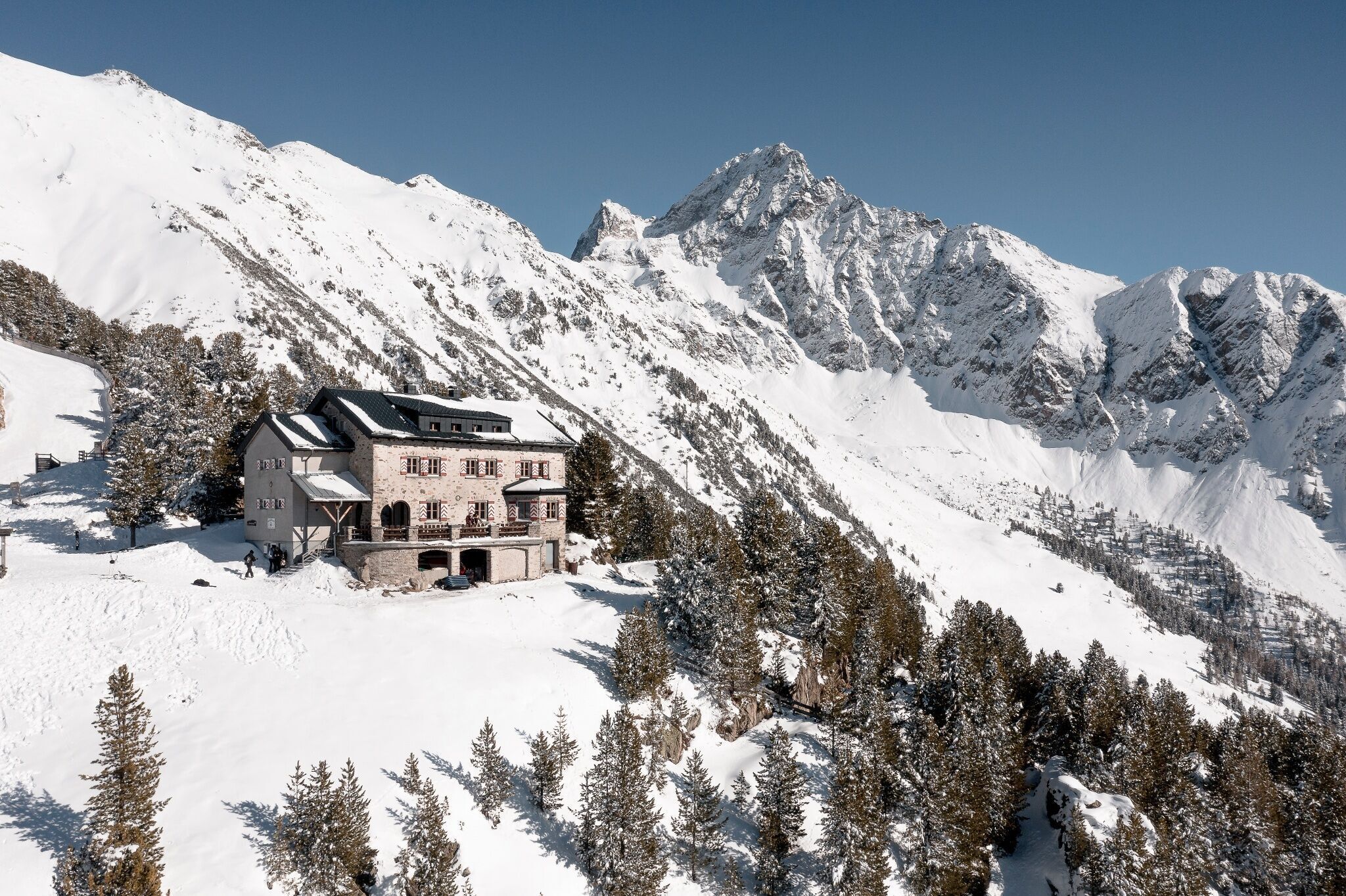
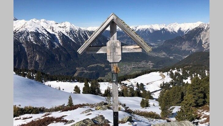
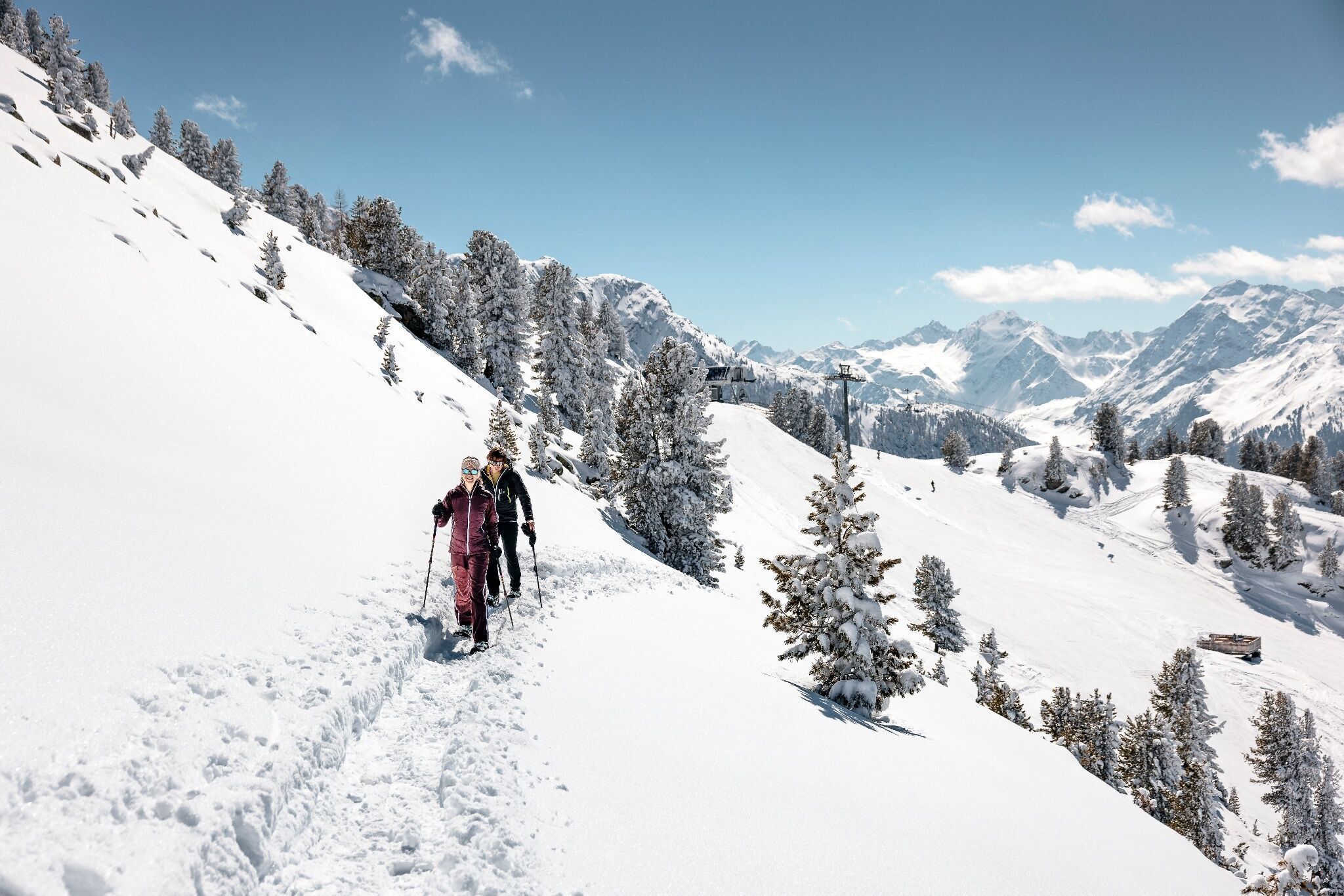
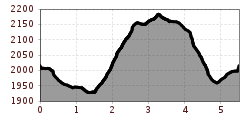
With the Acherkogelbahn you reach the Hochoetz ski region. The beautiful, signposted snowshoe trail starts below the panoramic restaurant (2020 m) past the "Rote Wandl". From there, the trail gently leads downhill, off-piste through the forest and then crosses under the Brunnenkopflift through the snow-covered winter forest to the Acherkogelblick viewpoint platform. The impressive view of the Acherkogel invites you to linger. The next part of the snowshoe trail becomes more challenging and requires some snowshoe experience. After about 1 km and 170 m altitude gain, you reach the Bielefelder Hut where you can relax, enjoy the view, and regain strength with a Kaiserschmarrn. For the endurance athletes, there is the option to continue to the Schaferkreuz. The path here is relatively easy and crosses the mountain side slightly uphill. At the Schafer Kreuz you have a magnificent panoramic view and can take in the 360° panorama. The descent follows the same path back to the Bielefelder Hut. Below the hut, the route branches off to the right. Here you follow the slightly steeper path downhill until you reconnect with the starting part of the route and follow it back to the Acherkogelbahn.


Nearby huts and mountain restaurants

Getting here

  • Arrival by public transport

    Travel comfortably and safely to Ötztal train station by train. At the station you will find public transportation or local taxi companies happy to take you to your desired destination! The current bus timetable is available at: http://fahrplan.vvt.at

  • Parking

    The following parking options are available:

    Parking lot Acherkogelbahn (paid)

    Parking lot rafting entry point (at the end of Oetz on the right side) (paid)

    Central parking lot Oetz (paid)

    Overnight parking during multi-day tours: central parking lot Oetz, tickets available at the Oetz information office.

More tours in the surrounding area

  • Ötztal Trek Stage 3

    Difficulty: difficult
    Length: 10.4 km Duration: 4:00 h Elevation uphill: 842 m
  • Ötztal Trek Stage 10

    Difficulty: difficult
    Length: 11.1 km Duration: 4:30 h Elevation uphill: 1,476 m
  • Ötztal Trek Stage 1

    Difficulty: medium
    Length: 18.6 km Duration: 6:30 h Elevation uphill: 1,561 m
  • Ötztal Trek Stage 14

    Difficulty: difficult
    Length: 6.3 km Duration: 3:00 h Elevation uphill: 1,004 m
  • Ötztal Trek Stage 11

    Difficulty: difficult
    Length: 12.0 km Duration: 5:00 h Elevation uphill: 705 m
  • Winter hiking trail Rotes Wandl - No. 431

    Opening hours: closed
    Difficulty: easy
    Length: 1.5 km Duration: 0:45 h Elevation uphill: 52 m
  • Ötztal Trek Stage 21

    Difficulty: difficult
    Length: 9.4 km Duration: 4:30 h Elevation uphill: 1,270 m
  • Ötztal Trek Stage 6

    Difficulty: difficult
    Length: 7.6 km Duration: 3:30 h Elevation uphill: 640 m
  • Ötztal Trek Stage 17

    Difficulty: difficult
    Length: 16.4 km Duration: 6:00 h Elevation uphill: 1,080 m
  • Mountain peak Rosskopf

    Difficulty: medium
    Length: 2.0 km Duration: 2:00 h Elevation uphill: 379 m
  • Mutsbühl

    Difficulty: medium
    Length: 4.5 km Duration: 1:30 h Elevation uphill: 470 m
  • Fundusfeiler - Umhausen

    Difficulty: difficult
    Length: 4.5 km Duration: 3:00 h Elevation uphill: 1,109 m
  • Wilder Mann

    Difficulty: medium
    Length: 2.4 km Duration: 2:30 h Elevation uphill: 665 m
  • Siegerlandhütte - Sölden

    Difficulty: medium
    Length: 8.0 km Duration: 3:30 h Elevation uphill: 780 m
  • Stuibenfall hike - Umhausen

    Opening hours: open
    Difficulty: easy
    Length: 2.9 km Duration: 1:45 h Elevation uphill: 456 m
  • Ötztal Trek Stage 4

    Difficulty: difficult
    Length: 8.9 km Duration: 4:00 h Elevation uphill: 802 m
  • Ötztal Trek Stage 7

    Difficulty: difficult
    Length: 5.3 km Duration: 2:00 h Elevation uphill: 376 m
Newsletter

The mountain is calling? So does our newsletter!

In our monthly newsletter we reveal the best holiday tips for Tyrol.