Mountain hikes Vorderhornbach - Stallmähder

Vorderhornbach / Allgäuer Alpen
Difficulty ratings: medium
Route length: 11.7 km
Duration: 4:00 h

Circular hike through woods and meadows!

Tour information

  • Requirement: medium
  • Length: 11.7 km
  • Duration: 4:00 h
  • Elevation uphill:450 hm
  • Elevation downhill:444 hm
Highest point1,447 m

Starting point

Badino natural swimming pond

Finishing point

Starting point
  • Fitness level 2 / 6
  • Technique 2 / 6

Features

  • Circular route

Best time of year

  • January
  • February
  • March
  • April
  • May
  • June
  • July
  • August
  • September
  • October
  • November
  • December

Trail condition

Asphalt, Gravel path, hiking trail

Equipment

Good equipment is essential for your hike. The following items should definitely be in your rucksack: - Food and drink - Functional clothing for rain, wind and cold - A change of clothes - Sun protection - First aid kit - Mobile phone with a full battery (Euro emergency number 112) - Hiking map or GPS - Hiking poles Nevertheless, the following applies: light luggage is also easier to carry, so you should not weigh down your rucksack with unnecessary ballast. In addition, your hiking equipment should of course also be adapted to your particular hiking tour.
Source: Lechtal-Reutte

Description

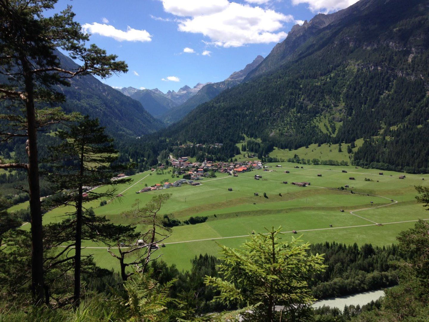
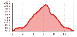
Your circular hike begins at the Badino natural swimming pond, you walk to the bridge over the Hornbach and follow the Weigweiser Krackwiesen trail. This beautiful hiking trail leads you along flower meadows and forest clearings to the footbridge over the Hornbach. There you cross the main road and follow the ascending forest path to the Stallmähdern. Your gravelled path continues through shady forests and takes you back to the path towards the road.

Getting here

  • Arrival by public transport

    Regional bus stop Vorderhornbach GH Kreuz

More tours in the surrounding area

Newsletter

The mountain is calling? So does our newsletter!

In our monthly newsletter we reveal the best holiday tips for Tyrol.