Kaiserwinklrunde

Kössen / Chiemgauer Alpen
Route length: 14.5 km
Duration: 3:00 h

Weg Nr. 13,11,12

Tour information

  • Length: 14.5 km
  • Duration: 3:00 h
  • Elevation uphill:257 hm
  • Elevation downhill:257 hm
Highest point696 m

Starting point

Sportplatz / Fußballplatz Kössen

Finishing point

Sportplatz / Fußballplatz Kössen
  • Fitness level 4 / 6
  • Technique 3 / 6

Best time of year

  • January
  • February
  • March
  • April
  • May
  • June
  • July
  • August
  • September
  • October
  • November
  • December

Description

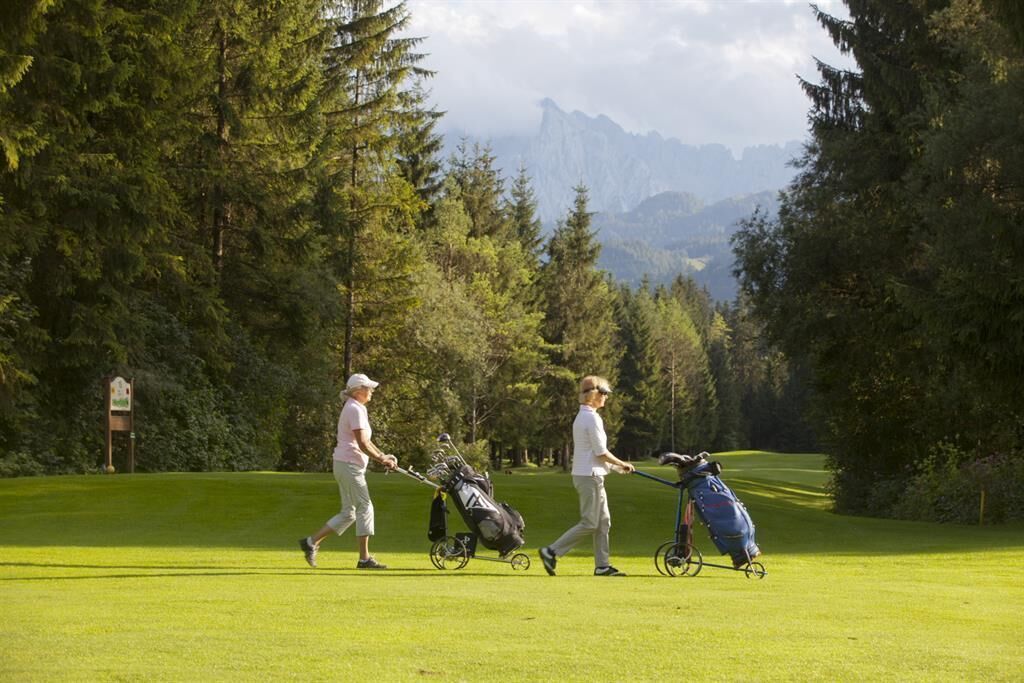
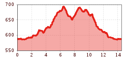
Start is the tourist office in Kössen. You walk to the Staffenbrücke and follow the river path until the soccer corner. From there walk through the settlement Außerkapelle, Gundharting, in direction to Walchsee, in Kranzach on the main road left, across the Kranzach bridge - then right passing by the Huttenbichl and the Hotel Riedl, next to the golf course back to the soccer court and to the centre of Kössen.(three intermediate climbs, gravel and asphalt roads)

Getting here

More tours in the surrounding area

Newsletter

The mountain is calling? So does our newsletter!

In our monthly newsletter we reveal the best holiday tips for Tyrol.