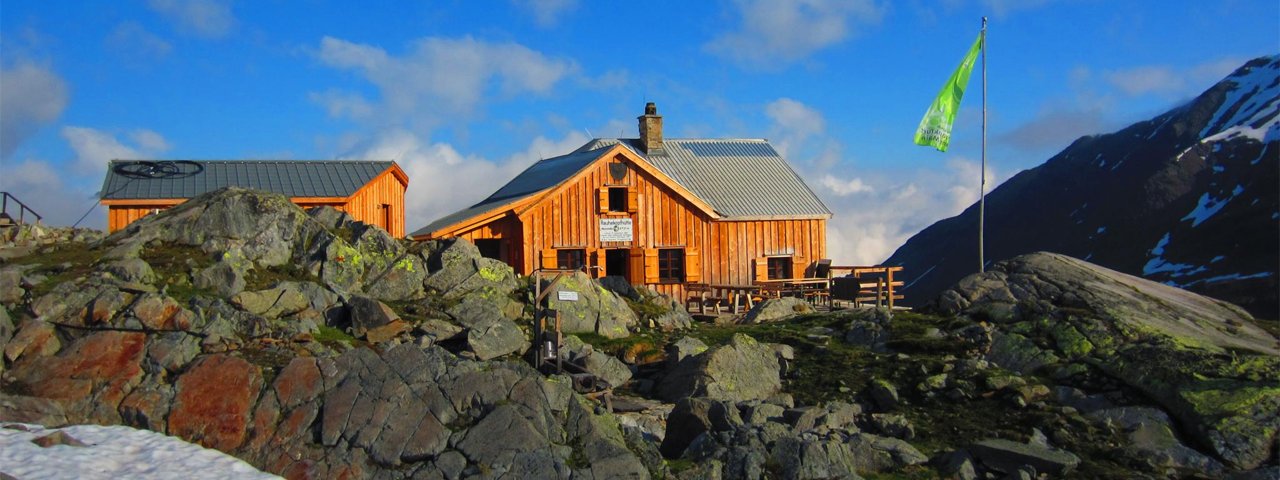
The Rauhekopfhütte (2,731 metres) is a mountain refuge on the Gepatsch glacier in the Ötztal Alps and one of the most traditional high-alpine huts.
Remote mountain refuge at the end of the Kaunertal Valley
German Alpine Club, Frankfurt am Main Division
Important! The Rauhekopfhütte will remain closed in 2020. For more information click here.
The ascent to the hut is an adventure in its own right. Leaving from the Gepatschhaus / Kaunertal Glacier Road, hikers climb up towards the Gepatsch glacier with its impressive masses of snow and ice. Up at the hut await wonderful views of the surrounding mountains and glaciers. As the scenery suggests, the adventures around the hut are challenging. They include many glacier crossings requiring the necessary equipment and experience. Unlike most huts, the Rauhekopfhütte is not looked after by a single person but instead by a team of volunteers who take turns every fortnight to check everything is in order. The perfect place to get away from it all and back to nature. There is even an outdoor shower for brave visitors!
How to get to the hut
From Gepatschhaus (via glacier) in 3.5 hours
Walks and hikes in the area (walking time to summit)
Fluchtkogel (3,500 metres), 3.25 hours, difficult (glacier equipment required)
Weißseespitze (3,526 metres), 3 hours, difficult (glacier equipment required)
Rauher Kopf (2,989 metres), 1 hour, difficult (glacier equipment required)
Hochvernagtspitze (3,539 metres), 3.5 hours, difficult
Further huts in the area
Brandenburger Haus, 3 hours
Taschachhaus, 5 hours
Vernagthütte, 5 hours
Remote mountain refuge at the end of the Kaunertal Valley German Alpine Club, Frankfurt am Main Division Important! The Rauhekopfhütte will…


