Mountainbike-Tour 422 Mösl - Penkenjoch

Mayrhofen, Zillertal / Tuxer Alpen
Difficulty ratings: difficult
Route length: 17.8 km
Duration: 3:00 h

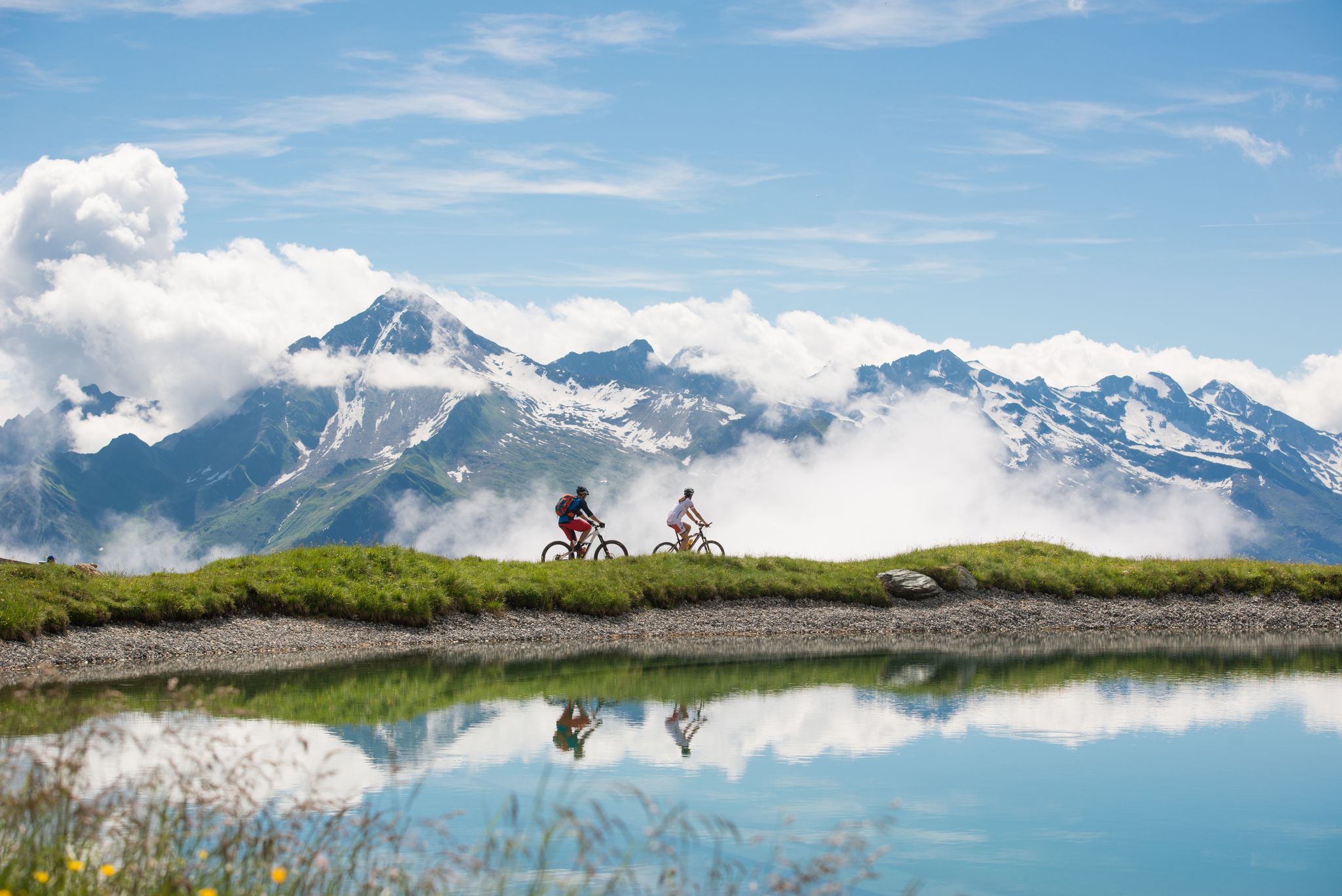
Ruggedly scenic yet challenging panoramic tour to a sunny plateau!

Tour information

  • Requirement: difficult
  • Length: 17.8 km
  • Duration: 3:00 h
  • Elevation uphill:800 hm
  • Elevation downhill:800 hm
Highest point2,080 m

Starting point

Abzweigung Schiestl's Sunnalm, Horberg, 6283 Hochschwendberg

Finishing point

Abzweigung Schiestl's Sunnalm, Horberg, 6283 Hochschwendberg
  • Fitness level 6 / 6
  • Technique 5 / 6

Best time of year

  • January
  • February
  • March
  • April
  • May
  • June
  • July
  • August
  • September
  • October
  • November
  • December

Trail condition

  • Surface: 4,18 km gravel; 4,71 km asphalt
  • Difficulty: 4,71 km easy; 2,72 km moderat; 1,46 km difficult
  • Gradient: 1,62 km up to 5%; 3,53 km 6-11%;2,97 km 12-16%; 0,76 km more than 17%

Equipment

-
Source: Zillertal

Description

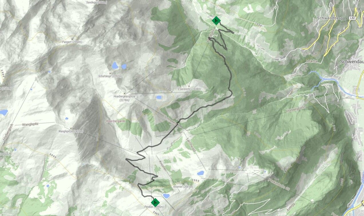
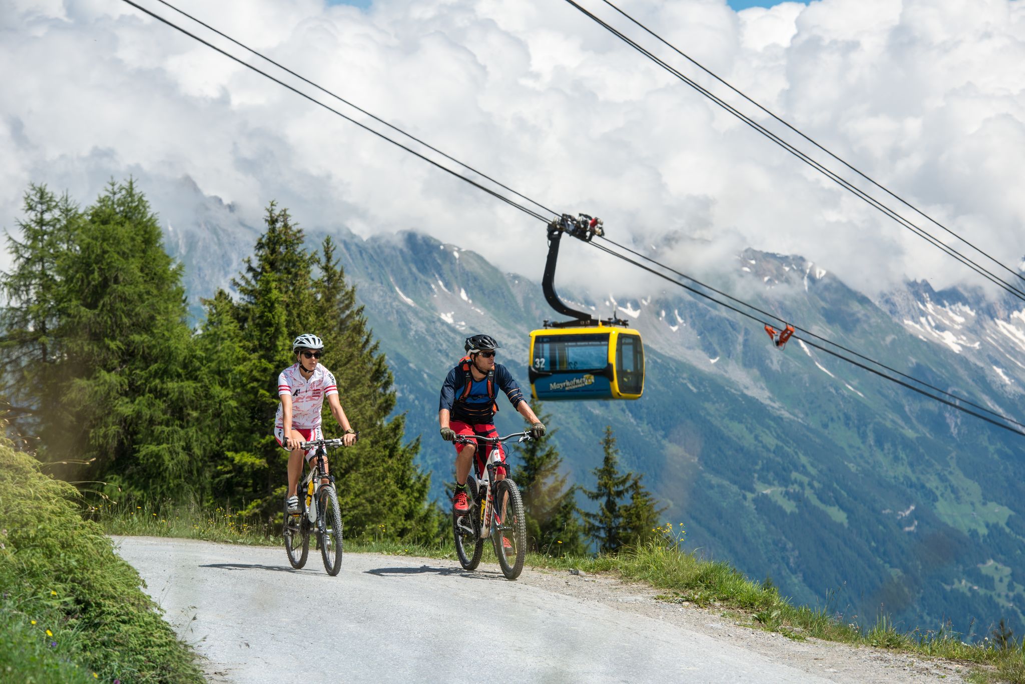
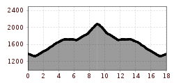
Route No. 422 starts at the turn-off towards Schiestl's Sunnalm 1800 m, a few metres before the Möslbahn cable car at Schwendberg. The gravel road leads for the most part through the forest. Savour the wonderful panoramic view from former Gasthof Goldbründl, before the trail continues on past Tappenalm 1715 m. At Mittertrettalm 1721 m, the trail leads downhill for a short section, where you can take a welcome breather before it continues along the valley floor after crossing Horbergbach stream and then climbs steeply up again to the Penkenjoch plateau. The last section is only suitable for experienced bikers. There are several places where you can stop for refreshments at Penkenjoch.
 

Nearby huts and mountain restaurants

Getting here

  • Arrival by public transport

    Bus no.: 8340; Stop: Mösl
    www.mayrhofen.at/fahrplaene
    The transportation is at the discretion of the bus driver!
     

Newsletter

The mountain is calling? So does our newsletter!

In our monthly newsletter we reveal the best holiday tips for Tyrol.