singletrack 486 Singletrail Hundskehljoch

Mayrhofen, Zillertal /
Difficulty ratings: difficult
Route length: 3.5 km
Duration: 2:00 h

Very challenging and adventurous tour to the border with South Tyrol!  

Tour information

  • Requirement: difficult
  • Length: 3.5 km
  • Duration: 2:00 h
  • Elevation uphill:620 hm
Highest point2,550 m

Starting point

Zollwachhütte, 6290 Brandberg

Finishing point

Hundskehljoch, 6290 Brandberg
  • Fitness level 6 / 6
  • Technique 6 / 6

Best time of year

  • January
  • February
  • March
  • April
  • May
  • June
  • July
  • August
  • September
  • October
  • November
  • December

Trail condition

  • Surface: 3,55 km off-raod
  • Difficulty: 3,55 km difficult
  • Gradient: 0,17 km up to 5%; 0,53 km 6-11%; 0,9 km 12-16%; 1,95 km more than 17%

Equipment

-
Source: Zillertal

Description

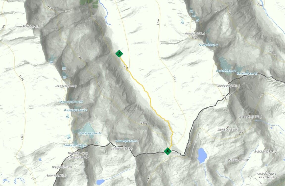
The old “Zollwachhütte” (customs guard hut) in Hundskehlgrund Valley is where single trail no. 486 begins and leads along a well-developed hiking trail, partly over rocks and stone slabs to Hundskehljoch. Due to the very steep and challenging nature of this trail, you may have to carry your bike on some sections. No refreshments are available on site, but you can stop for a break on your return to the Zillergrund.
Tip: From 

Nearby huts and mountain restaurants

Getting here

  • Arrival by public transport

    Bus no.: 8327; Stop: Bärenbad
    www.mayrhofen.at/fahrplaene
    The transportation is at the discretion of the bus driver!
     

Newsletter

The mountain is calling? So does our newsletter!

In our monthly newsletter we reveal the best holiday tips for Tyrol.