
Place:Alpbach
:Alpine pasture / hut / mountain restaurant
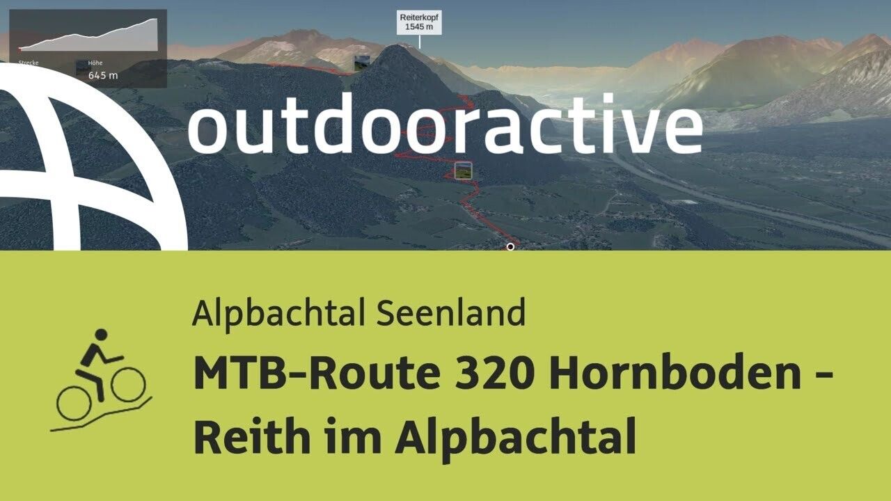
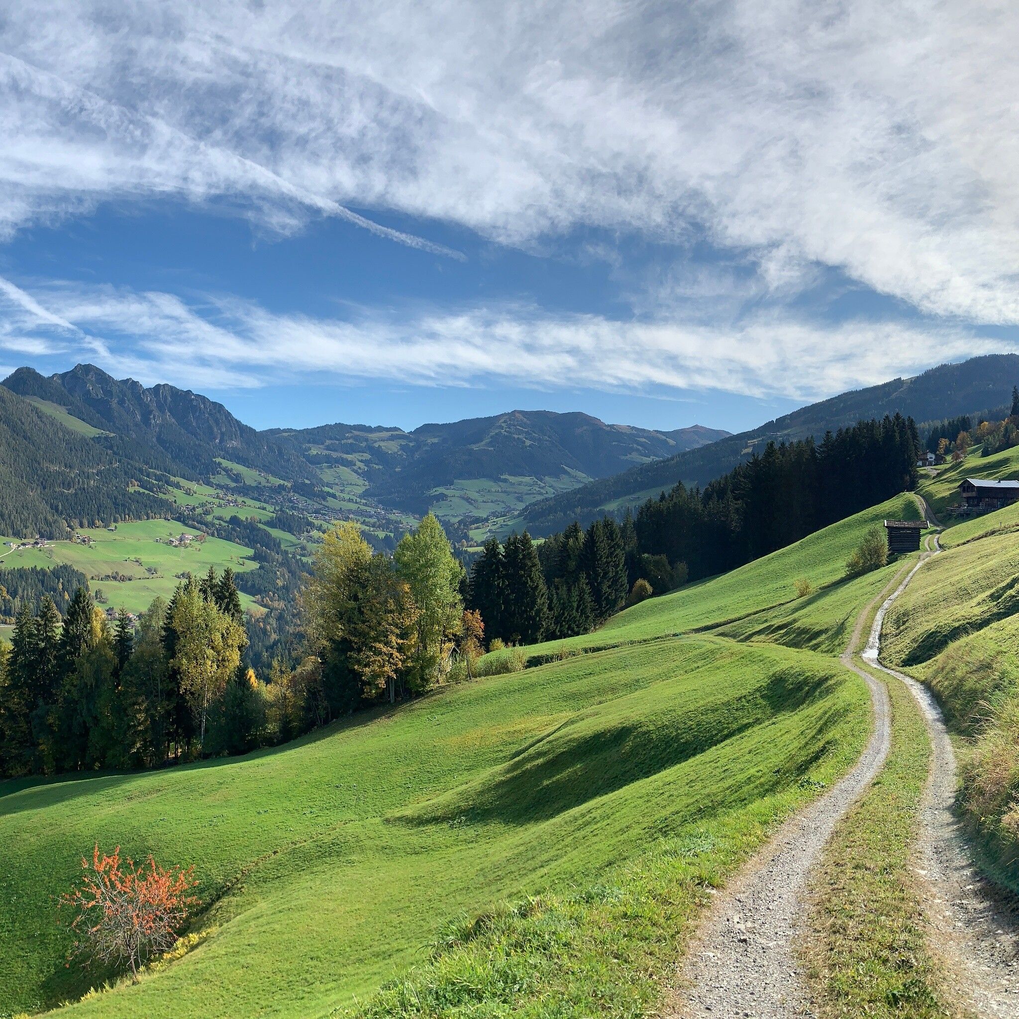
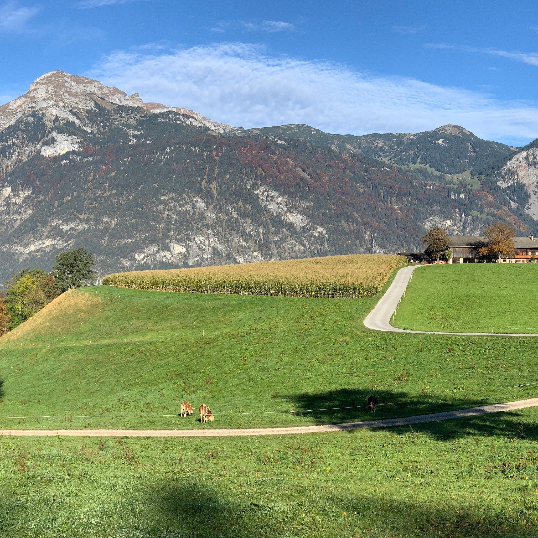
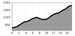
Varied but demanding route from Reith im Alpbachtal to the mountain station of the Wiedersbergerhornbahn in Alpbach
Winter closure from November 1 to April 1 of the following year all MTB routes and cycle paths are closed for safety reasons
There is no winter service for these routes and many MTB routes are avalanche-prone. Depending on snow conditions, some routes may be closed longer than April 1. For more information on snow conditions, contact the local tourism office.
Helmet, glasses, bike shorts, pullover, rain jacket, cap, biker backpack, drinking bottles, map, first aid kit, mobile phone, camera, lock, spare tube, mini tool, pump, patch kit, adhesive tape, sunscreen, muesli bars, snack, ...
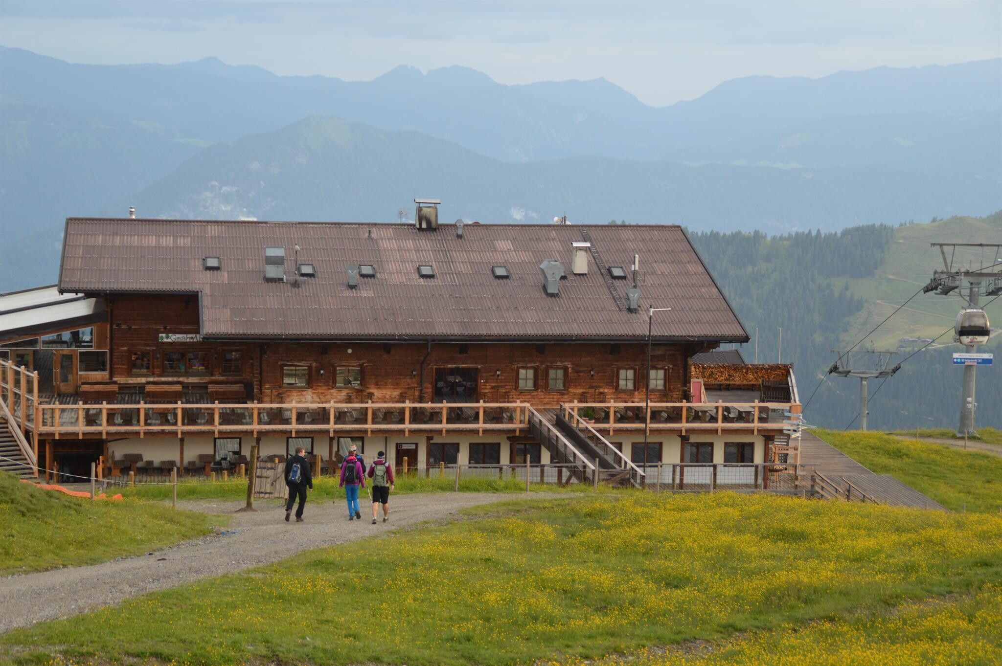
From the Reitherkogelbahn car park turn left cycle towards the village centre and the Heumilchkäserei (dairy). Take the second to the left and cycle through Ried to the Hub chapel. Turn left onto the unpaved panorama road and cycle uphill to the Hinterkogelhof. Continue on to the Fürstenhof and the Kerschbaumersattel (ridge into the Ziller Valley) and turn left. Turn left after the Kupfner chapel (approx. 300 m) turn right towards Neader and the Zulehenhof. The climb to the Hochlindalm (1.432 m) and on to the Kohlgrubenalm (1.608 m) begins here. Turn right and continue uphill to the Berggasthof Hornboden at 1.811 m (place where you can something to eat and drink) and to the Wiedersbergerhornbahn top station at 1.844 m (bikes can be transported back down the valley in the gondolas) or descend via MTB-route 307 Wiedersbergerhorn.
You can plan your trip here with Tyrol Transport Association
Bicycle transport up to 5 bikes
Parking available at the Reitherkogelbahn parking lot (start is directly at the parking lot)


.jpg")


Andi Frank (247).jpg")


")
Erwin Haiden, bikeboard.at.jpg")

-min.jpg")


")

