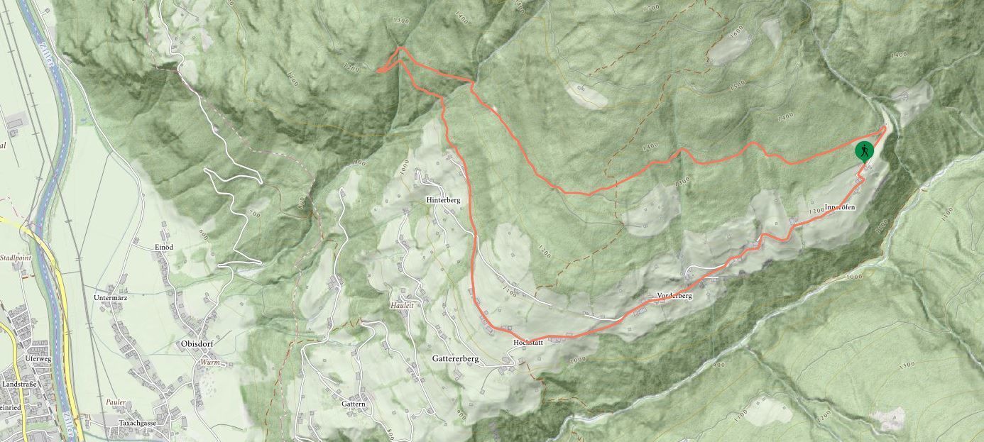
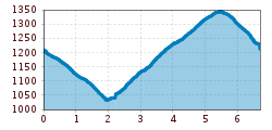
Open interactive mapOpen this POI on the interactive mapElevation profileAlmluft - Windhag circular walk.gpx
DescriptionStarting from the Almluft Alpine café the routes are, in each case, along forest tracks. stop off possibilities: Gasthof Almluft
Schleierwasserfall_Hart©AndiFrank.jpg © (c) Ferienregion Fügen-Kaltenbach, Andi Frank Nature Trail and Bird Nature TrailDifficulty:mediumLength:6.5 kmDuration:2:00 hElevation uphill:250 mSee trailSee trail: Nature Trail and Bird Nature Trail
Mountain station Spieljochbahn - Hochfügen Difficulty:mediumLength:12.2 kmDuration:4:00 hElevation uphill:270 mSee trailSee trail: Mountain station Spieljochbahn - Hochfügen
2019_best-of-zillertal_image_stummerberg_bike-and-hike_level26_web_20 (1).jpg © (c) Ferienregion Fügen-Kaltenbach im Zillertal, level26 Hamberg (2095m) from the Gasthof Almluft (Trail No. 37)Difficulty:mediumLength:9.4 kmDuration:4:45 hElevation uphill:865 mSee trailSee trail: Hamberg (2095m) from the Gasthof Almluft (Trail No. 37)
Sonnenaufgang_Kleiner_Gilfert_©FranzKupfner.jpg © (c) Ferienregion Fügen-Kaltenbach im Zillertal, Franz Kupfner Hochfügen - Kleiner Gilfert (2388m) Walk no. 27Difficulty:mediumLength:14.4 kmDuration:6:00 hElevation uphill:925 mSee trailSee trail: Hochfügen - Kleiner Gilfert (2388m) Walk no. 27
Give feedback for a chance to win a special holiday experience!Click here for the surveyClick here for the survey

Manfred Pfister.jpg")
.jpg")

