Manfred Pfister.jpg")
Difficulty:
medium
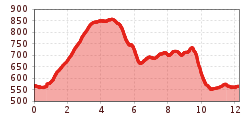
Length:
12.2 km
Duration:
4:00 h
Elevation uphill:
270 m
Bruck - Säulingerhof - Hart - Bruck (Trail No. 8)
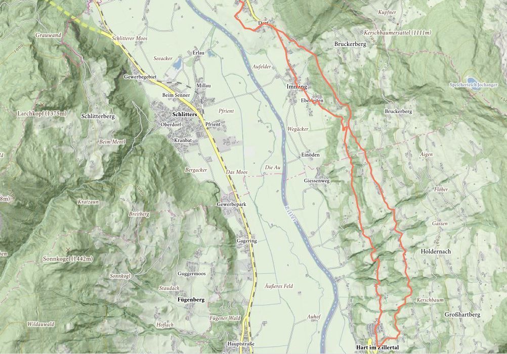
Starting from the Municipal office, this trail leads into the valley, past the Wetterkreuz cross, and through the meadows until you reach the district of Imming.At the first crossroads head towards Bruckerberg uphill to Säulingerhof - rising gently this quiet road leads to the Gasthof Säulingerhof - from there the trail runs on the level to the Marienkapelle (St Mary‘s Chapel; great view over the Rofan mountains). After the Marienkapelle continue on the road as far as the junction with the Kreuzweg that leads down the valley towards Oberhart. This runs through woodland and meadows past the Stations of the Rosary to the parish church in Oberhart - from Oberhart the path leads initially along a quiet Panorama road. At the Bruck/Imming fork keep left as you head downhill. The footpath continues towards Imming - pass through this hamlet and return to the starting point.
.jpg")


