
Difficulty:medium
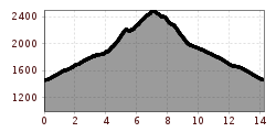
Length:14.4 kmDuration:6:00 hElevation uphill:925 m
This route requires good physical condition, sure-footedness, a head for heights, and Alpine experience.
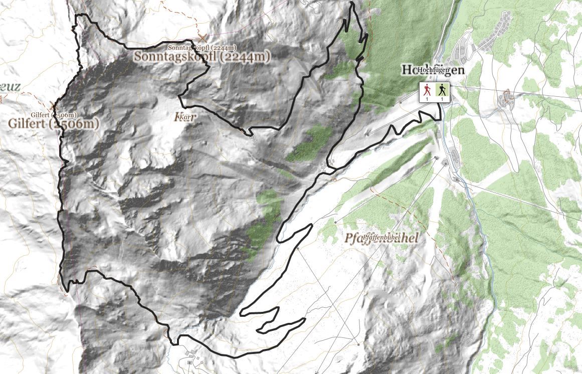
Departing from Hochfügen bus stop/car park, follow the gravel road to the Lamarkalm Niederleger. Once there, proceed to the right along a forest road until you reach the turn-off for Gilfert/Sonntagsköpfl mountain. You then begin your ascent up a narrow, grassy trail amid the pasture terrain. After completing a short section alongside a stream, bear right and make your way across the treeless landscape in a series of hairpin bends towards the Sonntagsköpfl (there is also a turn-off for the summit itself). Just below the summit cross, the trail leads to the left along a ridge section – with hikers needing to perform some straightforward block climbing to reach the junction at the Graukopf. Keep to the left again as you embark on a continuous ascent via a grassy plateau that offers an early glimpse of the wooden summit cross atop Gilfert mountain. Boasting views of the Karwendel mountains and the Inntal valley, plus a panorama that ranges from Hochfügen to the upper Zillertal valley, this is a breathtaking vantage point!
The descent leads you along ridge sections, some of which are exposed, and a narrow trail. However, the subsequent turn-off for the Lamarkalm Hochleger marks a return to easier going on the pasture terrain. The downhill hike follows the course of a stream as it alternates between its left and right banks. Once at the Lamarkalm Hochleger, you can complete the remainder of your return journey to Hochfügen on the gravel road.
stop off possibilities: restaurants in Hochfügen
.jpg")
Manfred Pfister.jpg")

