
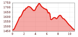
Difficulty:medium
Length:14.4 kmDuration:6:00 hElevation uphill:925 m
Loassattel - circular walk
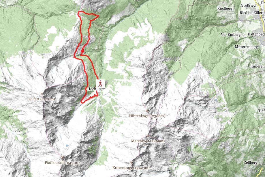
This hike begins in Hochfügen, where a steeply ascending gravel trail leads past the Lamarkalm Niederleger on the way to Sonntagsköpfl mountain. A beautiful narrow trail forks off to the right around 200 m after this pasture, guiding you into the forest, past the Maschentalalm Hochleger (no refreshment options), and onward to the Loassattel saddle. The final section of the hike is once again along a gravel road. Dining tip: +10 min. to get from the Loassattel saddle to Gasthof Loas inn. After passing the gate, follow the narrow hiking trail downhill (starting in the direction of Schellenberg) and then keep right while heading along a forest road to return
to Hochfügen. Alternatively, you can take another forest road that runs directly to Hochfügen.
stop off possibilities: restaurant Loas, restaurants in Hochfügen
.jpg")
Manfred Pfister.jpg")

