
Opening hours:Open today
Place:
Fügen
:
Restaurant, Alpine pasture / hut / mountain restaurant, café
Onkeljoch circuit route
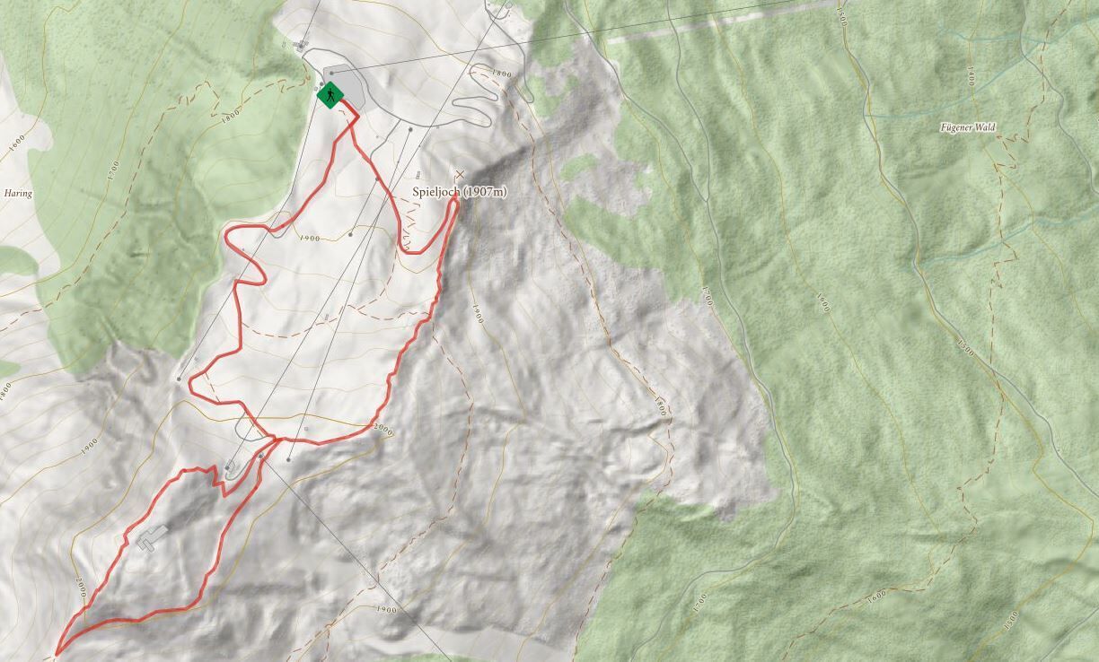
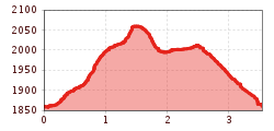
From the top station of the Spieljochbahn you hike along a wide path without difficulty to the Spieljoch summit cross at 1.920 m. Continue along a partly rocky hiking trail to the top station of the chairlift. From there, after a short climb, you reach the flat area of the Onkeljoch at 2.066 m. From the Onkeljoch the trail leads - past the mountain station of the Geolsbahn - to the trail junction Falschegg/Alpinsteig. This junction is also the turning point of the circular hike. First on the hiking trail back to the chairlift mountain station and further downhill on the wide gravel path to the mountain station of the Spieljochbahn.

Manfred Pfister.jpg")
.jpg")

