Manfred Pfister.jpg")
Difficulty:
medium
Length:
12.2 km
Duration:
4:00 h
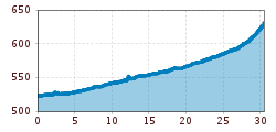
Elevation uphill:
270 m
The Zillerpromenade
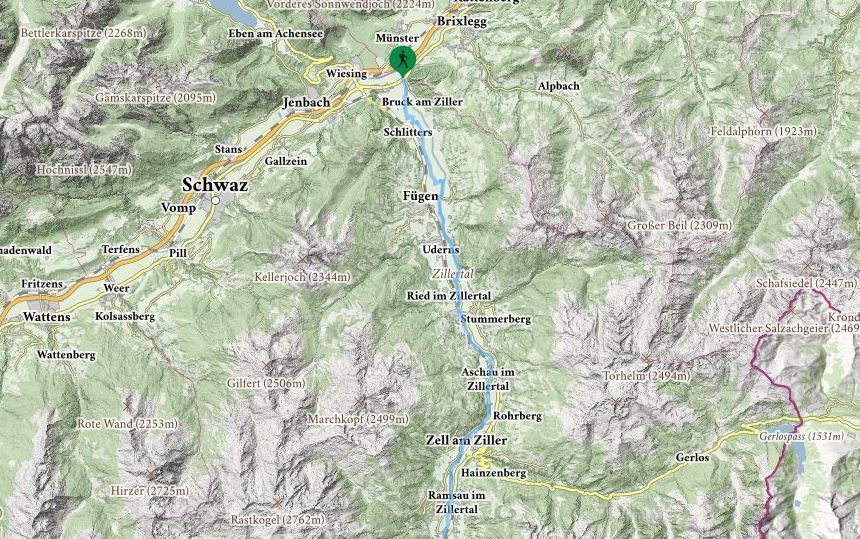
It is possible to walk the whole length of the Ziller valley - to north (Strass) and to the south (Mayrhofen) - alongside the river without any inclines. There are approx. 60 km of hiking trails through the valley along both left and right banks.
.jpg")


