Trail Gilfert circuit

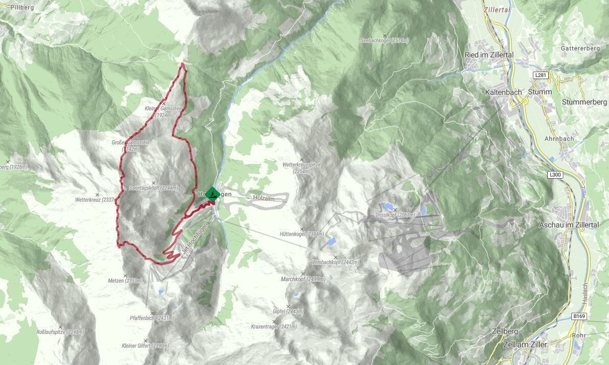
A wonderful, challenging trail running tour over the Loassattel to the Gilfert.
From the starting point in Hochfügen, follow the forest trail to the Lamark Niederleger and continue along the
Höhenweg to the Loassattel. Now the heart of the tour begins: over the picturesque mountain ridge
up to the summit of the Gilfert, always with a fantastic view of the Inn Valley. The
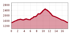
800 meters in altitude from the Loassattel to the Gilfert are quite a challenge, with a constant alternation of steep
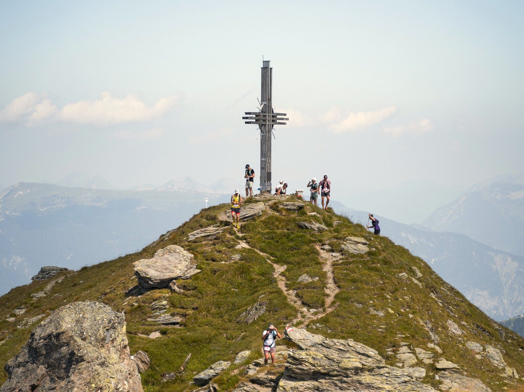
upswings alternate with flatter passages. However, it is never technically difficult. Once you have reached the
summit, you will be rewarded with a breathtaking 360 degree panorama.
and the Karwendel, to the south the Zillertal main ridge with its glaciers. From the summit you follow
the ridge downhill to the south until you reach the turn-off to the Lamark Hochleger.
The last section leads along the forest road, past the Lamark Niederleger again and back
to Hochfügen
