Winter hike Alpbachtaler Höhenweg

Reith im Alpbachtal / Kitzbüheler Alpen
Difficulty ratings: medium
Route length: 8.4 km
Duration: 2:30 h

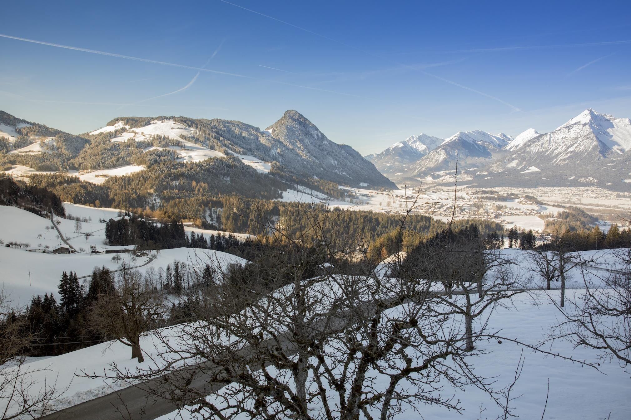
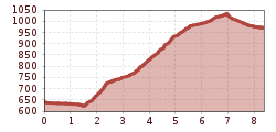
Walk from Reith i. A. village centre via the Brunner and Scheffachberg to Alpbach

Tour information

  • Requirement: medium
  • Length: 8.4 km
  • Duration: 2:30 h
  • Elevation uphill:437 hm
  • Elevation downhill:109 hm
Highest point1,042 m

Starting point

Reith im Alpbachtal

Finishing point

Alpbach
  • Fitness level 3 / 6
  • Technique 2 / 6

Best time of year

  • January
  • February
  • March
  • April
  • May
  • June
  • July
  • August
  • September
  • October
  • November
  • December

Equipment

Sturdy footwear

Source: Alpbachtal

Description

Departing from the village centre turn right in front of the Hotel Kirchenwirt and walk towards the hamlet Mayrhof. Cross the main road (L5) walking straight on towards Alpsteg (R20). Continue uphill along the road up to the turnoff for the Pinzgerhof. Turn right onto the R24 and along the R20 to Alpbach (A2).

We suggest taking the bus back to Reith.


Nearby huts and mountain restaurants

Getting here

  • Parking

    Reitherkogelbahn car park

Newsletter

The mountain is calling? So does our newsletter!

In our monthly newsletter we reveal the best holiday tips for Tyrol.