© TVB Paznaun-Ischgl

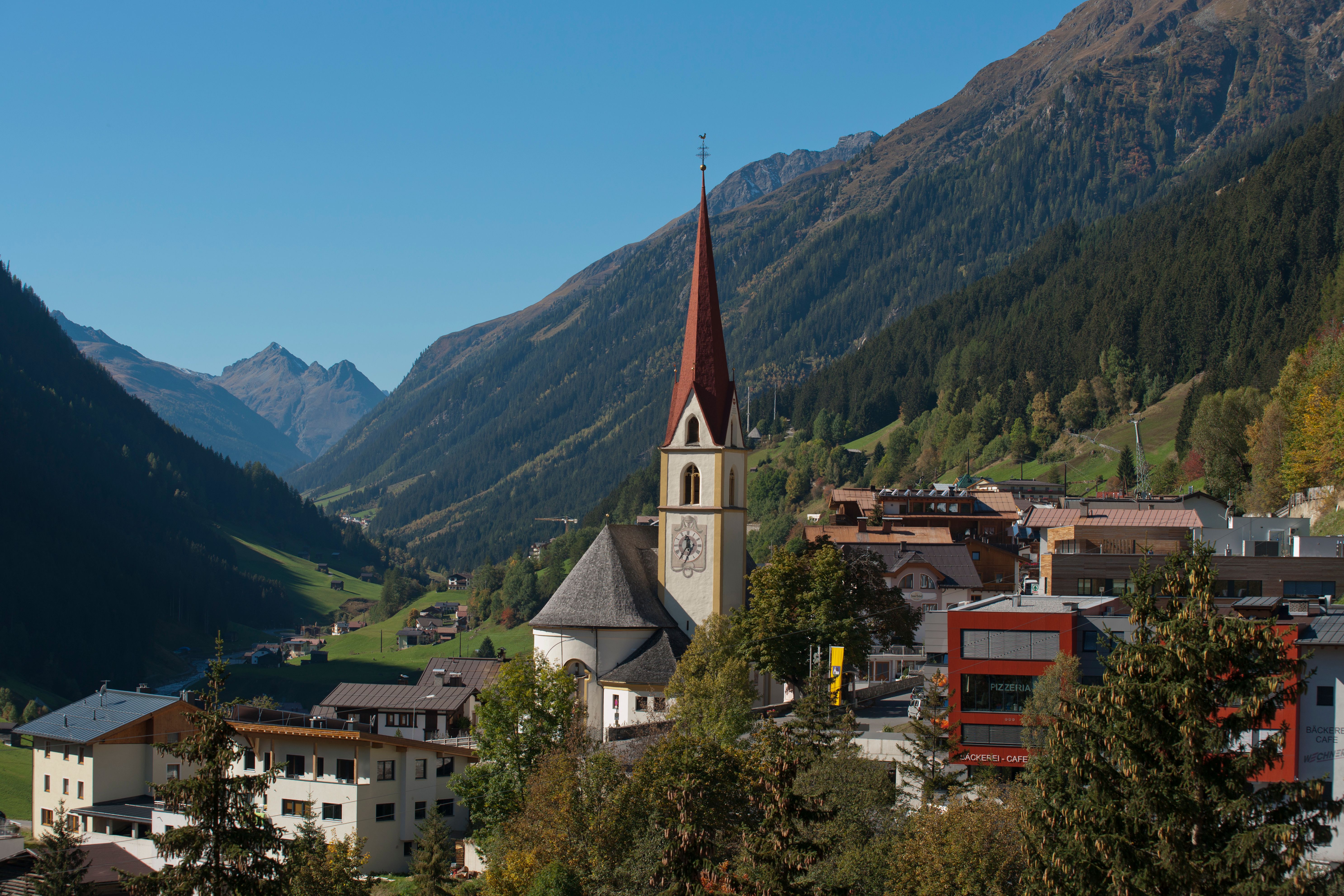
Weather in Kappl, 1,258 m

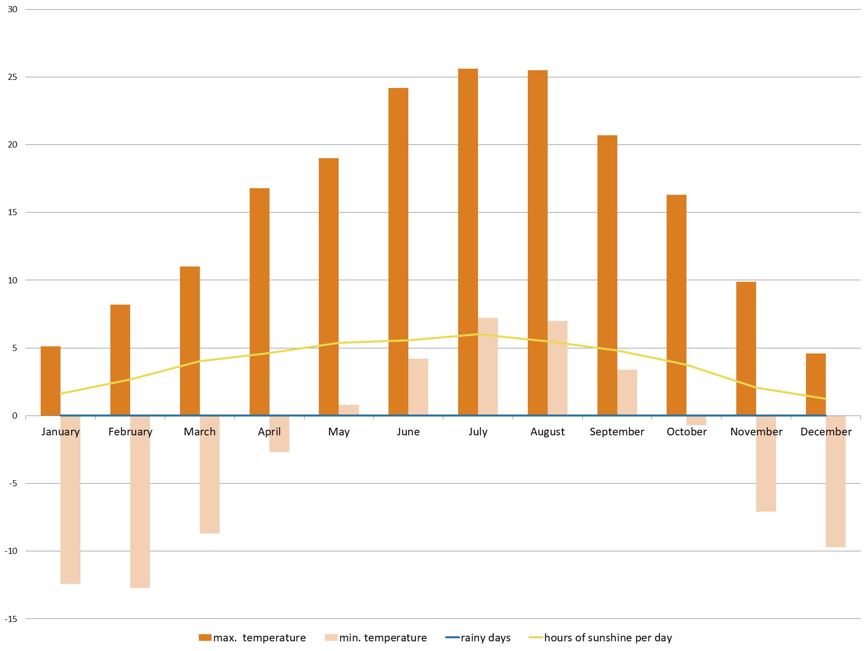
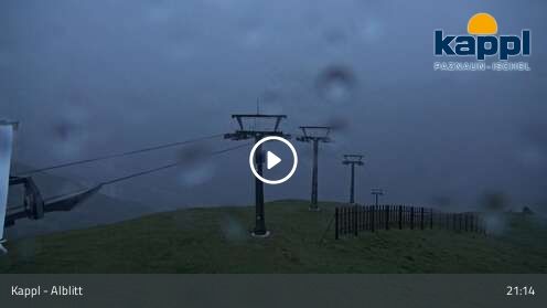
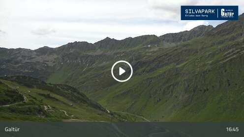
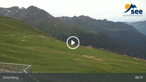
Here you will find the latest information on the weather in Kappl, Austria. As well as a summary of the current weather conditions, you will also receive a weather forecast for the next nine days. Use the hour-by-hour prediction to keep an eye on the development of the weather throughout the day. A number of webcams are also available to see the weather in real time. Climate diagrams show typical weather conditions in Kappl at different times of the year.

00:00

Heavy Rain
Wetter

3°C

Precipitation: 90%


Wind: 5 km/h

01:00

Heavy Rain
Wetter

3°C

Precipitation: 95%


Wind: 5 km/h

02:00

Snow
Wetter

3°C

Precipitation: 100%


Wind: 5 km/h

03:00

Snow
Wetter

2°C

Precipitation: 95%


Wind: 5 km/h

04:00

Snow
Wetter

2°C

Precipitation: 95%


Wind: 10 km/h

05:00

Snow
Wetter

2°C

Precipitation: 70%


Wind: 10 km/h

06:00

Snow Showers
Wetter

3°C

Precipitation: 65%


Wind: 10 km/h

07:00

Snow Showers
Wetter

3°C

Precipitation: 60%


Wind: 10 km/h

08:00

Rain Showers
Wetter

4°C

Precipitation: 55%


Wind: 10 km/h

09:00

Rain Showers
Wetter

4°C

Precipitation: 90%


Wind: 10 km/h

10:00

Heavy Rain
Wetter

4°C

Precipitation: 65%


Wind: 10 km/h

11:00

Heavy Rain
Wetter

5°C

Precipitation: 70%


Wind: 10 km/h

12:00

Heavy Rain
Wetter

5°C

Precipitation: 75%


Wind: 10 km/h

13:00

Heavy Rain
Wetter

5°C

Precipitation: 65%


Wind: 10 km/h

14:00

Heavy Rain
Wetter

4°C

Precipitation: 60%


Wind: 10 km/h

15:00

Heavy Rain
Wetter

4°C

Precipitation: 60%


Wind: 5 km/h

16:00

Partly Cloudy
Wetter

3°C

Precipitation: 25%


Wind: 5 km/h

17:00

Partly Cloudy
Wetter

2°C

Precipitation: 30%


Wind: 5 km/h

18:00

Snow
Wetter

2°C

Precipitation: 80%


Wind: 5 km/h

19:00

Snow
Wetter

2°C

Precipitation: 75%


Wind: 5 km/h

20:00

Snow
Wetter

1°C

Precipitation: 80%


Wind: 5 km/h

21:00

Snow
Wetter

1°C

Precipitation: 75%


Wind: 5 km/h

22:00

Snow
Wetter

1°C

Precipitation: 70%


Wind: 5 km/h

23:00

Snow
Wetter

1°C

Precipitation: 75%


Wind: 5 km/h

00:00

Snow
Wetter

0°C

Precipitation: 75%


Wind: 5 km/h

01:00

Snow
Wetter

0°C

Precipitation: 70%


Wind: 5 km/h

02:00

Snow
Wetter

0°C

Precipitation: 90%


Wind: 5 km/h

03:00

Snow
Wetter

0°C

Precipitation: 95%


Wind: 5 km/h

04:00

Snow
Wetter

-1°C

Precipitation: 65%


Wind: 5 km/h

05:00

Snow
Wetter

-1°C

Precipitation: 70%


Wind: 5 km/h

06:00

Snow
Wetter

1°C

Precipitation: 95%


Wind: 5 km/h

07:00

Snow
Wetter

2°C

Precipitation: 100%


Wind: 5 km/h

08:00

Snow
Wetter

3°C

Precipitation: 95%


Wind: 5 km/h

09:00

Heavy Rain
Wetter

4°C

Precipitation: 90%


Wind: 5 km/h

10:00

Heavy Rain
Wetter

4°C

Precipitation: 75%


Wind: 5 km/h

11:00

Heavy Rain
Wetter

5°C

Precipitation: 55%


Wind: 5 km/h

12:00

Rain
Wetter

5°C

Precipitation: 55%


Wind: 5 km/h

13:00

Rain
Wetter

5°C

Precipitation: 55%


Wind: 0 km/h

14:00

Heavy Rain
Wetter

5°C

Precipitation: 55%


Wind: 0 km/h

15:00

Heavy Rain
Wetter

4°C

Precipitation: 60%


Wind: 0 km/h

16:00

Heavy Rain
Wetter

4°C

Precipitation: 60%


Wind: 0 km/h

17:00

Snow
Wetter

3°C

Precipitation: 90%


Wind: 5 km/h

18:00

Snow
Wetter

1°C

Precipitation: 85%


Wind: 0 km/h

19:00

Snow
Wetter

1°C

Precipitation: 85%


Wind: 5 km/h

20:00

Snow
Wetter

1°C

Precipitation: 85%


Wind: 0 km/h

21:00

Snow
Wetter

0°C

Precipitation: 50%


Wind: 0 km/h

22:00

Snow
Wetter

0°C

Precipitation: 50%


Wind: 0 km/h

23:00

Snow
Wetter

-1°C

Precipitation: 50%


Wind: 0 km/h

Monday, Apr 3, 2023

morning, 7:00 - 11:00

Wetter

-1°C

30%

5 km/h

afternoon, 12:00 - 17:00

Wetter

3°C

10%

10 km/h

evening, 18:00 - 22:00

Wetter

0°C

5%

10 km/h

Light snowfall at daybreak, then more and more sunshine during the day.

Tuesday, Apr 4, 2023

morning, 7:00 - 11:00

Wetter

-6°C

0%

0 km/h

afternoon, 12:00 - 17:00

Wetter

2°C

0%

10 km/h

evening, 18:00 - 22:00

Wetter

-1°C

10%

5 km/h

The day starts sunny, but will be partly cloudy in the afternoon.

Wednesday, Apr 5, 2023

morning, 7:00 - 11:00

Wetter

-5°C

5%

5 km/h

afternoon, 12:00 - 17:00

Wetter

2°C

10%

5 km/h

evening, 18:00 - 22:00

Wetter

-1°C

30%

5 km/h

Rather sunny weather during the day with clouds mainly in the morning and towards the evening

Thursday, Apr 6, 2023

morning, 7:00 - 11:00

Wetter

-4°C

20%

5 km/h

afternoon, 12:00 - 17:00

Wetter

6°C

20%

5 km/h

evening, 18:00 - 22:00

Wetter

3°C

20%

5 km/h

Partly sunny in the morning, gradually becoming cloudy in the afternoon.

Friday, Apr 7, 2023

morning, 7:00 - 11:00

Wetter

-1°C

15%

5 km/h

afternoon, 12:00 - 17:00

Wetter

8°C

15%

5 km/h

evening, 18:00 - 22:00

Wetter

4°C

15%

5 km/h

Morning clouds will clear gradually. Then frequent sunny periods.

Saturday, Apr 8, 2023

morning, 7:00 - 11:00

Wetter

-1°C

15%

5 km/h

afternoon, 12:00 - 17:00

Wetter

7°C

20%

5 km/h

evening, 18:00 - 22:00

Wetter

4°C

20%

5 km/h

The day will be dry, but mostly cloudy with occasional sunny spells.

Sunday, Apr 9, 2023

morning, 7:00 - 11:00

Wetter

0°C

15%

0 km/h

afternoon, 12:00 - 17:00

Wetter

8°C

15%

5 km/h

evening, 18:00 - 22:00

Wetter

5°C

25%

5 km/h

The day will be dry, but mostly cloudy with occasional sunny spells.

Saturday

Apr 1, 2023

Wetter

max. 8°C

min. 1°C

Sunday

Apr 2, 2023

Wetter

max. 7°C

min. 0°C

Monday

Apr 3, 2023

Wetter

max. 4°C

min. -4°C

Tuesday

Apr 4, 2023

Wetter

max. 4°C

min. -7°C

Wednesday

Apr 5, 2023

Wetter

max. 3°C

min. -6°C

Thursday

Apr 6, 2023

Wetter

max. 7°C

min. -5°C

Friday

Apr 7, 2023

Wetter

max. 9°C

min. -2°C

Saturday

Apr 8, 2023

Wetter

max. 8°C

min. -1°C

Sunday

Apr 9, 2023

Wetter

max. 10°C

min. 0°C

Current webcams in Kappl

show more +
Climate diagram Kappl
TemperatureSunshine HoursPrecipitation
Climate information
Temperature

Located in the heart of the Alps, Tirol lies within the temperate climate zone.

The temperature conditions are characterised by moderate warming during the daytime and clearly defined seasons. Altitude has a large influence on the temperature. As a rule, the higher the altitude the lower the temperature. However, in winter it is sometimes the case that cold air settles in the valley while warm air rises to higher altitudes.

Hours of sunshine

In Tirol's alpine environment there are two factors which influence the number of hours of sunshine.

Firstly, local topography determines if a specific location lies in the shade of a mountain or not. Secondly, cloud cover and fog also play a major role, though in Tirol fog tends to burn off quickly. As a rule, mountain peaks and south-facing slopes get the most hours of sunshine.

Precipitation

Precipitation falls across the region in the form of rain and snow.

This is the result of weather fronts which form at the point where warm and cold air meets. The Alps represent a barrier stopping air from flowing, so the highest levels of precipitation tend to be on the northern and southern edges of the Alps. Basins and valleys within the Alps, such as the Inn Valley, receive less precipitation. During the summer months precipitation falls generally in the form of short but heavy local showers.

How did you like this article?

Want to receive an answer? If so, please get in touch using the contact form.

Go up

Is your inbox in need of a holiday?

Then subscribe to our weekly newsletter full of exclusive holiday tips from Tirol!