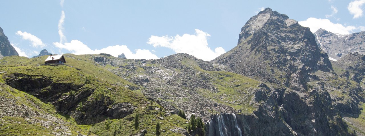
The Anton-Renk-Hütte (2,261 metres) is a mountain hut located on the Glockturmkamm ridge between the Upper Inn Valley and the Kaunertal Valley. It is perfect for those who want to get away from it all.
Self-catering hut on the Aachen High Trail
German Alpine Club, Aachen Division
Named after the author and mountaineer Anton Renk, this self-catering hut built in 1926 is located in the north-western part of the Glockturmkamm ridge dividing the Upper Inn Valley from the Kaunertal Valley. It can be reached both from Ried in the Upper Inn Valley and Fendels in the Kaunertal Valley. Two cable cars are availbale to those who wish to shorten the relatively long ascent. After picking up the key down in the valley, visitors can look forward to an enjoyable stay in this basic but cosy hut including a wood-burning oven, a cooking area, crockery and solar energy. Water can be drawn from the fountain in front of the hut. However, there is no shower. The only place nearby serving food is the Stalanzalpe, which is around half an hour away on foot. One of the many natural highlights in the area around the hut is the 150-metre-high Renkfälle waterfall. Next to the waterfall is the "Anton-Renk-Klettersteig", a fixed-rope via ferrata with iron handholds and footholds. The hut is located on the Aachen High Trail, which leads to the Gepatschhaus lodge in the Kaunertal Valley.
How to get to the Anton-Renk-Hütte
Mountain hike: Anton-Renk-Hütte - Fallender Bach from Ried in the Upper Inn Valley: 8 hours
From Ried or Fendels, you can take the cable car to Sattelboden. From there it is 2.5 hours.
Four-day trek Fendels - Pfunds
Walks and hikes in the area
Kuppkarlesspitze (2,990 metres), 4 hours
Feichtener Karlspitze (2,916 metres), 2.5 hours, difficult
Pfroslkopf (3,146 metres), 4 hours, difficult
Alter Mann (2,887 metres), 3 hours
Anton-Renk-Klettersteig (difficulty rating: D/E)
Other huts in the area, long-distance hiking trails
Stalanzalpe, 30 minutes
Gepatschhaus, 10 hours
Verpeilhütte, 10 hours
Hohenzollernhaus, 12 hours
Self-catering hut on the Aachen High Trail German Alpine Club, Aachen Division Named after the author and mountaineer Anton Renk, this self-catering…


