Contact
Alois Eiter
Postfach 60
6561 Ischgl
0043 5444 21021
info@heidelberger-huette.at
http://www.heidelberger-huette.at
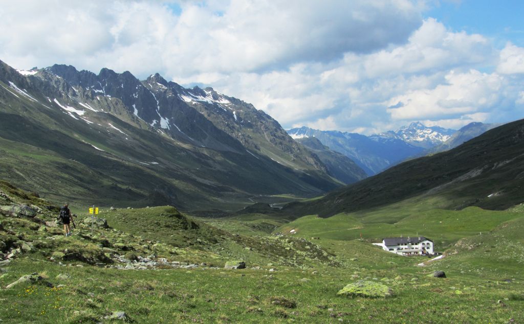
The Heidelberger Hütte (2,264 metres) is a high-alpine refuge in the Silvretta Mountains. It lies just over the border, on Swiss territory.

Cosy hut with sauna and fine views
German Alpine Club, Heidelberg Division
The Heidelberger Hütte – known in the local Swiss dialect Romansh as "Chamanna Fenga" – lies at the foot of the 3,399-metre-high Fluchthorn peak in the Silvretta Mountains. It is run from the resort of Ischgl in Austria, but it actually sits three kilometres over the border on Swiss territory. Built in the year 1889, it is today a cosy high-alpine refuge and the only mountain hut in Switzerland owned by the German Alpine Club. It is a popular base for hikers, climbers, mountaineers, trailrunners and, in winter, ski touring enthusiasts and snowshoe walkers. The Heidelberger Hütte enjoys a fine location at the end of the gently rising Fimbatal Valley, surrounded by 3,000-metre peaks and ridges. To the west there are a number of glaciers that can be explored by experienced mountaineers. The hut serves hearty food and has seminar facilities for meetings and events. Last but not least, at the end of a long day there is the chance to relax in the hut's own sauna.
From Ischgl via Bodenalpe 4 hours, from mid-way station of Silvrettabahn cable car 3 hours, from Galtür via Lareinalm 5.5 hours, from Samnaun via Val Musaina 6 hours, from Ramosch/Sent 6 hours.
Ritzenjoch (2,686 metres), 1.5 hours, intermediate
Breite Krone/Curuna Lada (3,079 metres), 3.5 hours, intermediate
Heidelberger Spitze (2,965 metres), 2.5 hours, difficult
Piz Tasna (3,179 metres), 4.5 hours, difficult
Fluchthorn (3,397 metres), 5 hours, difficult closed due to rockfall!
Jamtalhütte, 4.5 hours
Alois Eiter
Postfach 60
6561 Ischgl
0043 5444 21021
info@heidelberger-huette.at
http://www.heidelberger-huette.at


