Contact
Leonhard Siller
Schulweg 28
6167 Neustift
0043 664 1657461 (Jun-Sept)
+43/5226/30496
info@nuernbergerhuette.at
http://www.nuernbergerhuette.at
The Nürnberger Hütte (2,278 metres) is a mountain hut near the Main Alpine Ridge in the Stubai Alps. It is an excellent base camp for mountain adventures and crossings over to South Tirol, Italy.

Family-friendly hut on the Stubai High Trail
German Alpine Club, Nürnberg Division
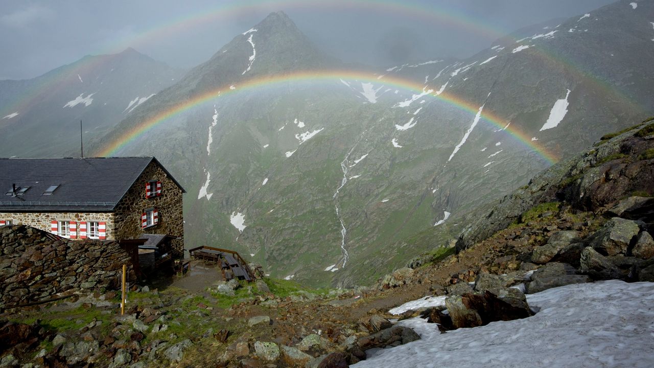
Perched high above the Langental Valley, a side valley at the southern end of the Stubaital Valley leading up onto the glaciers, the Nürnberger Hütte is a popular base for high alpine adventures and hikes across the border to South Tirol, Italy. It is also a good place from which to climb the Wilder Freiger, a mighty mountain rising to the south-east of the hut. Built at the end of the 19th century, the hut today sleeps 130 guests and is located on the Stubai High Trail. Meals are prepared using produce sourced from the region, including milk, cheese and meat from the farm run by the hut's owners. An extension contains a boulder wall and a table tennis table. Near to the hut you will find a via ferrata fixed-rope climbing trail as well as two rock-climbing areas.
From the car park south of Ranalt or from the bus stop "Nürnberger Hütte" via the Bsuchalm in 2.5 hours.
Mairspitze (2,780 metres), 2 hours, intermediate
Gamsspitzl (3,051 metres), 2.75 hours, intermediate
Östlicher Feuerstein (3,267 metres), 4 hours, difficult (glacier crossing)
Wilder Freiger (3,419 metres), 4.5 hours, difficult (glacier crossing)
Nürnberger Hütte via ferrata climbing route (B/C - intermediate)
Bremer Hütte, 3.5 hours
Sulzenauhütte, 2.75 hours.
Magdeburger Hütte (South Tirol, Italy), 6.5 hours
Becherhaus, 5 hours
Müllerhütte, 5 hours
Teplitzer Hütte, 5 hours
Dresdner Hütte, 5.75 hours
Innsbrucker Hütte, 8.75 hours
Tribulaunhütte, 8.75 hours
The hut is located on the Stubai High Trail.
Leonhard Siller
Schulweg 28
6167 Neustift
0043 664 1657461 (Jun-Sept)
+43/5226/30496
info@nuernbergerhuette.at
http://www.nuernbergerhuette.at


