Mountainbike-Tour 458 Labergalm

Mayrhofen, Zillertal /
Difficulty ratings: medium
Route length: 13.8 km
Duration: 2:45 h

Along the bike tracks of local culture and tradition!  

Tour information

  • Requirement: medium
  • Length: 13.8 km
  • Duration: 2:45 h
  • Elevation uphill:690 hm
  • Elevation downhill:690 hm
Highest point1,783 m

Starting point

Feuerwehrhaus, Brandberg 13, 6290 Brandberg

Finishing point

Feuerwehrhaus, Brandberg 13, 6290 Brandberg
  • Fitness level 4 / 6
  • Technique 3 / 6

Best time of year

  • January
  • February
  • March
  • April
  • May
  • June
  • July
  • August
  • September
  • October
  • November
  • December

Trail condition

  • Surface: gravel; asphalt; off-raod; unknown
  • Difficulty: easy; moderat; difficult
  • Gradient: up to 5%; 6-11%; 12-16%; more than 17%

Equipment

-
Source: Zillertal

Description

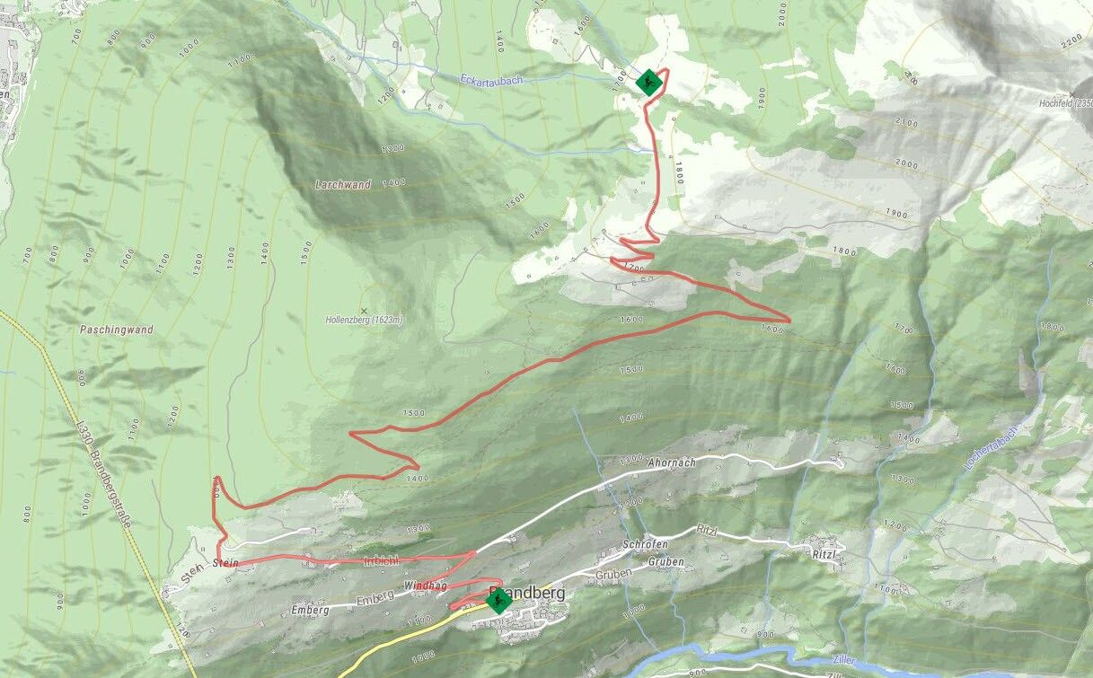
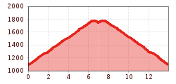
The fire station in Brandberg is the starting point for Route No. 458. From here, the route leads uphill along the asphalted road towards Steinerkogel Guesthouse. After approx. 2 km, turn right and follow the road towards the forest, where the asphalt road ends. You have the opportunity here to make a small detour to Berggasthof Steinerkogel 1263 m and enjoy refreshments whilst savouring the impressive view. The ascent continues through the forest along a well-maintained gravel trail, which is repeatedly intersected by a footpath. After having left the forest for some time, you will reach Laberg and the turning point of this route. The view can be enjoyed here while catching your breath for the return journey amidst the scenic countryside.
 

Nearby huts and mountain restaurants

Getting here

  • Arrival by public transport

    Bus no.: 4100; Stop: Brandberg GH Thanner
    www.mayrhofen.at/fahrplaene
    The transportation is at the discretion of the bus driver!
     

Newsletter

The mountain is calling? So does our newsletter!

In our monthly newsletter we reveal the best holiday tips for Tyrol.