Mountain hikes Alpenschlössl Castel Tour

open
Söll / Kitzbüheler Alpen
Difficulty ratings: easy
Route length: 4.3 km
Duration: 1:15 h

Through the districts of Ried and Paisslberg on a leisurely walk for everyone.

Tour information

  • Requirement: easy
  • Length: 4.3 km
  • Duration: 1:15 h
  • Elevation uphill:100 hm
  • Elevation downhill:100 hm
Highest point770 m

Starting point

Hiking starting point Alpenschlössl, Söll (762 m)

Finishing point

Hiking starting point Alpenschlössl, Söll (762 m)
  • Fitness level 1 / 6
  • Technique 2 / 6

Features

  • Circular route
  • Suitable for families

Best time of year

  • January
  • February
  • March
  • April
  • May
  • June
  • July
  • August
  • September
  • October
  • November
  • December

Trail condition

The composition of the trail varies between asphalt, forest road, meadow and gravel path.

Equipment

Rucksack, sturdy hiking/mountaineering boots with anti-slip treaded soles, weather-appropriate hiking gear (breathable), a change of clothes, sun protection (sunglasses, sun cream, lip protection, headgear), waterproofs (rain jacket/poncho, pocket umbrella, rucksack protector), cold protection (hat, gloves), sufficient food and drink, hiking poles (height adjustable) if required, first aid kit incl. rescue blanket and bivouac sack, mobile phone with fully charged battery, headlamp, plastic bag for waste, hiking map, route description and information materials (GPX track), ID, insurance card, cash
Source: Wilder Kaiser

Description

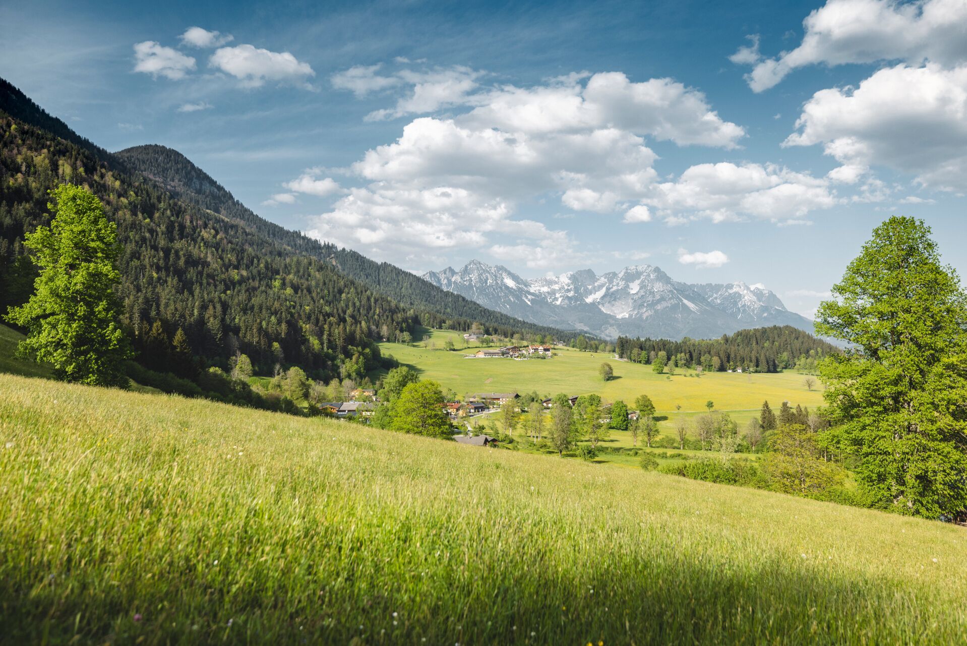
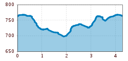
The starting point for this leisurely loop is the Alpenschlössl hiking starting point. Walk past the hotel of the same name along the meadow path until you reach the Steher Lengau forest path. Turn left here and follow the path to the neighbourhood of Ried. At the bottom of the crossroads, keep right on the tarmac road. Pass the Hitscherhof farm and continue along the road in the direction of Badhaus. Opposite the Badhaus inn, a meadow path signposted to Itter leads you through the forest. Continuing along the idyllic forest path, the route climbs a short distance until you reach the Schössergraben stile. Turn right here and follow the road to the Hinterfirsthof farm and then back towards Badhaus. From there, turn left across the Badhausgraben back to the starting point at the Alpenschlössl hiking starting point.

Nearby huts and mountain restaurants

  • Badhaus

    Opening hours:Open today
    Place: Söll
    : Restaurant
    see restaurant details: Badhaus

Getting here

  • Parking

    Hiking starting point Alpenschlössl, Söll (762 m) - for free

More tours in the surrounding area

  • Panoramic circuit Brandstadl–Hartkaiser

    Difficulty: easy
    Length: 6.0 km Duration: 1:50 h Elevation uphill: 170 m
  • Hochalm hike

    Difficulty: medium
    Length: 19.6 km Duration: 7:00 h Elevation uphill: 1,140 m
  • Hintere Goinger Halt summit tour

    Difficulty: difficult
    Length: 8.9 km Duration: 6:30 h Elevation uphill: 1,090 m
  • Winter walking Biedringer Platte

    Opening hours: open
    Length: 12.7 km Duration: 5:30 h Elevation uphill: 470 m
Newsletter

The mountain is calling? So does our newsletter!

In our monthly newsletter we reveal the best holiday tips for Tyrol.