Mountain hikes Gramais to the Kogelsee

Gramais / Lechtaler Alpen
Difficulty ratings: medium
Route length: 3.2 km

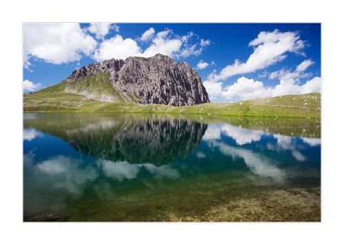
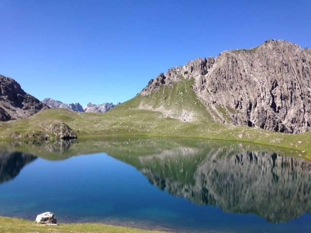
The Kogelsee is a mountain lake in the Lechtal Alps at an altitude of 2171 metres. The Kogelsee, which lies below the Bockkar peaks, has a diameter of just under 200 metres. There are two smaller lakes near the Kogelsee, the Gufelsee and the Parzinnsee.

Tour information

  • Requirement: medium
  • Length: 3.2 km
  • Elevation uphill:837 hm
Highest point2,173 m

Starting point

Car park at the town hall

Finishing point

Kogelsee

Features

  • Suitable for families

Best time of year

  • January
  • February
  • March
  • April
  • May
  • June
  • July
  • August
  • September
  • October
  • November
  • December

Trail condition

Gravel, path

Equipment

Good equipment is essential for your hike. The following items should definitely be in your rucksack: - Food and drink - Functional clothing for rain, wind and cold - A change of clothes - Sun protection - First aid kit - Mobile phone with a full battery (Euro emergency number 112) - Hiking map or GPS - Hiking poles Nevertheless, the following applies: light luggage is also easier to carry, so you should not weigh down your rucksack with unnecessary ballast. In addition, your hiking equipment should of course also be adapted to your particular hiking tour.
Source: Lechtal-Reutte

Description

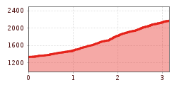
Your ascent begins in Gramais at 1,328 m, in the centre of the village at the Gschwendtbrücke bridge and leads you first towards Sattele and then through the Kogelkartal valley to the mountain lake. The shorter of the two marked routes is the one that takes you through the Kogelkartal valley. An ascent on the marked hiking trail takes around 2.5-3 hours.

More tours in the surrounding area

Newsletter

The mountain is calling? So does our newsletter!

In our monthly newsletter we reveal the best holiday tips for Tyrol.