Mountain hikes Hochalm - Heuberg - Nr. 88, 89

Walchsee / Kaisergebirge
Difficulty ratings: medium
Route length: 15.8 km
Duration: 6:30 h

Trail Nr. 88, 89

Tour information

  • Requirement: medium
  • Length: 15.8 km
  • Duration: 6:30 h
  • Elevation uphill:1,252 hm
  • Elevation downhill:1,247 hm
Highest point1,603 m

Starting point

Parking lot Hochberg

Finishing point

Parking lot Hochberg
  • Fitness level 4 / 6
  • Technique 3 / 6

Features

  • Circular route

Best time of year

  • January
  • February
  • March
  • April
  • May
  • June
  • July
  • August
  • September
  • October
  • November
  • December

Trail condition

Forest road, path, meadow path

Equipment

Breathable outdoor clothing suitable for the weather, sturdy footwear, food (snacks, drinks),
sun protection (sunglasses, sun cream & cap), rain protection, cash; guest card if using the bus
Source: Kaiserwinkl

Description

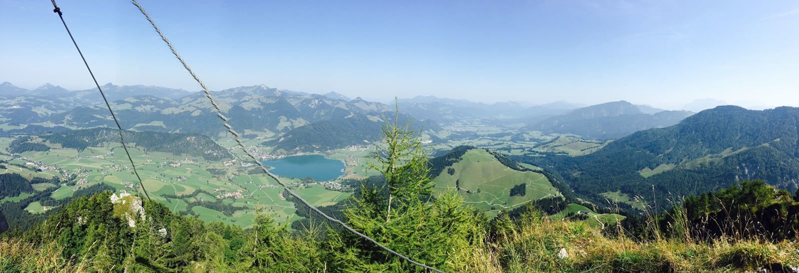
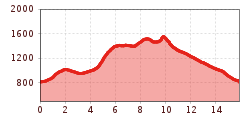
Right at the beginning of the hike you have a beautiful view of the Walchsee, the surrounding mountains, like the Lochnerhorn or the Brennkopf, as well as the moorlands, which stand out clearly from the grassland. Along the Habersau valley, you will reach the Kleinmoosenalm, from where it is not far to the Hochalm. From here you take the high-way to the Heuberg Gipfelkreuz with a very nice view. From the Heuberg down to the Hageralm and the forest trail along Gwirchtalm back to the starting point.
 

Getting here

  • Arrival by public transport

    By bus with line 4030 to the stop Kaufhaus Erharter

  • Parking

    Parking lot Hochberg

More tours in the surrounding area

  • Burgeralm

    Difficulty: medium
    Length: 13.8 km Duration: 6:00 h Elevation uphill: 974 m
  • Brennkopf

    Difficulty: medium
    Length: 8.6 km Duration: 4:00 h Elevation uphill: 738 m
Newsletter

The mountain is calling? So does our newsletter!

In our monthly newsletter we reveal the best holiday tips for Tyrol.