Arrival by public transport
Take bus line 4030 to the Durchholzen stop.
Weg Nr. 45, 88, 52, 88
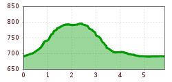
The Hochberg Loop starts at the paid parking area near the Zahmer Kaiser ski lifts.
An information board at the lower end of the parking lot points the way up the mountain to the right, in the direction of Hochberg, passing the Paxerhof with its beautiful Lüftlmalerei (traditional Bavarian mural paintings).
At the second road junction, turn left and cross the bridge, then follow the signs toward Hochberg.
With the Zahmer Kaiser range on your right, the trail leads through gently rolling terrain and a short stretch of forest, until you reach the Goferlhof and Bergerhof farms.
Turn right there and follow the paved road for about 1 km.
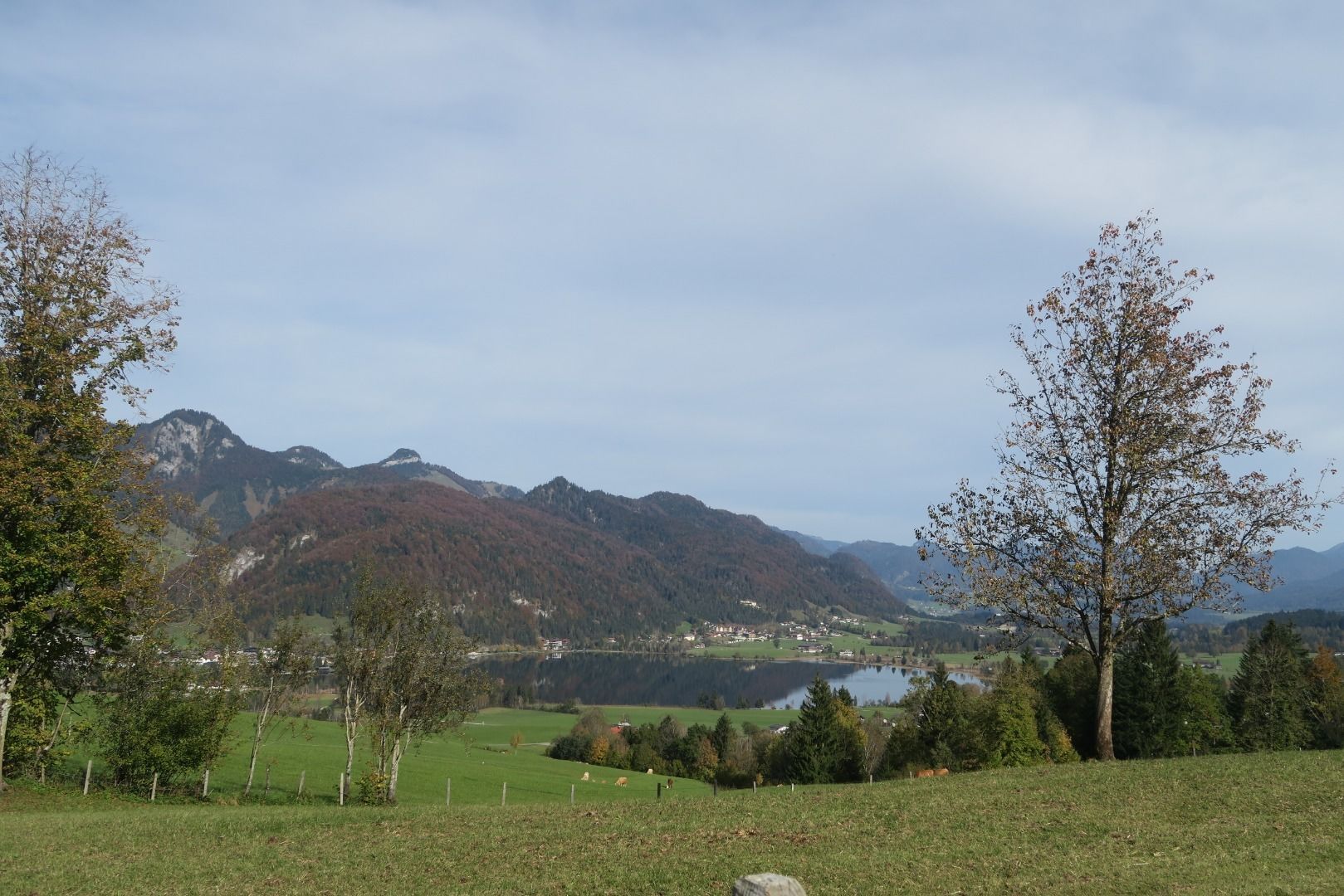
A spectacular view of Walchsee and the lake makes the climb worthwhile.
At the Heuberg hiking car park, turn left to descend the mountain toward the second hiking car park at Lippenalm.
About 100 meters below, turn left onto a gravel path that leads downhill at an angle – this brings you to the Bichl district.
Keeping left, you will soon reach the Schnapflhof, then continue straight to the Liesfeld area, which extends to the main road (Bundesstraße).
The final section of the route passes the Durchholzen chapel and follows the sidewalk along the road back to the starting point.
Take bus line 4030 to the Durchholzen stop.
At the Zahmer Kaiser mountain lift.

 bernhard bergmann.JPG")
