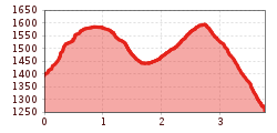
Long-distance hike Kaiserkrone - alternative route at the foot of the Sonnenstein

Scheffau am Wilden Kaiser / Kaisergebirge
Difficulty ratings: medium
Route length: 3.8 km
Duration: 2:30 h

Fork 823/826 – via waterfall – Veitskirche – Steiner-Hochalm

Tour information

  • Requirement: medium
  • Length: 3.8 km
  • Duration: 2:30 h
  • Elevation uphill:360 hm
  • Elevation downhill:490 hm
Highest point1,606 m

Starting point

Fork on the Wilder-Kaiser-Steig 823/826 (1,405 m)

Finishing point

Steiner-Hochalm, Scheffau (1,257 m)
  • Fitness level 4 / 6
  • Technique 3 / 6

Features

  • Multi-day hike

Best time of year

  • January
  • February
  • March
  • April
  • May
  • June
  • July
  • August
  • September
  • October
  • November
  • December

Trail condition

The composition of the trail varies between trails, meadow paths, forest trails, fields of scree.

Equipment

Rucksack, sturdy hiking/mountaineering boots with anti-slip treaded soles, weather-appropriate hiking gear (breathable), a change of clothes, sun protection (sunglasses, sun cream, lip protection, headgear), waterproofs (rain jacket/poncho, pocket umbrella, rucksack protector), cold protection (hat, gloves), sufficient food and drink, hiking poles (height adjustable) if required, first aid kit incl. rescue blanket and bivouac sack, mobile phone with fully charged battery, headlamp, plastic bag for waste, hiking map, route description and information materials (GPX track), ID, insurance card, cash

Additions for overnight stay at mountain hut:
Mountain hut sleeping bag, indoor shoes, toiletries and towel, personal medication, headlamp, Alpine Club ID Card, cash, charger for mobile phone The hiking routes between the huts are often rather long, we recommend taking plenty of food and drink and booking your overnight stays well in advance.
Source: Wilder Kaiser

Description

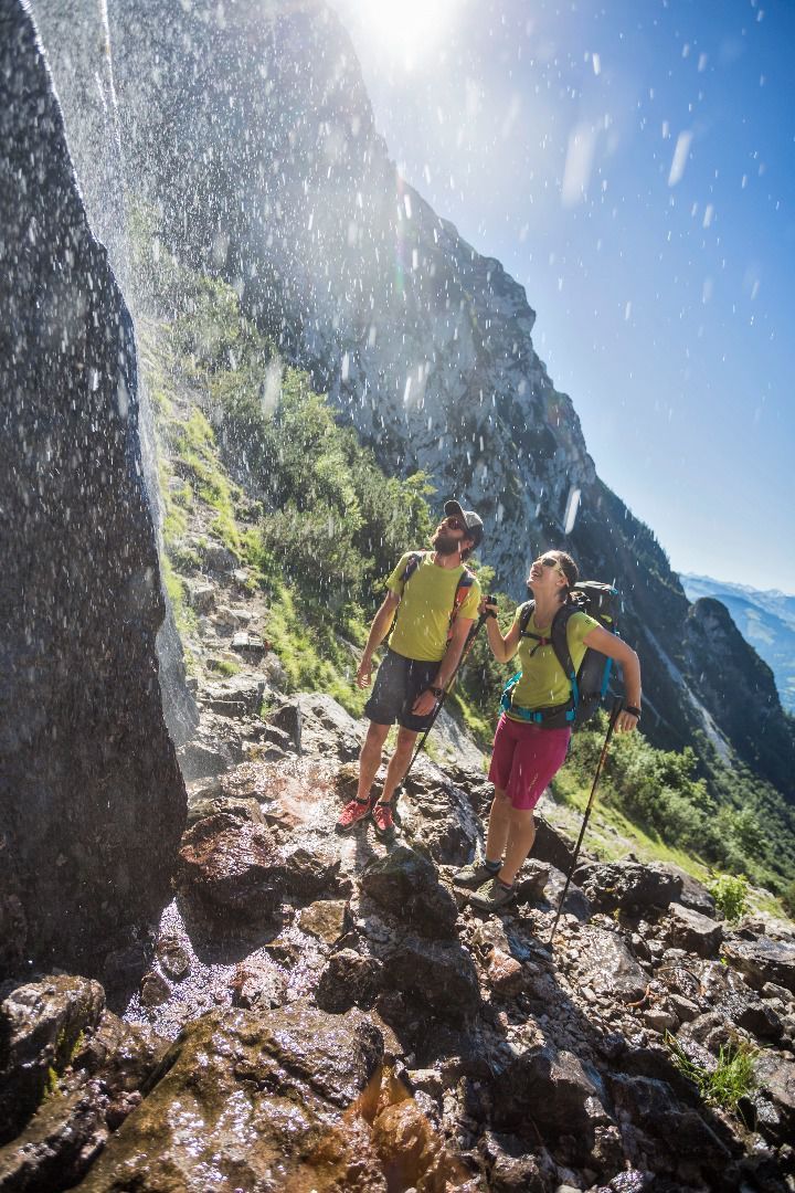
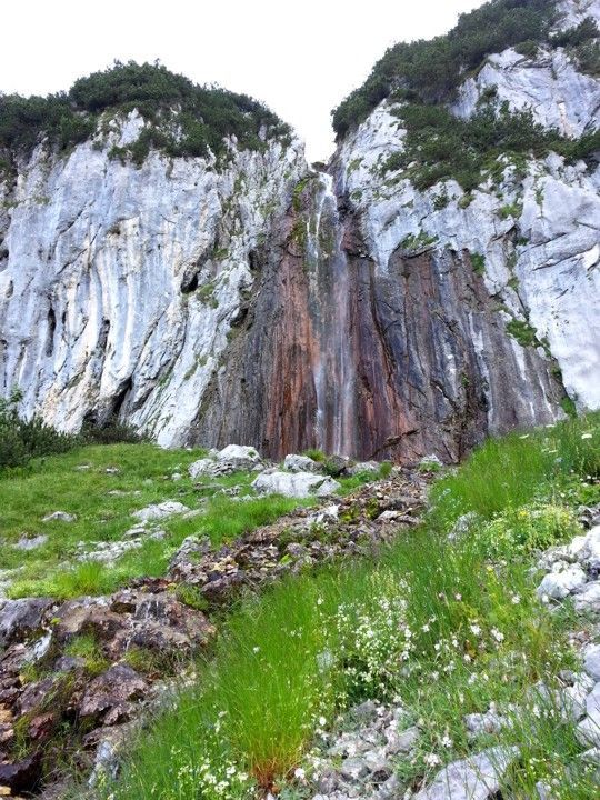
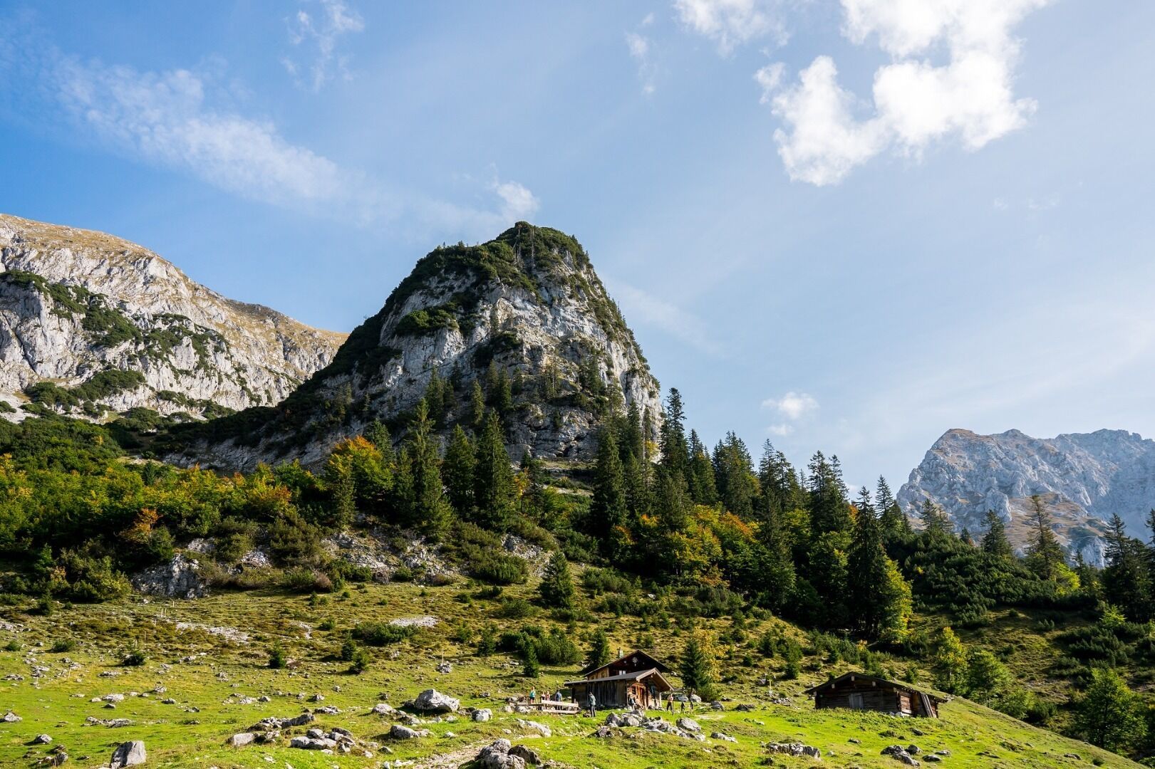
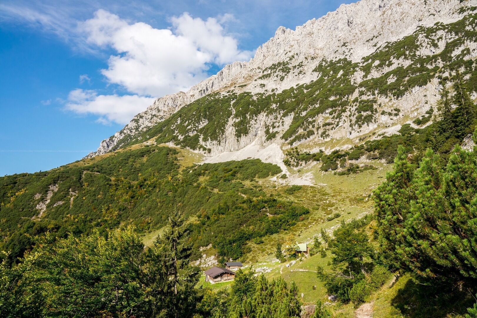
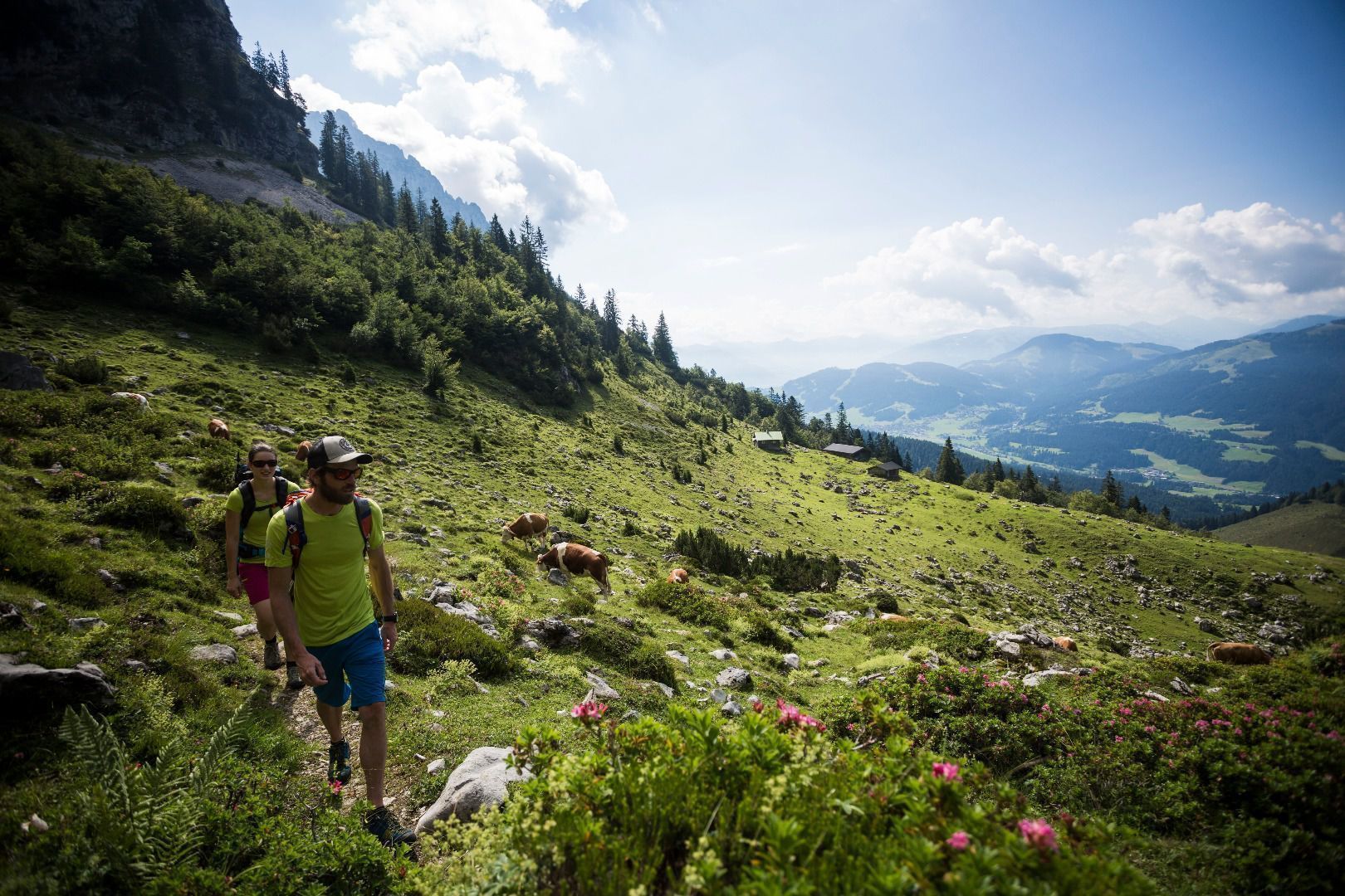
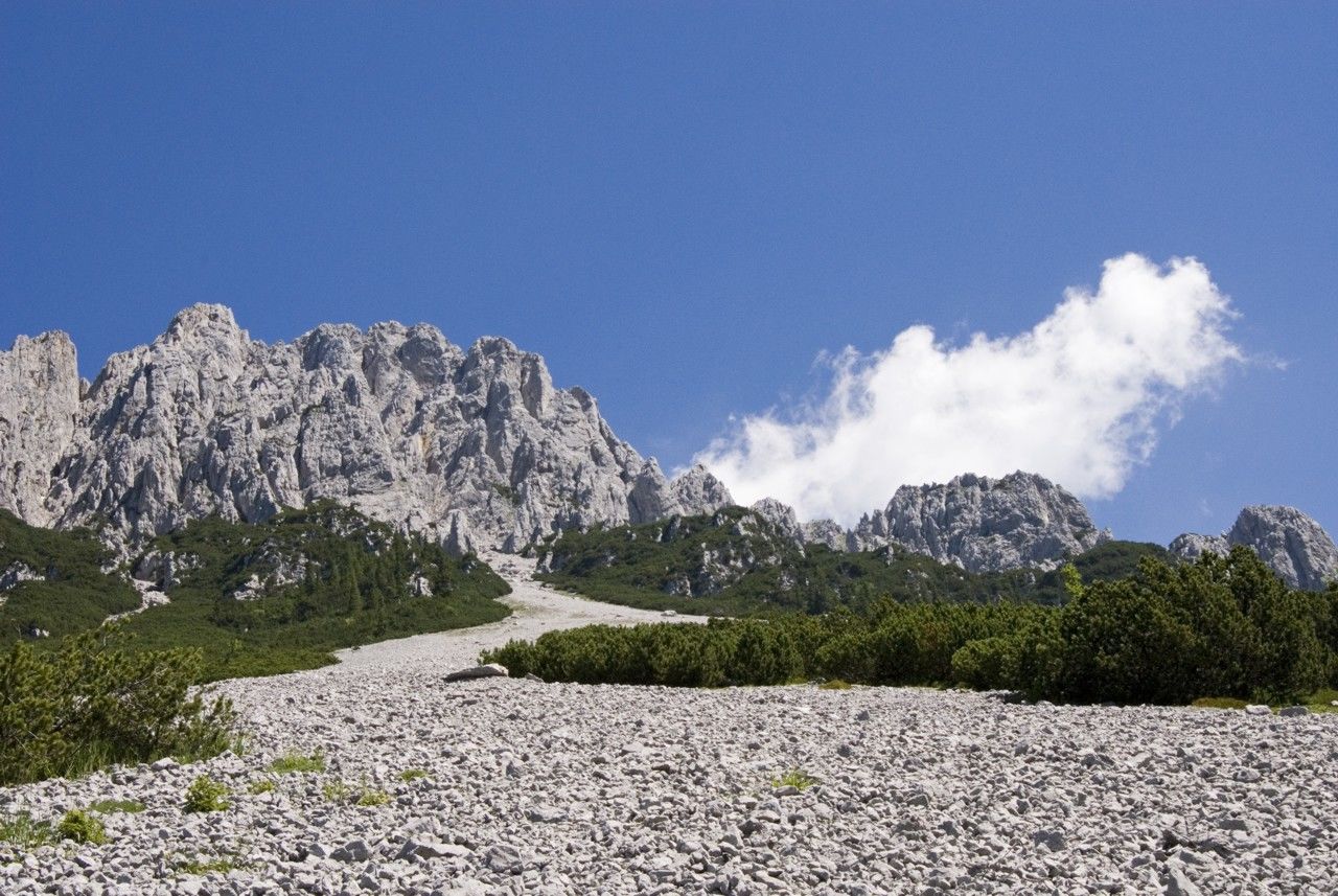
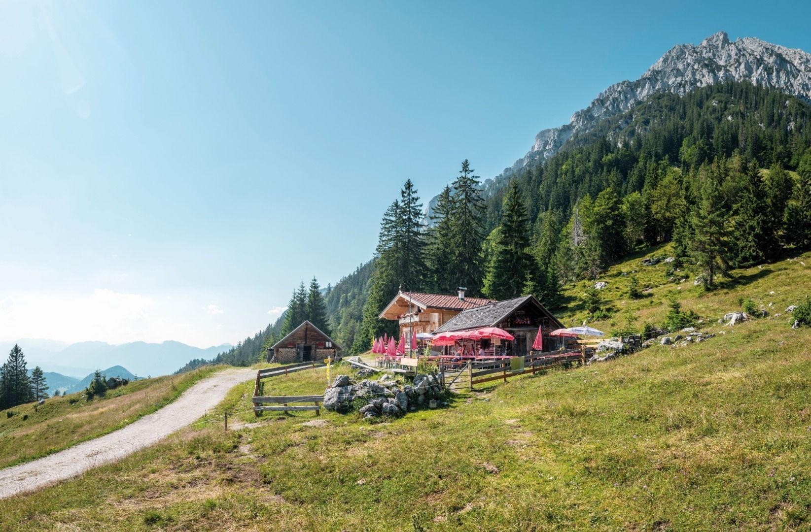
Hike along path 826 heading north (waterfall, Treffauer/Tuxeck, Sonneck) until you reach the waterfall. Enjoy a refreshing cool-down beneath the snow cirque before continuing on path 826 towards the west. After around 15 minutes, you will reach one of the most beautiful viewing points in the Wilder Kaiser region. From the foot of the Sonnenstein mountain, hike in a westerly direction along path 814 through mountain pine and steep Alpine meadows and go past the access point to the Scheffauer mountain. Heading through a field of scree, onward below the “Veitskirche” (rock formation) and via the "Hochofen", you will come to the Steiner-Hochalm mountain hut on path 814a heading south.

Requirements: surefootedness

More tours in the surrounding area

Newsletter

The mountain is calling? So does our newsletter!

In our monthly newsletter we reveal the best holiday tips for Tyrol.