Mountain hikes Ölbank Round Tour

Hopfgarten im Brixental / Kitzbüheler Alpen
Difficulty ratings: medium
Route length: 14.4 km
Duration: 4:00 h

Varied hike through the Kelchsau mountains, along idyllic alpine pastures.

Tour information

  • Requirement: medium
  • Length: 14.4 km
  • Duration: 4:00 h
  • Elevation uphill:700 hm
  • Elevation downhill:700 hm
Highest point1,500 m

Starting point

Car park Kelchsau-Unterdorf

Finishing point

Car park Kelchsau-Unterdorf
  • Fitness level 3 / 6
  • Technique 3 / 6

Features

  • Circular route

Best time of year

  • January
  • February
  • March
  • April
  • May
  • June
  • July
  • August
  • September
  • October
  • November
  • December

Trail condition

asphalt, forest path, mountain path

Equipment

Outdoor clothing, sturdy shoes
Sufficient food and drink!
First aid kit
Mobile phone with full battery & charger Hiking map & guide literature possibly GPS device or GPS data to be loaded onto the mobile phone
Sun protection (sunglasses, sun cream & cap)
Rain protection
Cash
 
Source: Kitzbüheler Alpen Management GmbH

Description

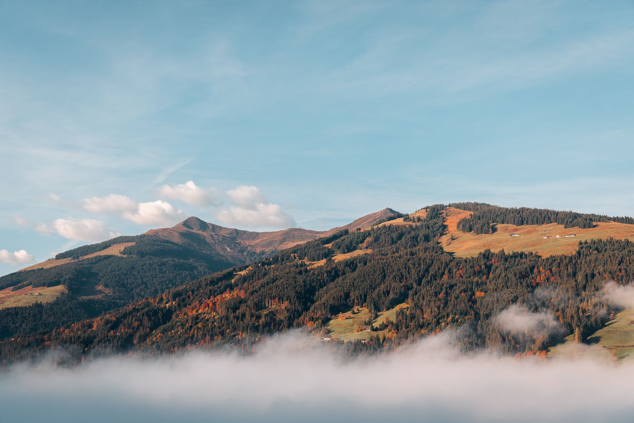
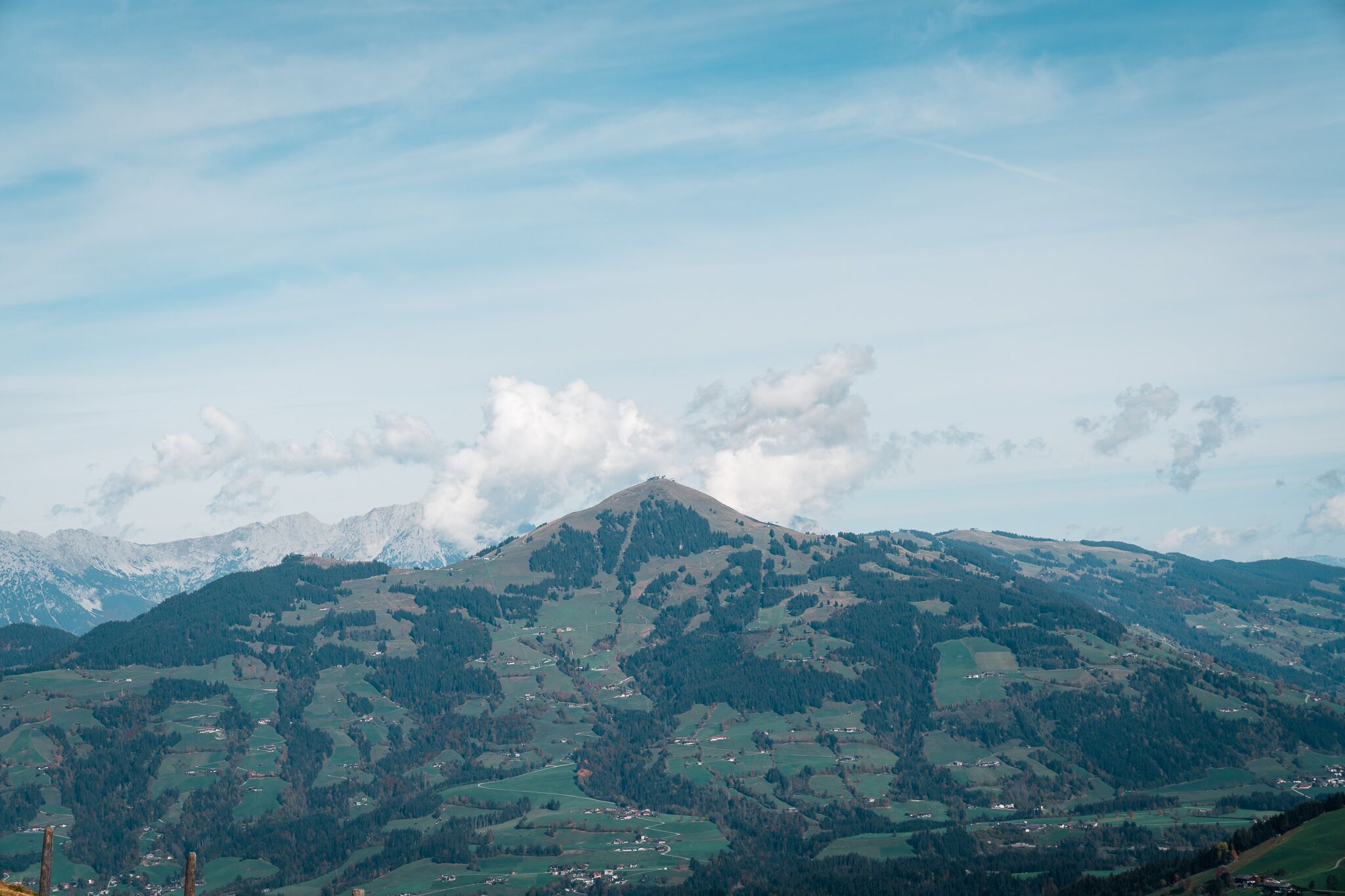
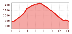
The starting point for this hike is the Kelchsau-Unterdorf car park. Cross the bridge and walk left along the rushing Ache into the valley to the first fork. From there, follow the signs no. 79+79/1 in the direction of the Ölbank circular trail. Follow the tarmac road uphill until you turn into the forest. Pass the Vordere and Hintere Ölbankalm and continue in the direction of the Untere Lodronalm. At the Unterlodron junction, follow trail no. 79/1 to the Demmelshütten. Return to the starting point along the Fortsstraße road back to Kelchsau. The last part of the hike leads through the centre of Kelchsau. 
There are no refreshment stops along the way, so we recommend taking enough food and drink with you.
 

Getting here

  • Arrival by public transport

    bus: Kelchsau Hofstattbahn

    Guest card of the region = train ticket from Wörgl to Hochfilzen + bus ticket from Mariastein to Kitzbühel included

    More detailed information: www.hohe-salve.com/mobility
     

  • Parking

    Car park Kelchsau-Unterdorf

More tours in the surrounding area

  • Niederau - Foisching Hut

    Difficulty: easy
    Length: 6.5 km Duration: 2:15 h Elevation uphill: 253 m
  • Schafsiedel

    Difficulty: medium
    Length: 15.6 km Duration: 6:45 h Elevation uphill: 1,280 m
  • KAT WALK COMPACT

    Difficulty: medium
    Length: 83.0 km Duration: 36:45 h Elevation uphill: 5,462 m
  • KAT WALK FAMILY

    Difficulty: medium
    Length: 52.5 km Elevation uphill: 3,390 m
Newsletter

The mountain is calling? So does our newsletter!

In our monthly newsletter we reveal the best holiday tips for Tyrol.