Mountain hikes Schafsiedel

Hopfgarten im Brixental / Kitzbühel Alps
Difficulty ratings: medium
Route length: 15.6 km
Duration: 7:00 h

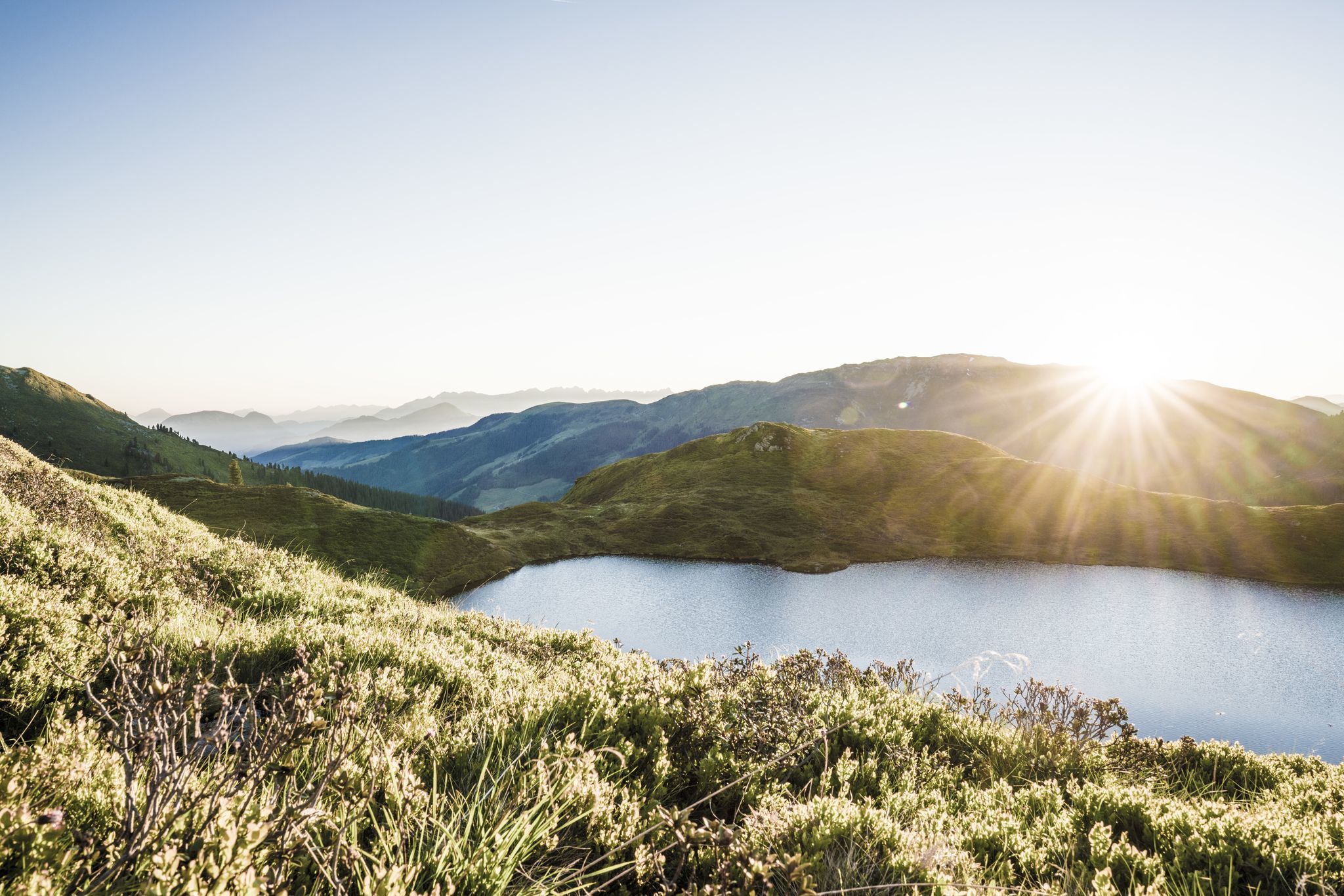
The Wildalmseen lakes meant well with us, after all there are three of these idyllic mountain lakes along the way - and one is more beautiful than the other.

Tour character

Moderately difficult hike through the lovely Kitzbühel Alps landscape past the lower, middle and upper Wildalmsee lakes. From the latter, only a short ascent to the summit of the Schafsiedel, one of the highest peaks in the ridge line of the Kitzbühel Alps. Beautiful distant views of the Hohe Tauern National Park.
Tour information

  • Requirement: medium
  • Length: 15.6 km
  • Duration: 7:00 h
  • Elevation uphill:1,280 hm
  • Elevation downhill:1,280 hm
Highest point2,447 m

Starting point

Gasthof Wegscheid

Finishing point

Gasthof Wegscheid
  • Fitness level 5 / 6
  • Technique 3 / 6

Best time of year

  • January
  • February
  • March
  • April
  • May
  • June
  • July
  • August
  • September
  • October
  • November
  • December

Trail condition

Forest path, hiking path

Equipment

outdoor clothing Sturdy shoes
sufficient food and water
First aid kit
Mobile phone with full battery & charger
Hiking map & guide literature Possibly a GPS device or download the GPS data to your mobile phone
Sun protection (sunglasses, sunscreen & cap)
Rainwear
cash
Source: Kitzbüheler Alpen Management GmbH

Description

The starting point of this hike is the parking lot at Gasthof Wegscheid in Kurzen Grund. From there, follow the signs no. 728 in the direction of Schafsiedel. Along the forest path you reach the alpine pasture area and the Neue Bamberger Hütte. On well-marked mountain paths you walk past the Lower and Middle Wildalmsee lakes, over some terrain steps you reach the Upper Wildalmsee lake and then the Schafsiedel (2,447 m).
You return to the starting point via the same path.
Despite the refreshment facilities, we recommend that you take food and drink with you for the tour.

Nearby huts and mountain restaurants

Getting here

  • Arrival by public transport

    bus: Steinerbrücke  in Kelchsau

    Guest card of the region = train ticket from Wörgl to Hochfilzen  + bus ticket from Mariastein to Kitzbühel
    includedvalid on ÖBB local trains (S, REX) and InterRegio trains (IR) between Kirchbichl - Wörgl
    and Hochfilzen. Notvalid on RJ, RJX, EC, IC, ICE, D and NJ/EN trains.


    More detailed information: www.hohe-salve.com/mobility

  • Parking

    From Innsbruck/Munich: A12 exit Wörgl Ost - feeder road B178 towards St. Johann i. T. & Kitzbühel - after the tunnel exit towards Hopfgarten - at the roundabout take the B170 towards Hopfgarten - turn right after the underpass and cross  the bridge towards Kelchsau - into the valley on the L205 Kelchsauer Straße approx. 10 km to the toll station (car toll EUR 5.-) - after the toll station turn left – into the Kurzer Grund valley to Gasthof Wegscheid.
    From Kitzbühel: B170 Brixentalstraße direction Wörgl - in Hopfgarten before the second railway underpass turn left over the bridge direction Kelchsau - approx. 10 km to toll station (car toll EUR 5,-) - after toll station turn left – into the Kurzer Grund valley to Gasthof Wegscheid
    free parking at the toll station Kelchsau (+ 2 hours) or directly at Gasthof Wegscheid

Weather

Today

clear sky
10°C/0°C
60%0.4l5 km/h

Sun

snow showers
5°C/0°C
65%1.5l0 km/h

Mon

mainly clear
6°C/-1°C
10%0l0 km/h
Go to weather forecast

More tours in the surrounding area

  • Kaiserkrone - stage 5

    Difficulty:medium
    Length:10.8 kmDuration:5:15 hElevation uphill:880 m
  • Kaiserkrone - stage 4

    Difficulty:medium
    Length:16.1 kmDuration:6:30 hElevation uphill:640 m
  • Koasa Trail Stage 4

    Difficulty:medium
    Length:20.6 kmDuration:7:35 hElevation uphill:923 m
  • Koasa Trail Stage 1

    Difficulty:medium
    Length:16.9 kmDuration:6:45 hElevation uphill:937 m
  • Koasa Trail Stage 3

    Difficulty:medium
    Length:19.9 kmDuration:7:10 hElevation uphill:730 m
  • Koasa Trail Stage 5

    Difficulty:medium
    Length:14.0 kmDuration:6:45 hElevation uphill:935 m
  • Koasa Trail Stage 2

    Difficulty:medium
    Length:11.8 kmDuration:7:15 hElevation uphill:1,078 m
  • Alpine Outdoor Gallery

    Difficulty:easy
    Length:6.7 kmDuration:2:00 hElevation uphill:117 m
  • The Wiegalm

    Difficulty:medium
    Length:10.5 kmDuration:4:45 hElevation uphill:680 m
  • Eifersbacher Wasserfall

    Difficulty:medium
    Length:5.9 kmDuration:2:30 hElevation uphill:241 m
  • Brechhorn

    Difficulty:medium
    Length:11.8 kmDuration:5:00 hElevation uphill:600 m
  • Teufelsgasse - "Devil's Lane"

    Difficulty:medium
    Length:7.6 kmDuration:3:00 hElevation uphill:343 m
  • Bichlachrunde

    Difficulty:easy
    Length:10.5 kmDuration:3:30 hElevation uphill:295 m
  • Möslalmkogel via Wörgl

    Difficulty:medium
    Length:10.3 kmDuration:3:30 hElevation uphill:580 m
Newsletter

The mountain is calling? So does our newsletter!

In our monthly newsletter we reveal the best holiday tips for Tyrol.
