
Let the Koasa Trail begin! On the first part of the trail, you’ll come across a hermitage, a rock chapel, maybe a chamois, probably some homemade herbal syrup, and definitely the Koasa.
A moderately difficult opening stage of the Koasa Trail, which leads from the rural valley areas around St. Johann in Tirol up into the quieter Niederkaiser region, with the Wilder Kaiser and the Niederkaiser Ridge constantly providing stunning views along the way. Paved and gravel sections alternate with forest trails, root-strewn woodland paths, and a rocky, partly exposed mountain trail; at times, the route becomes noticeably steeper on wooden steps and switchbacks. Particularly atmospheric are the Maria Blut Hermitage, a place of tranquility and spiritual energy, and the Gmail Chapel, built directly into the rock; in addition, there are frequent clearings offering views of the Leukental Valley and the alpine pasture region, where the Wilder Kaiser once again rises impressively. Places to rest and stop for refreshments along this stage include the Bacheralm, the Gut Kramerhof Restaurant, and the Gasthof Griesenau.

Maria Blut Hermitage: A Place of Peace and Power
The hiking meeting point at the information office in St. Johann in Tirol is your Starting Point for Stage 1 of the Koasa Trail—and thus the kickoff for the first section of the Trail Quintet. As you set off past the impressive farms of the Tirolean Unterinntal, your gaze will already be drawn to the Wilder Kaiser and the Niederkaiserkamm.
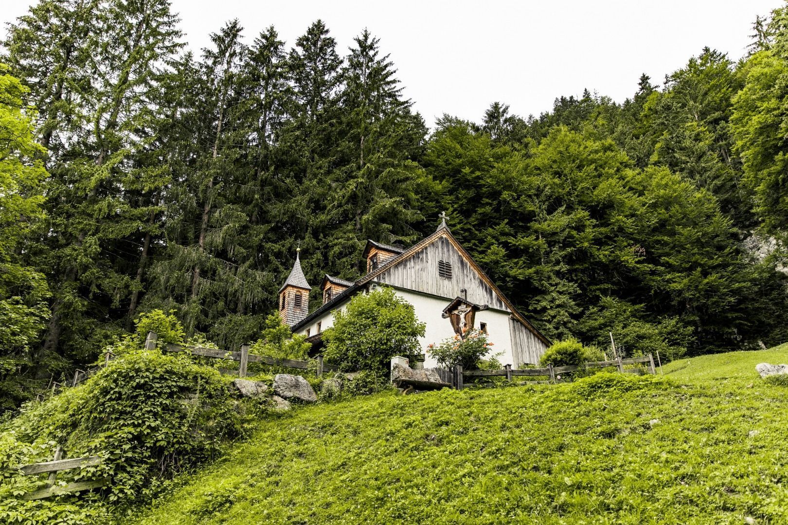
The trail continues along a root-strewn forest path, at the end of which a clearing opens up: Here you’ll catch sight of the so-called Maria Blut Hermitage, a pilgrimage chapel with charming little towers made of wooden shingles. Hermits have inhabited this spot, located at 856 meters above sea level, for more than 300 years. The rustic wooden bench in front of the wayside shrine invites you to sit down for a moment, pause, and let this peaceful place work its magic on you.
A Rock Chapel & a Serene Forest
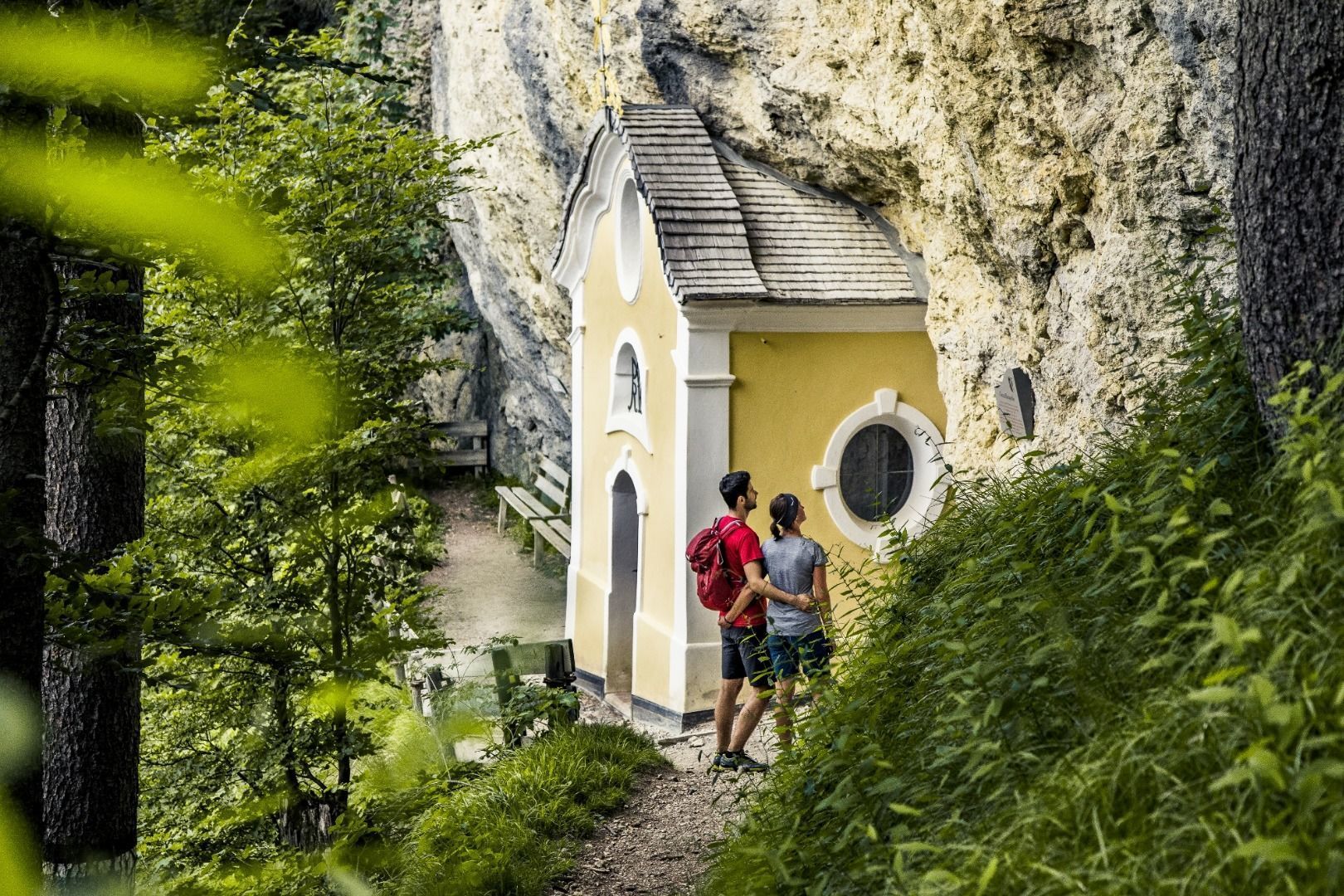
After a good rest, head back into the forest on your right, where the path soon becomes a bit steeper and you’ll continue hiking up wooden steps. With a little luck, you’ll spot one of the chamois that love to roam this area. After a few switchbacks, your next stop is the highly Baroque Gmail Chapel (917 m), built directly into the rock—an architecture often photographed for its originality.
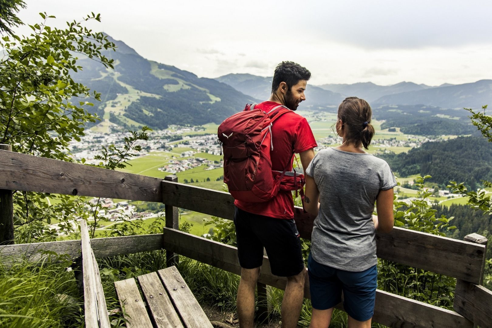
Now you’re getting closer to the Niederkaiser Ridge, where you’ll soon pass through a magnificent mixed forest. Its canopy repeatedly reveals gaps, as if the forest were intentionally allowing you to enjoy the magnificent view of the Leukental valley at regular intervals.
The charming Kräuteralm
At 1,274 meters, the Schatterkopf marks the highest point of Stage 1. After that, the trail begins its first descent. A narrow trail leads you down to Gasteig, where your legs may start to show the first signs of fatigue after you’ve already been on the trail for about 3.5 hours. You’ll pass the Metzgeralm and the Bacheralm. The Bacheralm, with its typical Tyrolean dark-green shutters, is inhabited by a married couple in the summer.
Flowerpots adorn the wooden steps leading to the entrance of the Mountain hut, and the air is filled with the scent of the most wonderful alpine herbs, which the dairymaid uses to make all kinds of products. Officially, this gem isn’t a working hut, but anyone who arrives there hungry and thirsty is usually treated to a meal and herbal tea—as long as the pantry has something to offer.
Final Mountain Ascent & Rewarding View
Refreshed, you’ll next tackle the descent into the valley at the edge of the hamlet of Gasteig. Once you reach the bottom, keep an eye out for the barbecue area at the Hotel Gut Kramerhof, as that’s where the trail leads into a small side valley. The final “climb” is a short, steep forest trail that leads into an enchanted-looking forest.
After 5.5 hours of walking, it’s time for the next rewarding view: After a final stretch through the woods, you suddenly emerge back into an alpine pasture area, from where the Wilder Kaiser once again towers before you in all its splendor. After taking in this view, the next hour’s descent into the village of Griesenau and the Kaiserbach Valley is Easy.
Bus: Lines 800, 810, 866, 8301; St. Johann in Tirol Bahnhof stop
Train: Line 201 (Giselabahn); St. Johann in Tirol Bahnhof stop
Okto Hiking Bus: Lines 1–4; Steinlechnerparkplatz stop
Coming from Wörgl or Kitzbühel on Federal Highway B178, take the St. Johann-West/Zentrum exit. Go straight through the roundabout. At the second roundabout, take the first exit (Dampflfeld). The Steinlechnerplatz parking lot is located a few meters down on the left. Tip: Start right here.
Coming from Kirchdorf on Federal Highway B178, take the St. Johann-West/Zentrum exit. At the roundabout, take the third exit (Dampflfeld). The Steinlechnerplatz parking lot is located a few meters down on the left. Tip: Start right here.
Public parking lots: St. Johann in Tirol Steinlechnerplatz (Dampflfeld 4, paid parking, multi-day parking); Koasa Stadium (Salzburgerstraße 15, free); Almdorf (cemetery, free, multi-day parking);
Underground parking garage: Klausnerpark (Brauweg 3, paid parking, multi-day parking available)


