
Opening hours:Today closed
Place:Angerberg
:Restaurant, Alpine pasture / hut / mountain restaurant
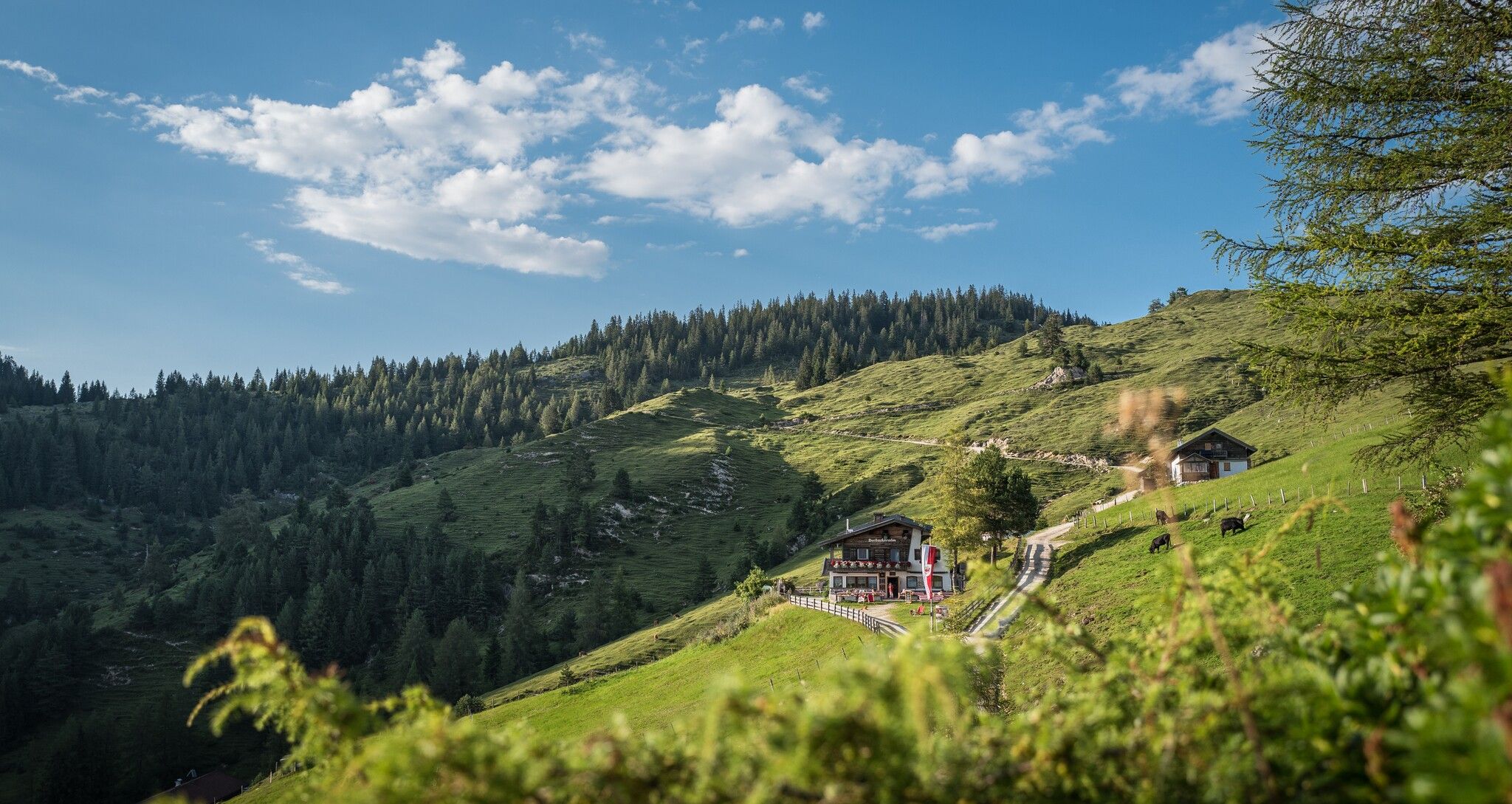
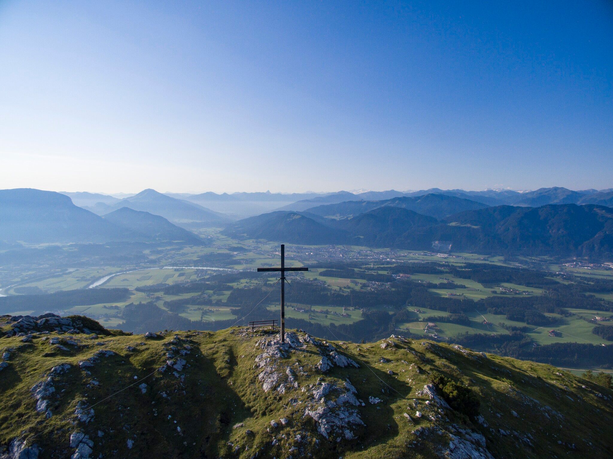
We reveal two of our favorite places in spring. Firstly: The Buchackeralm is open early in the year from Thursday to Sunday and is known for its Black Angus breeding and sunny spots with great views. Second: The Hundsalmjoch offers one of the most contrasting views over the Inn Valley - from the Wilder Kaiser over the green Unterland and the turquoise Innschlaufe to the white main Alpine ridge.
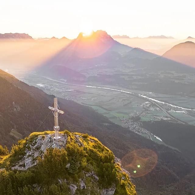
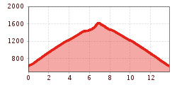
Medium-difficulty mountain hike on forest paths and easy mountain trails. The highlights along the way are the exceptional Buchackeralm, which is open every Thursday to Sunday from March to October. After climbing to the summit of the Hundsalmjoch, you should relax on its terrace. The first part to the Buchackeralm is partly steep and strenuous on a beautiful forest path high above the Inn Valley with many hairpin bends. In between, the wide view over the Inntal valley opens up again and again and accompanies you for most of the day. The ascent to the Hundsalmjoch is easy or moderately difficult and follows a beautiful route through sparse mountain forest and alpine meadows to the panoramic cross. The view is truly exceptional for a mountain of this low altitude and extends from the Karwendel to the Wilder Kaiser and from the Bavarian Prealps to the Großglockner and Zillertal main ridge. Deep below, the Inn meanders through the Inn Valley, which you can study in detail from up here. The descent can be combined with a visit to the ice cave and the Adlerhorst viewing platform.
Outdoor clothing, sturdy shoes
Sufficient food and drink
First aid kit
Mobile phone with full battery & charger Hiking map & guide literature
possibly GPS device or GPS data to be loaded onto the mobile phone
Sun protection (sunglasses, sun cream & cap)
Rain protection
Cash
The hike starts in the Angerberg district of Embach at the Rading car park (600 m). From there, a forest path winds its way uphill to a fork in the trail at around 1.230 m above sea level. Keep to the right here and you will soon reach the Buchackeralm. The trail then continues at a moderate incline to the Daxerhütte, just before the Adlerhorst viewing platform. Passing the hut, the trail first follows the forest road for a short distance, then leads uphill along a narrow path to the Hundalmjoch. On the way to the summit, you will be rewarded with a wonderful view of the Inn Valley.
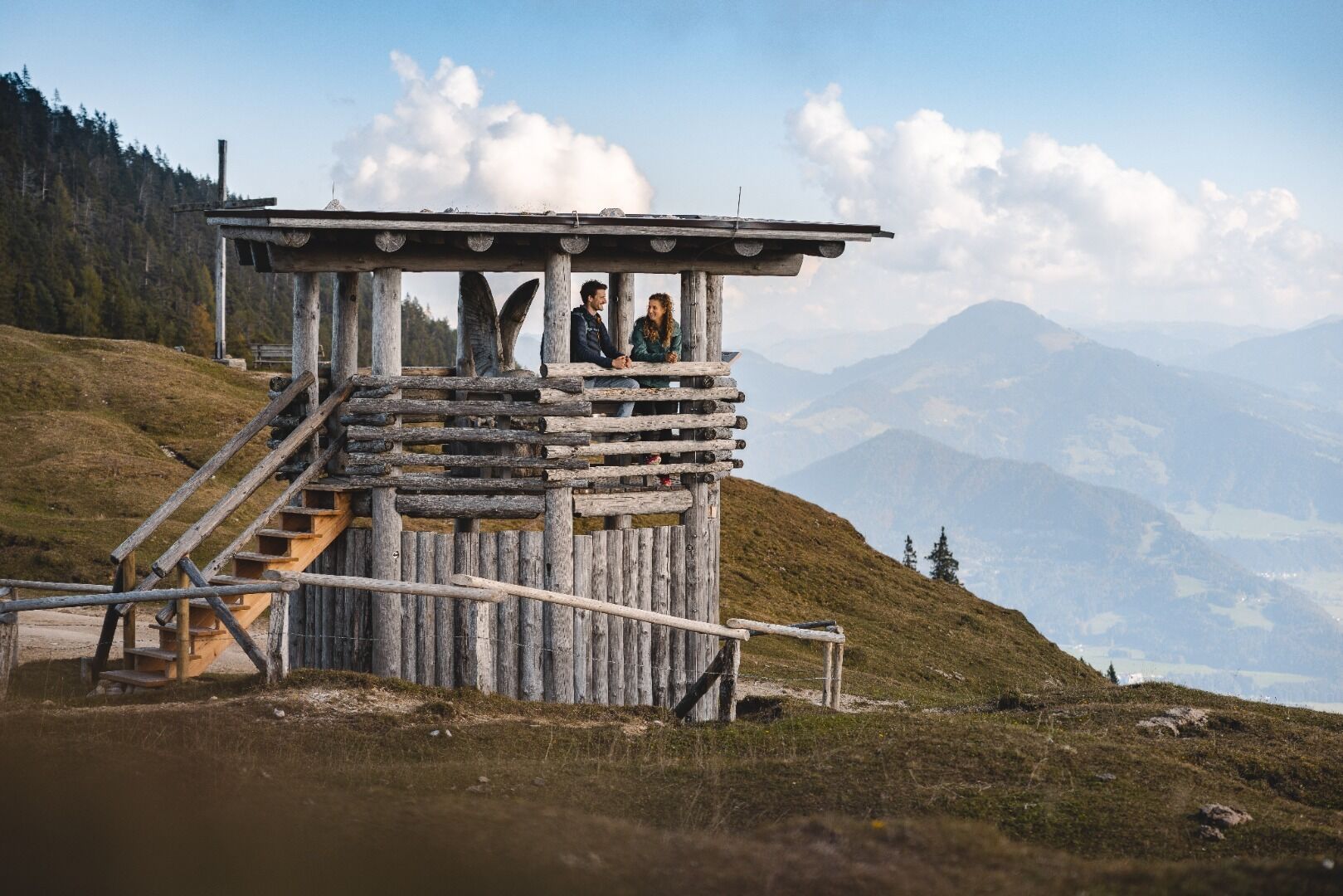
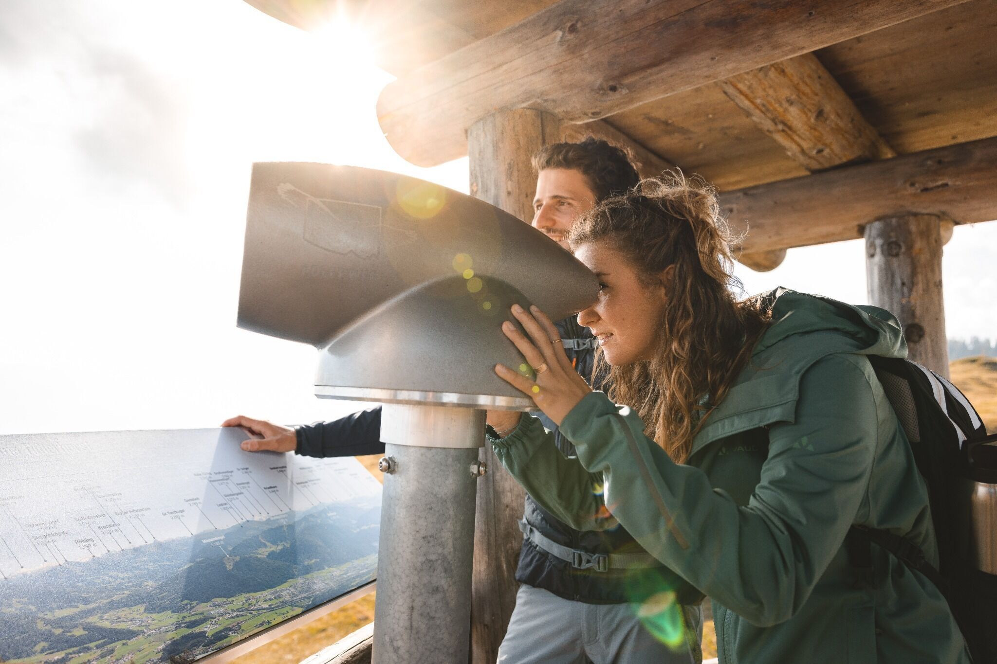
Next to the beautiful summit cross, an impressive panorama opens up, inviting you to take a long break. The descent leads across alpine meadows to the Adlerhorst. The Adlerweg telescope offers views of numerous peaks in the Kitzbühel Alps and the Hohe Tauern. From here, you also have the option of continuing on to the nearby ice cave. Please note the current opening hours at eishoehle.tirol.
The return route takes you back to the starting point along the same route.
Bus: Bus stop Angerberg Franzlerbrücke
Guest card of the region = train ticket from Wörgl to
Hochfilzen
+ bus ticket from Mariastein to Kitzbühel included
Valid on
ÖBB local trains (S, REX) and InterRegio trains (IR) between Kirchbichl - Wörgl
and Hochfilzen.
Not
valid on RJ, RJX, EC, IC, ICE, D and NJ/EN trains.
More detailed information:www.hohe-salve.com/mobility
Parking area Lettenbichl, Buchackeraufstieg


.jpg")


.jpg")


.jpg")


