Mountain hikes Eifersbacher Wasserfall

St. Johann in Tirol / Kitzbühel Alps
Difficulty ratings: medium
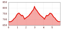
Route length: 5.9 km
Duration: 2:30 h

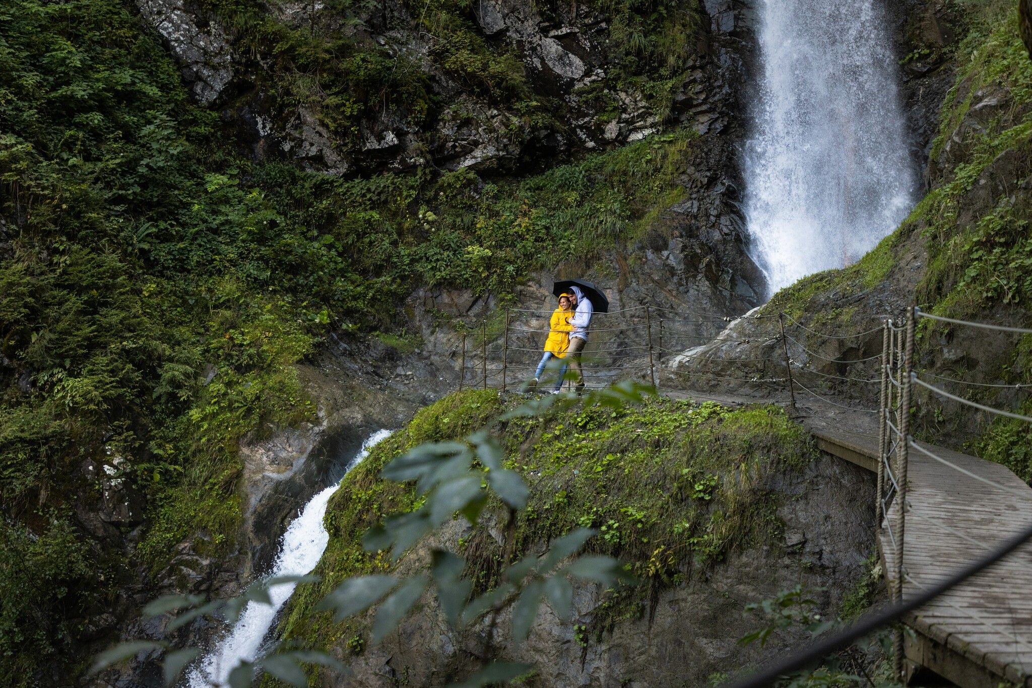
The Eifersbach waterfall is one of our favorite places for hot summer days. The path to refreshment is short and beautifully laid out.

Tour character

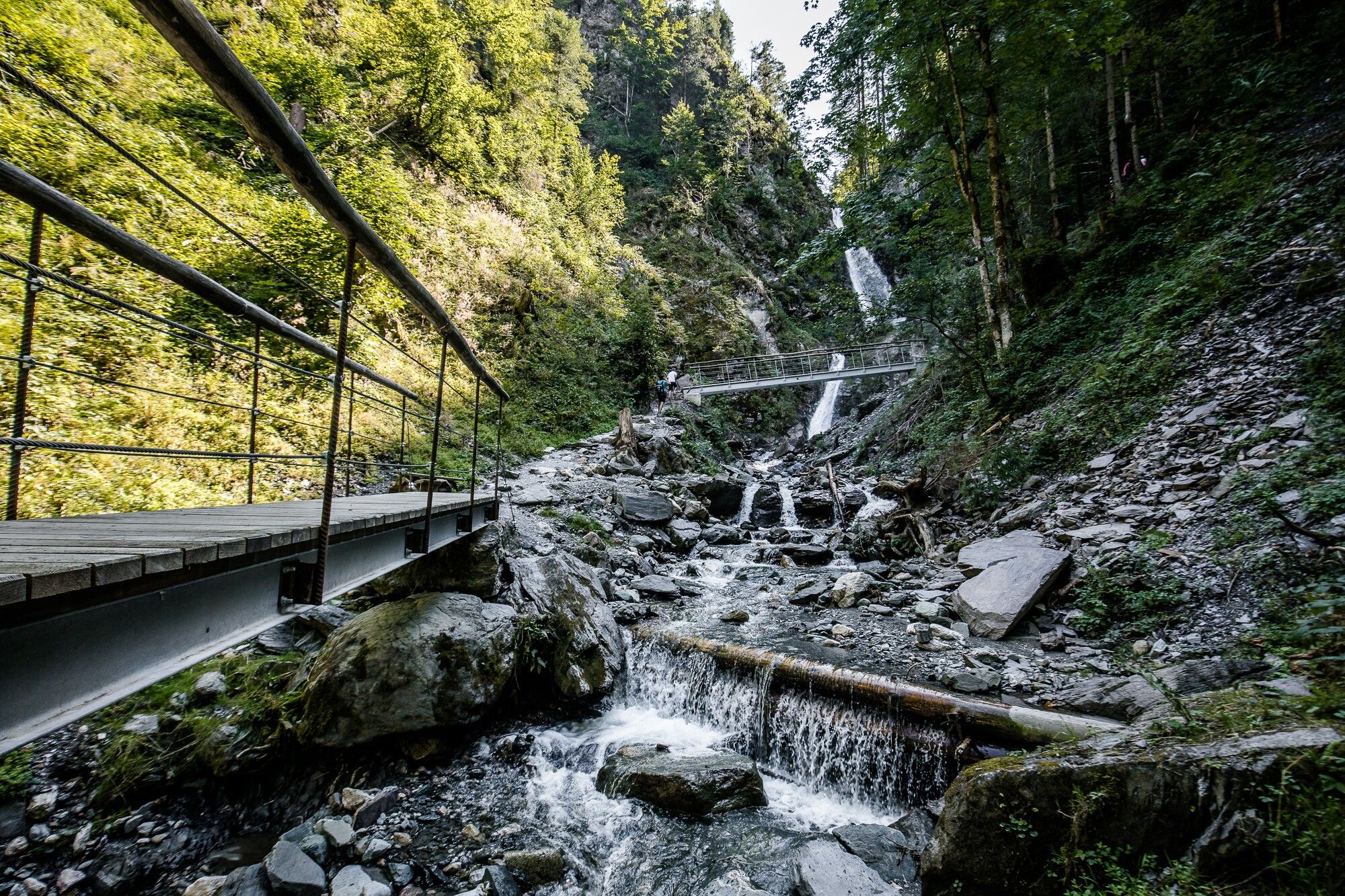
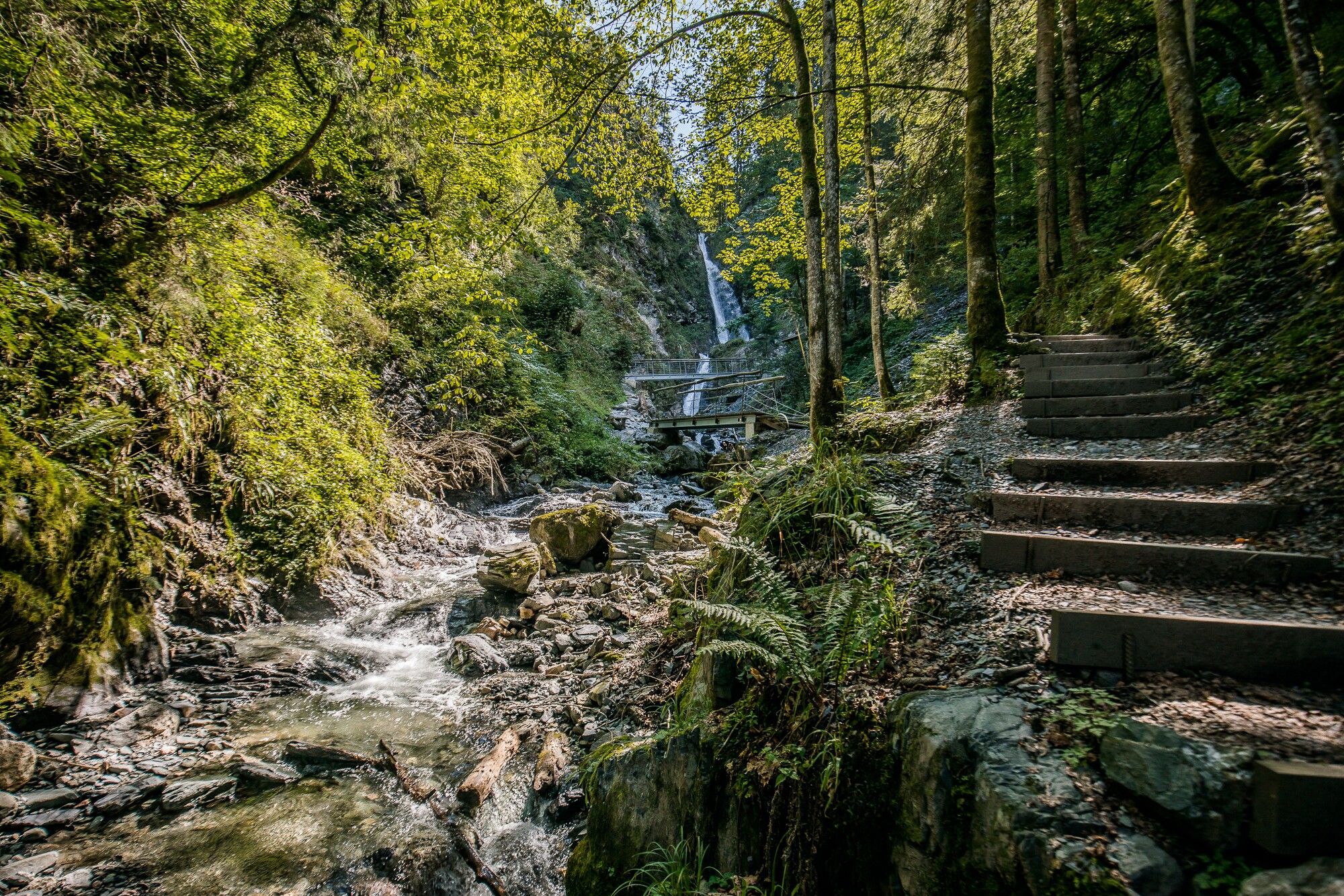
Easy hike to the beautiful Eifersbach waterfall. Most of the way along forest, woodland and meadow paths, then over bridges and footbridges shortly before the waterfall. Along the way, you pass the Theresienkapelle chapel and a wooden fountain, where the Samerbadl once had a healing effect on its visitors. The hike can be extended to a 3-hour round trip via the Hornblicksee lake and with a stop at the Gander Schup.

Tour information

  • Requirement: medium
  • Length: 5.9 km
  • Duration: 2:30 h
  • Elevation uphill:241 hm
  • Elevation downhill:235 hm
Highest point850 m

Starting point

St. Johann in Tirol - Parkplatz Kaiserfels

Finishing point

St. Johann in Tirol - Parkplatz Kaiserfels

Features

  • Suitable for families

Trail condition

Varied hiking trail over forest and root paths, steel steps and forest tracks

Equipment

- outdoor clothing
- sturdy shoes
- Sufficient food and drinks
- First aid kit
- Mobile phone with full battery & charger
- Hiking map & guide literature
- GPS device or download the GPS data to your mobile phone if necessary
- Sun protection (sunglasses, sun cream, cap)
- Rain protection
- Cash
Source: Kitzbüheler Alpen Management GmbH

Description

On hot days, hikers can find refreshment on a stroll between meadows and forests past the Eifersbach waterfall in Winkl-Schattseite near St. Johann in Tirol. Start at the car park of the Eichenhof lifts and turn left towards St. Johann until you reach the Tannweg. Turn left at the end of the Tannweg. From the Tann farm, walk along a flat meadow path to the Bichln farm and then through the forest down to the Theresienbad chapel. From there, a forest path leads slightly uphill along the Eiferbach stream. The last few metres to the waterfall are made passable with bridges and footbridges. Then, finally, the waters of the Eifersbach waterfall plunge over 25 metres into the valley beside you. This is an ideal place to take in nature and refresh yourself with crystal-clear, cool spring water.

The way back is the same as the access route.

Translated with DeepL.com (free version)

Getting here

  • Arrival by public transport

    With the Gisela cable car: Exit St. Johann in Tirol railway station
    With the Postbus 8301: Exit St. Johann in Tirol Eichenhof

    Or conveniently and free of charge in the summer months from Monday to Friday with the Okto - hiking bus.

    Journey times and details can be found here: 
    kitzalps.cc/mobil

  • Parking

    Free Eichenhof car park (Winkl-Schattseite 6b, 6380 St. Johann in Tirol)

Weather

Today

moderate rain
15°C/7°C
80%10.7l5 km/h

Fri

clear sky
18°C/6°C
0%0l5 km/h

Sat

clear sky
22°C/4°C
0%0l5 km/h
Go to weather forecast

More tours in the surrounding area

  • Koasa Trail Stage 4

    Difficulty:medium
    Length:20.6 kmDuration:7:35 hElevation uphill:923 m
  • Koasa Trail Stage 1

    Difficulty:medium
    Length:16.9 kmDuration:6:45 hElevation uphill:937 m
  • Koasa Trail Stage 3

    Difficulty:medium
    Length:19.9 kmDuration:7:10 hElevation uphill:730 m
  • Koasa Trail Stage 5

    Difficulty:medium
    Length:14.0 kmDuration:6:45 hElevation uphill:935 m
  • Kaiserkrone - stage 4

    Difficulty:medium
    Length:16.1 kmDuration:6:30 hElevation uphill:640 m
  • Kaiserkrone - stage 5

    Difficulty:medium
    Length:10.8 kmDuration:5:15 hElevation uphill:840 m
  • Alpine Outdoor Gallery

    Difficulty:easy
    Length:6.7 kmDuration:2:00 hElevation uphill:117 m
  • Koasa Trail Stage 2

    Difficulty:medium
    Length:11.8 kmDuration:7:15 hElevation uphill:1,078 m
  • The Wiegalm

    Difficulty:medium
    Length:10.5 kmDuration:4:45 hElevation uphill:680 m
  • Brechhorn

    Difficulty:medium
    Length:11.8 kmDuration:5:00 hElevation uphill:600 m
  • Angerer Alm

    Difficulty:medium
    Length:5.7 kmDuration:2:45 hElevation uphill:652 m
  • 1st stage KAT Walk Kompakt

    Difficulty:medium
    Length:14.2 kmDuration:7:15 hElevation uphill:1,212 m
  • KAT Walk Alpine stage 6

    Difficulty:medium
    Length:19.0 kmDuration:7:30 hElevation uphill:1,000 m
  • 2nd stage KAT Walk Alpine

    Difficulty:medium
    Length:18.0 kmDuration:8:00 hElevation uphill:1,140 m
  • KAT WALK COMPACT

    Difficulty:medium
    Length:83.0 kmDuration:36:45 hElevation uphill:5,462 m
Newsletter

The mountain is calling? So does our newsletter!

In our monthly newsletter we reveal the best holiday tips for Tyrol.