Mountain hikes Schattseit route short

Söll / Kitzbühel Alps
Difficulty ratings: easy
Route length: 4.8 km
Duration: 1:30 h

Deceleration round with breathtaking views of the Wilder Kaiser.

Tour information

  • Requirement: easy
  • Length: 4.8 km
  • Duration: 1:30 h
  • Elevation uphill:120 hm
  • Elevation downhill:120 hm
Highest point760 m

Starting point

Talstation Bergbahn, Söll (725 m)

Finishing point

Talstation Bergbahn, Söll (725 m)
  • Fitness level 1 / 6
  • Technique 1 / 6

Best time of year

  • January
  • February
  • March
  • April
  • May
  • June
  • July
  • August
  • September
  • October
  • November
  • December

Trail condition

The composition of the route varies between tarmac and gravel roads, meadow and forest paths.

Equipment

Rucksack, sturdy hiking/mountaineering boots with anti-slip treaded soles, weather-appropriate hiking gear (breathable), a change of clothes, sun protection (sunglasses, sun cream, lip protection, headgear), waterproofs (rain jacket/poncho, pocket umbrella, rucksack protector), cold protection (hat, gloves), sufficient food and drink, hiking poles (height adjustable) if required, first aid kit incl. rescue blanket and bivouac sack, mobile phone with fully charged battery, headlamp, plastic bag for waste, hiking map, route description and information materials (GPX track), ID, insurance card, cash
Source: TVB Wilder Kaiser

Description

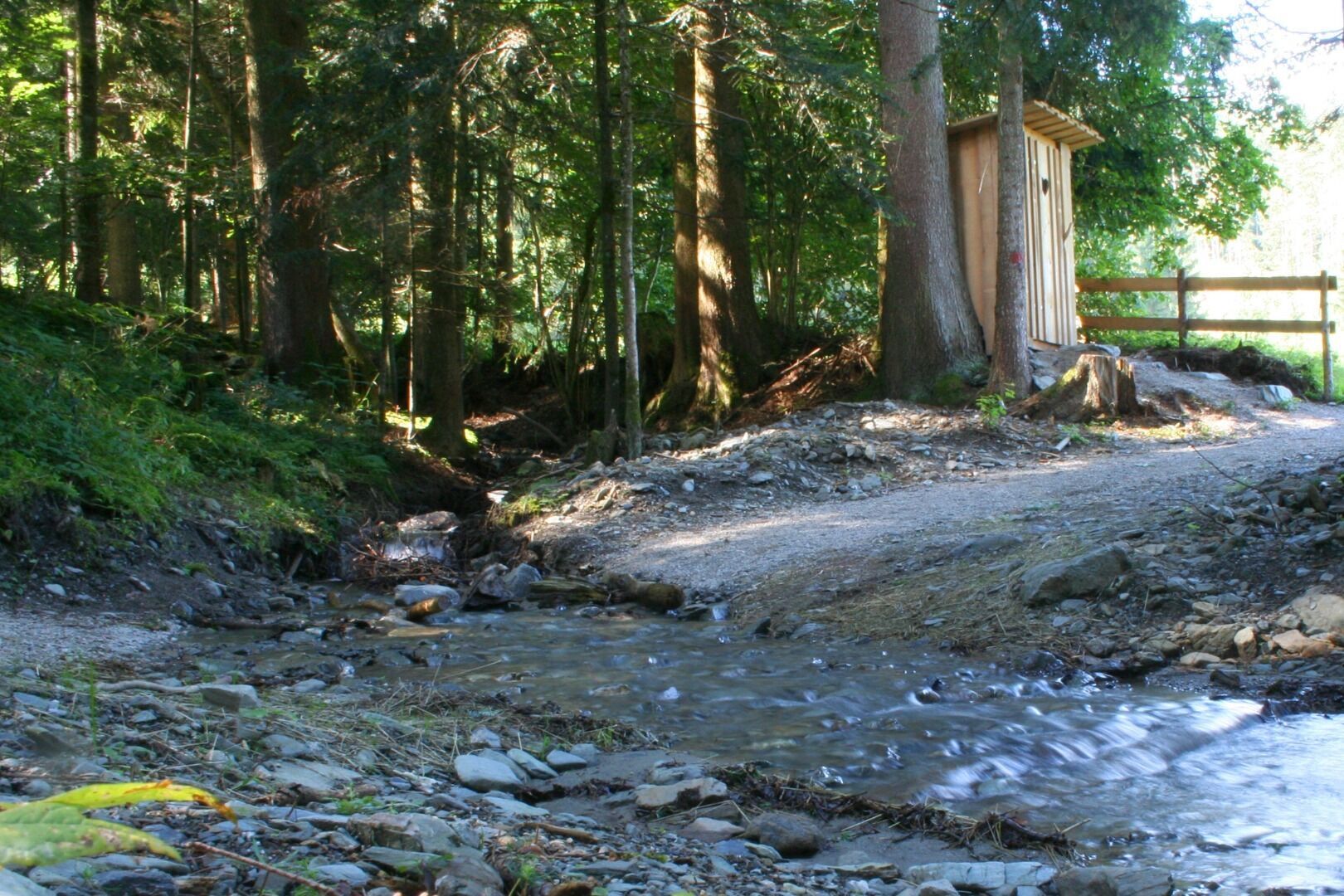
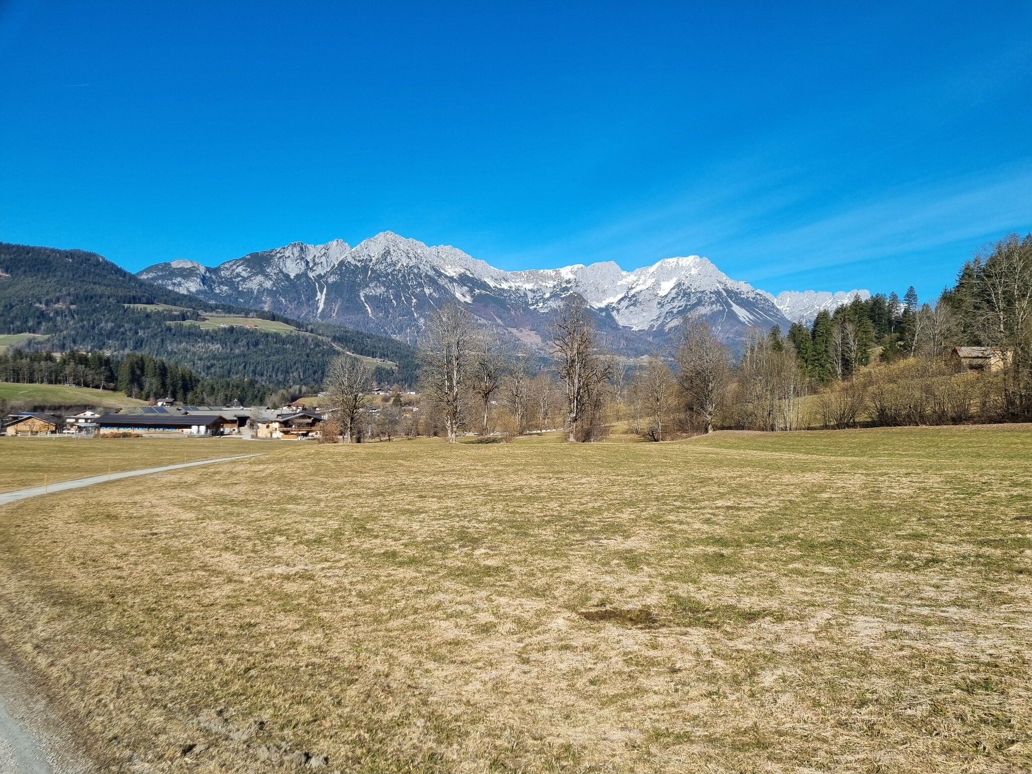
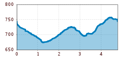
This leisurely circular trail starts at the lift car park at the Söll valley station. From there, follow the signs in the direction of Scheffau. Enjoy the view of Lake Ahornsee along the tarmac road until you reach the neighbourhood of Bach. Having already left the lake behind you, continue up the road for a short distance, where you then turn left onto a meadow path that takes you across the shady side of Söll towards Scheffau. Take advantage of the peace and quiet along the Schattseitweg to take a deep breath and marvel at the view of the Kaiser mountains. Once you reach the Küchlpoit stand, continue along the meadow path, past the trees, until you reach a tarmac road. Turn left here and follow the road in the direction of Hauniger Dörfl. The next signpost will lead you back to Söll via the farm shops at Poiderhof and Keilhof. Before the Jägerbrücke bridge in the Gänsleit district, keep left and follow the Schottwerg to the Ahornsee lake and continue back to the starting point at the lift car park.

Nearby huts and mountain restaurants

Getting here

  • Arrival by public transport

    KaiserJet stop “Söll Gondelbahn Hochsöll – Hexenwasser”.
    More information at: www.wilderkaiser.info

  • Parking

    Parking area cable car valley station, Söll (725 m) – free

More tours in the surrounding area

  • Winter walking Biedringer Platte

    Opening hours:closed
    Length:12.7 kmDuration:5:30 hElevation uphill:470 m
  • Hochalm hike

    Difficulty:medium
    Length:19.6 kmDuration:7:00 hElevation uphill:1,140 m
  • Hintere Goinger Halt summit tour

    Difficulty:difficult
    Length:9.3 kmDuration:6:30 hElevation uphill:1,090 m
  • Panoramic circuit Brandstadl–Hartkaiser

    Difficulty:easy
    Length:6.0 kmDuration:1:50 hElevation uphill:170 m
Newsletter

The mountain is calling? So does our newsletter!

In our monthly newsletter we reveal the best holiday tips for Tyrol.