
Opening hours:Today closed
Place:
Wildschönau
:
Restaurant, Alpine pasture / hut / mountain restaurant
Via an adventurous climb and a lovely waterfall
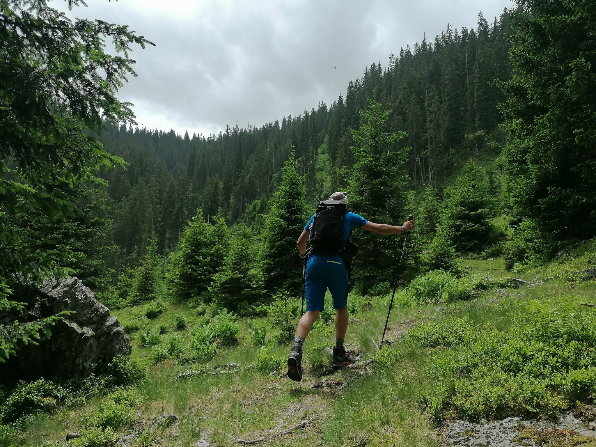
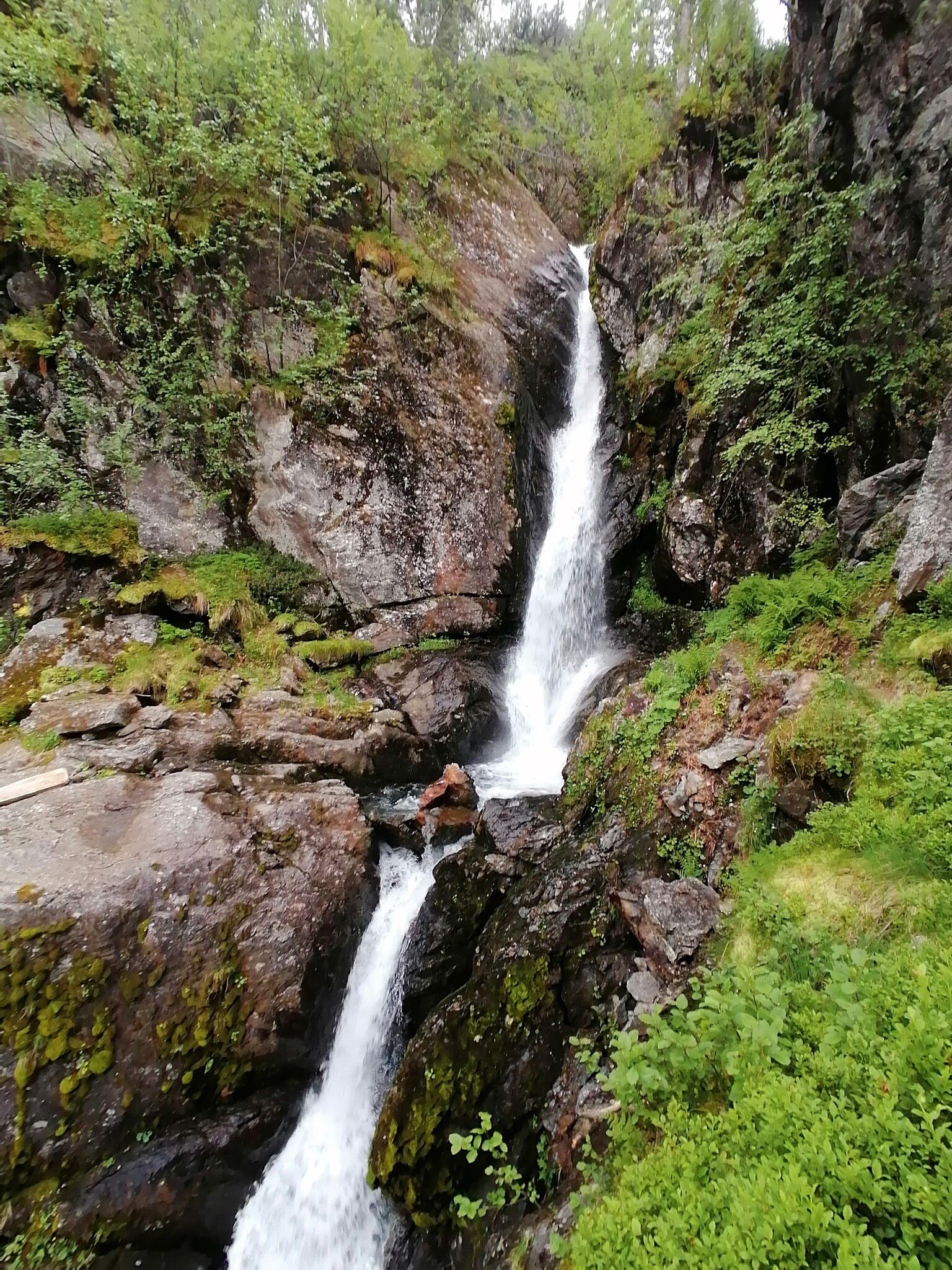

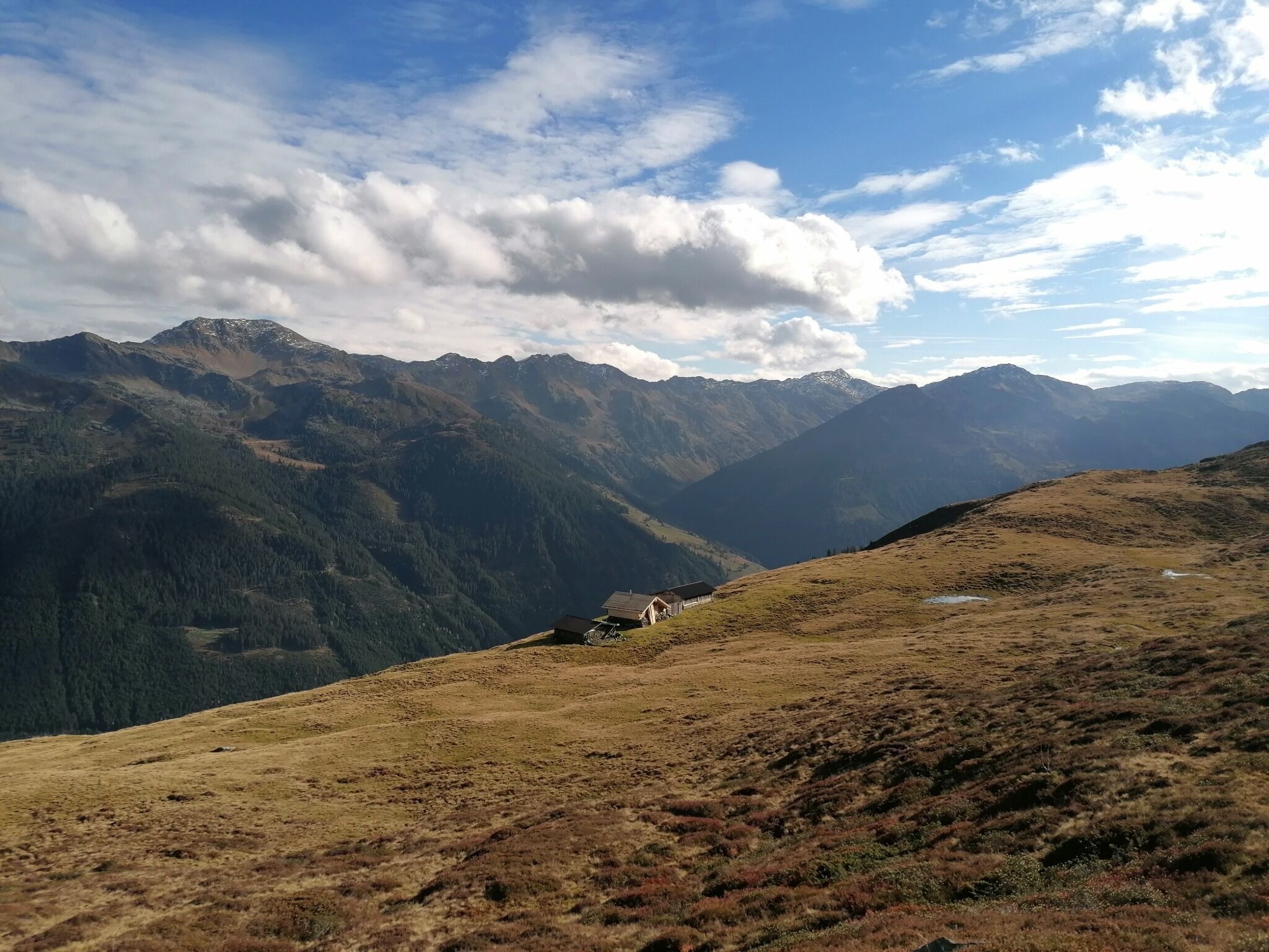
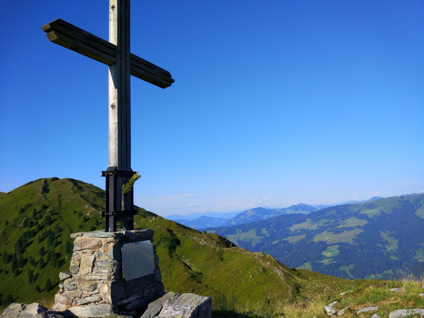
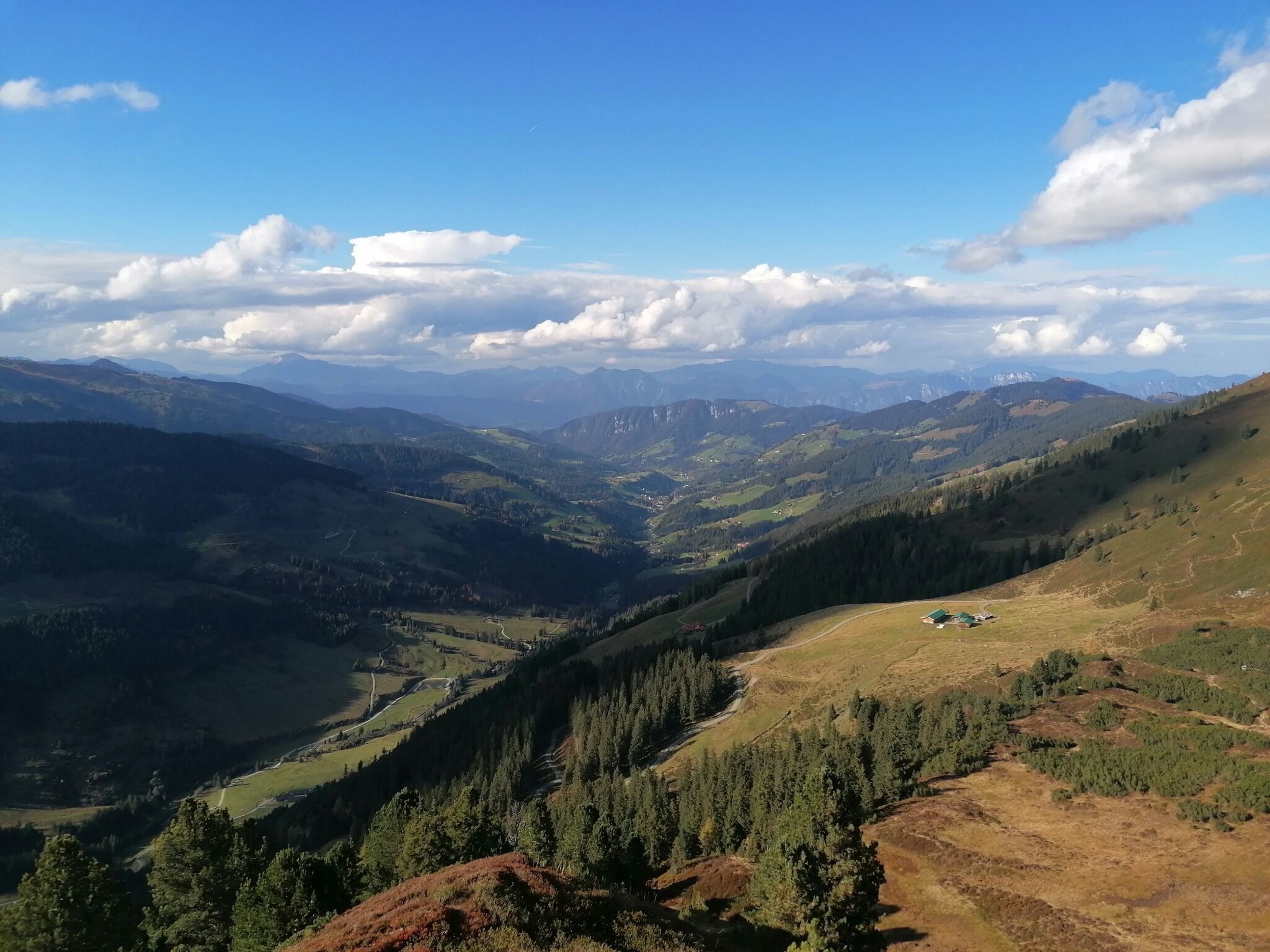
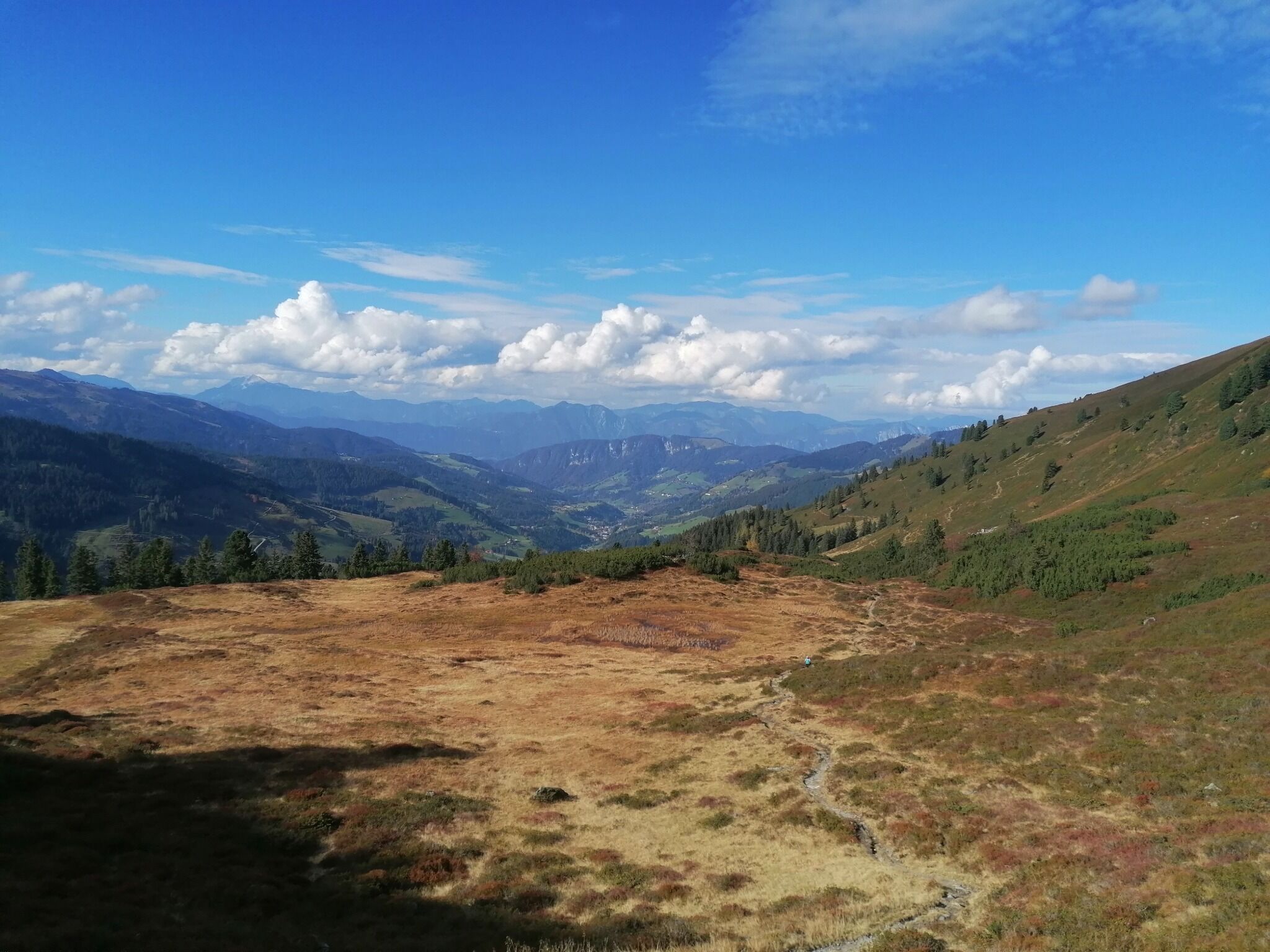

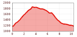
Follow the forest path nr. 5 starting from the Schönanger Alm Gasthof. After the Kundl Alm, a group of wooden alm huts continue on nr. 5 up the steep Kastensteig. Good physical fitness is required here. Almost at the top take a detour to the lovely waterfall. Passed the giant Glockhausstein boulder, stuff of Wildschönau legend, take the flat route over to the marshy Siedljoch on rt. 32 to the cross on the Breitegg Spitze.
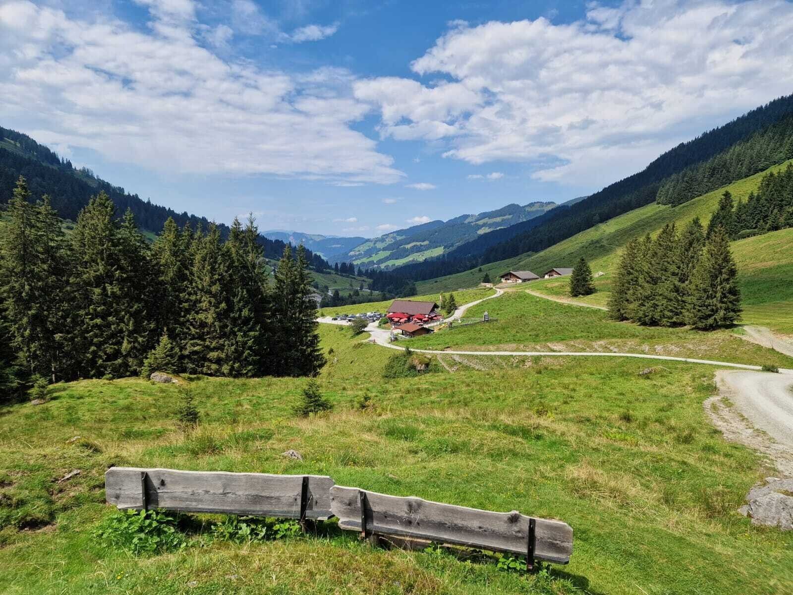
The path back to the starting point (nr. 4) is all downhill. Drop into the Breitegg Alm for a drink.


