Summit hikes Summit hike: Schwendberg Rastkogelhütte parking lot - Rastkogel

Mayrhofen, Zillertal / Tuxer Alpen
Difficulty ratings: medium
Route length: 16.0 km
Duration: 6:00 h

Climb the Rastkogel and enjoy breathtaking views at 2,762 meters of the Zillertal Alps and the Hintertux Glacier. The gentle ascent over the Sidanjoch makes this hike an unforgettable experience for every mountain lover!

Tour information

  • Requirement: medium
  • Length: 16.0 km
  • Duration: 6:00 h
  • Elevation uphill:1,000 hm
  • Elevation downhill:1,000 hm
Highest point2,762 m

Starting point

Rastkogelhütte parking lot, Hochschwendberg, 6283 Hippach-Schwendberg (Zillertaler Höhenstraße)

Finishing point

Rastkogelhütte parking lot, Hochschwendberg, 6283 Hippach-Schwendberg (Zillertaler Höhenstraße)
  • Fitness level 4 / 6
  • Technique 4 / 6

Best time of year

  • January
  • February
  • March
  • April
  • May
  • June
  • July
  • August
  • September
  • October
  • November
  • December

Trail condition

  • Well-marked hiking trail
  • Gentle ascent to Sidanjoch
  • Narrow mountain paths
  • Some rocky sections
  • Sure-footedness required
  • Final section steeper but manageable

Equipment

-
Source: Zillertal

Description

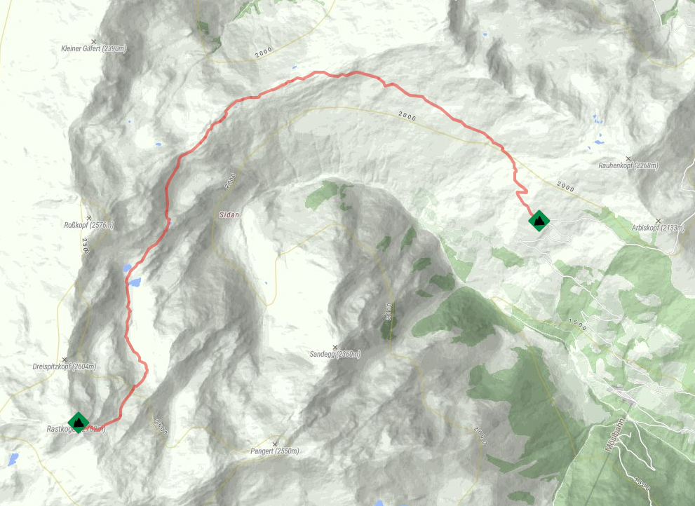
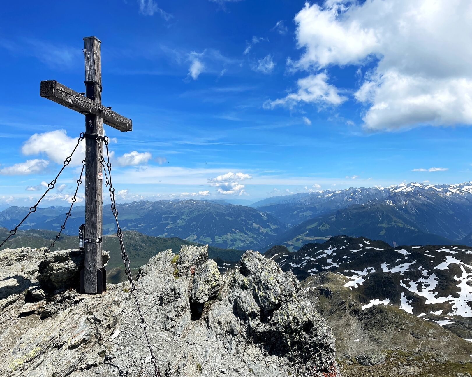
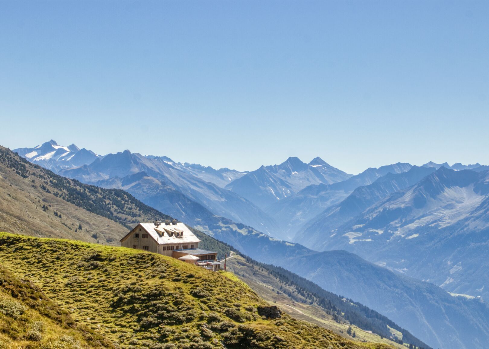
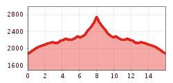
After reaching the Rastkogelhütte, 2.117 m, the trail Nr. 318 gently leads you to the Sidanjoch, 2.127 m. Follow the ridge to the first elevation and then continue eastward on trail Nr. 302a. Here, the path forks, and you choose once again trail Nr. 318, which takes you southward to the summit of Rastkogel, 2.762 m in about 1 hour. From here, you can enjoy splendid views of the Zillertal Alps and the Ahornspitze, 2.976 m, as well as a clear view of the Hintertux Glacier to the south.

Nearby huts and mountain restaurants

Getting here

More tours in the surrounding area

Newsletter

The mountain is calling? So does our newsletter!

In our monthly newsletter we reveal the best holiday tips for Tyrol.