Arrival by public transport
By bus with line 4030 to the stop Kaufhaus Erharter
Trail Nr.: 88, 89
Starting point: car park tennis hall Walchsee (with the Kaiserwinkl Card for free)
or bus stop Walchsee Kaufhaus Erharter (bus line 4030)
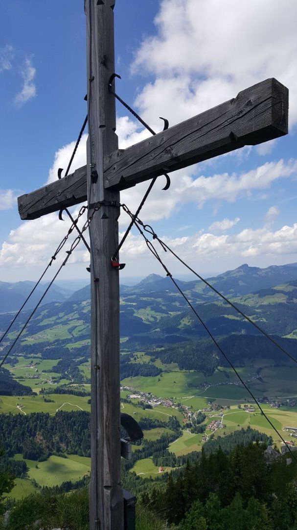
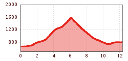
At the beginning you follow the Seestraße in southern direction to the signposts Heuberg. After approx. 1 km turn right onto the path no. 52. After a short climb you will come to the parking lot Lippenalm. Continue to follow the path on the right and then left past the parking Heuberg (alternatively you can also park here) and take the forest road direction Gwirchtalm. After about 1 km turn right onto the steep path no. 89 in the direction of Heuberg. You walk up the trail and cross 3 times the forest road (of course, the hike along the forest road is possible). Now along the forest road to the Hageralm - at the Hageralm left over on the trail over the Almenwiese to Heubergsattel and from there it goes steeply uphill to the summit cross of Heuberg (1603 m) - Stamp "gold" in Kaiserwinkl hiking pass. On Heuberg you can enjoy an unforgettable dreamlike view.
Retour A: the same route
Retour B: Round Trip Heuberg - at the Heubergsattel turn right down the path and turn right again past the Jöchlalm, along the forest path until you come back onto the trail from the ascent.
Retour C: At the Heuberg saddle, turn right down the path, continue on the left, always following the Steig path no. 90 and crossing the Winkelalm direction Durchholzen (bus stop)and follow the street.
By bus with line 4030 to the stop Kaufhaus Erharter
Parking lot Lippenalm or parking lot Tennis hall
 bernhard bergmann.JPG")

