
Difficulty:difficult
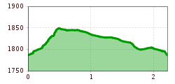
Length:93.5 kmElevation uphill:7,700 m
Short description:This path leads around Neunerköpfle and provides information about nature, mountains, and animals in the Tannheimer Tal.Technique: **Quality of experience: ******Recommended season:JanuaryFebruaryMarchAprilMayJuneJulyAugustSeptemberOctoberNovemberDecemberProperties:LoopScenicRefreshment stops availableFamily friendlySummit route

Description:
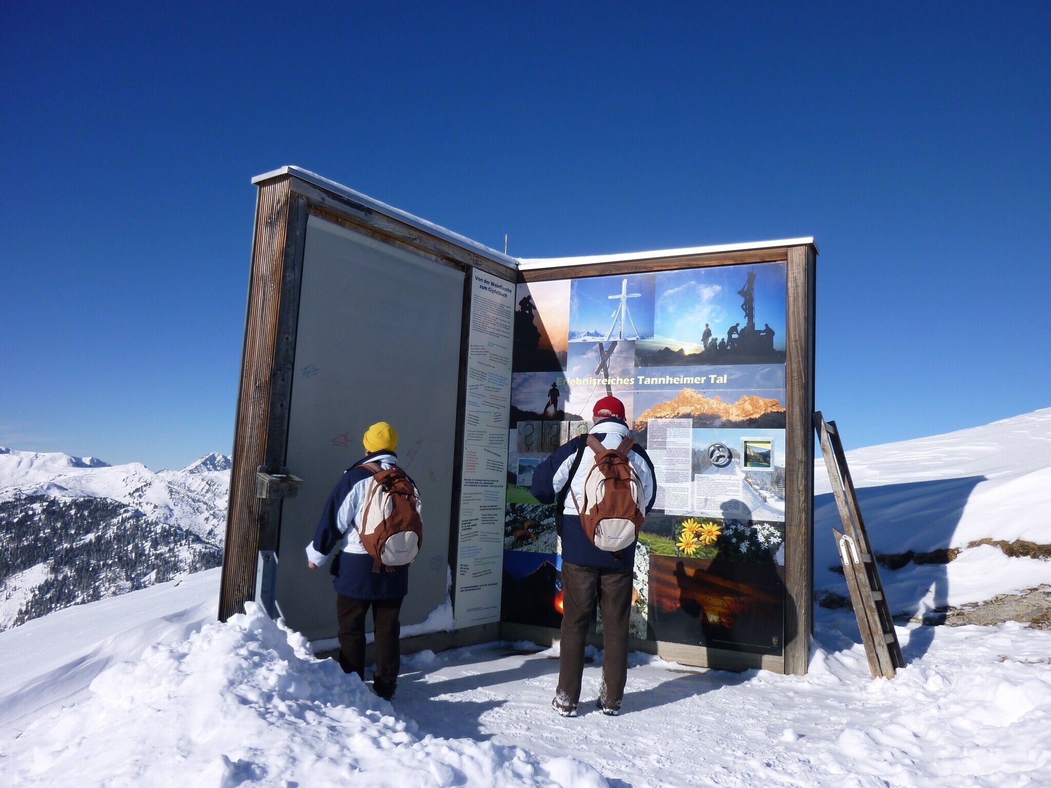
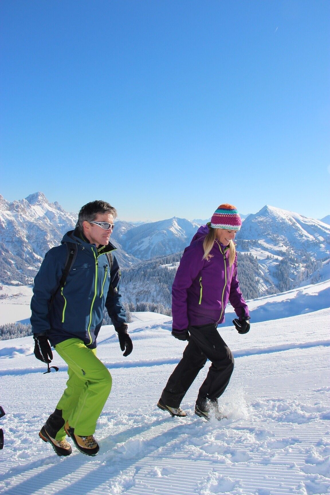
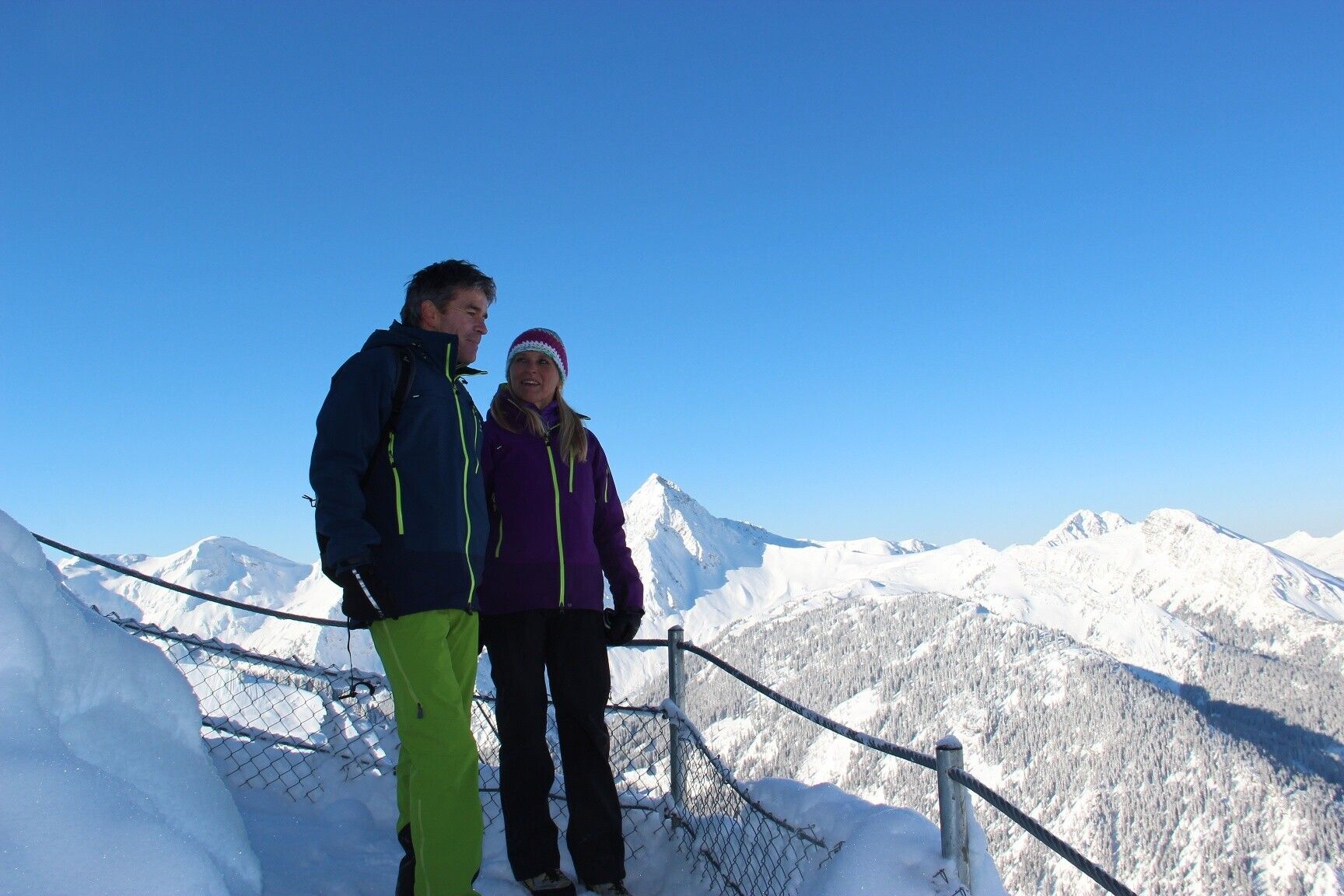
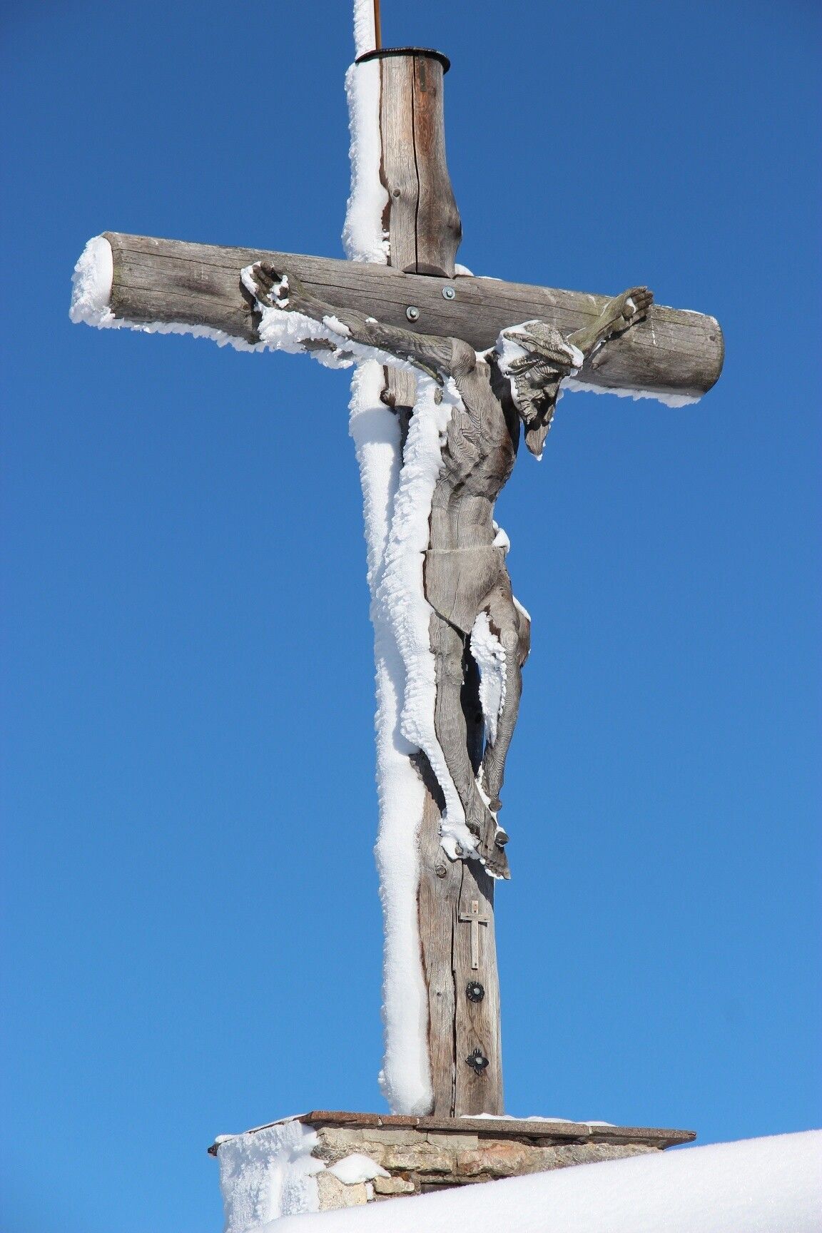
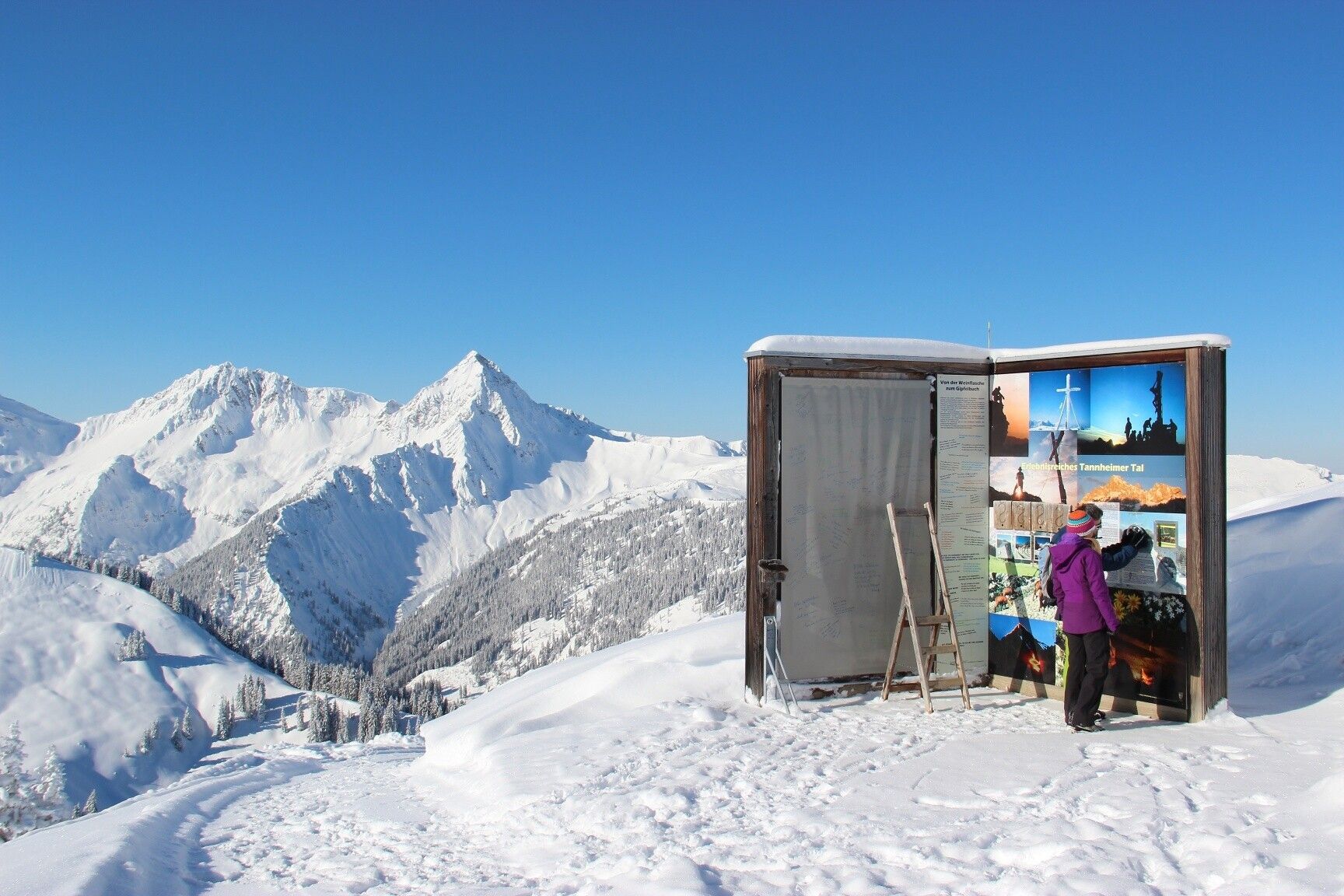
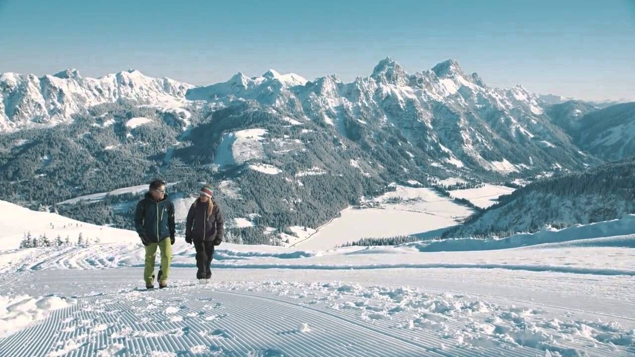
The hike on and around Neunerköpfle in Tannheim is suitable for families and starts at the mountain station of the gondola. The winter hiking trail is cleared daily and leads to the summit of Neunerköpfle. There is also the largest summit register in the Alps (2 pages each 3 x 2.3 m) where you can also sign your name. The wonderful view over the entire Tannheimer Tal is maintained even on the approx. 2.2 km long new hiking trail at just under 1900 meters above sea level.
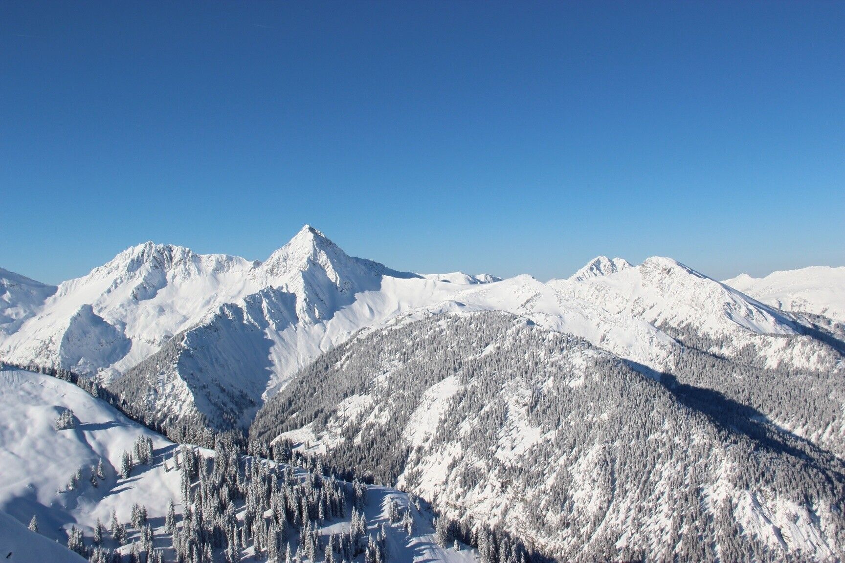
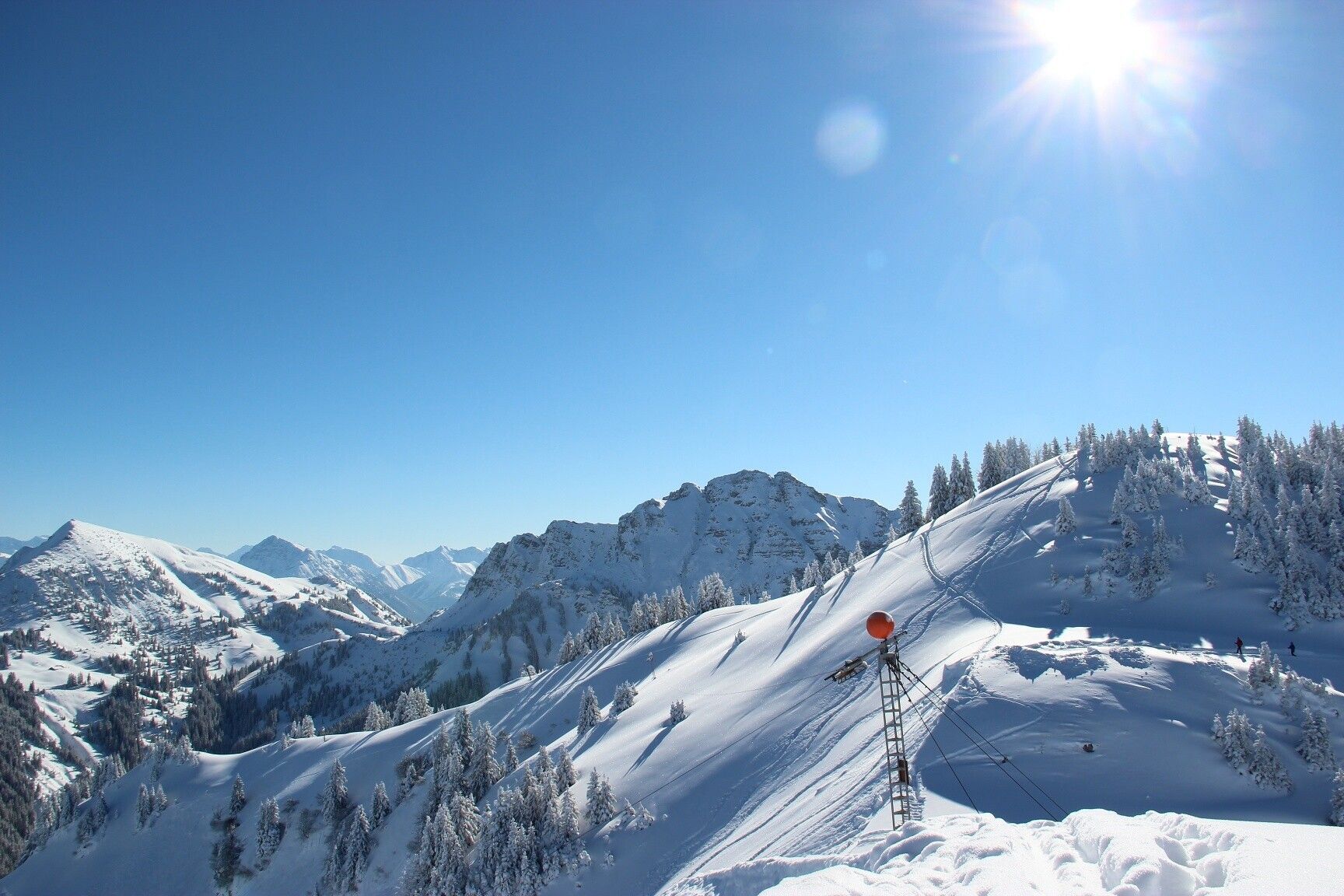
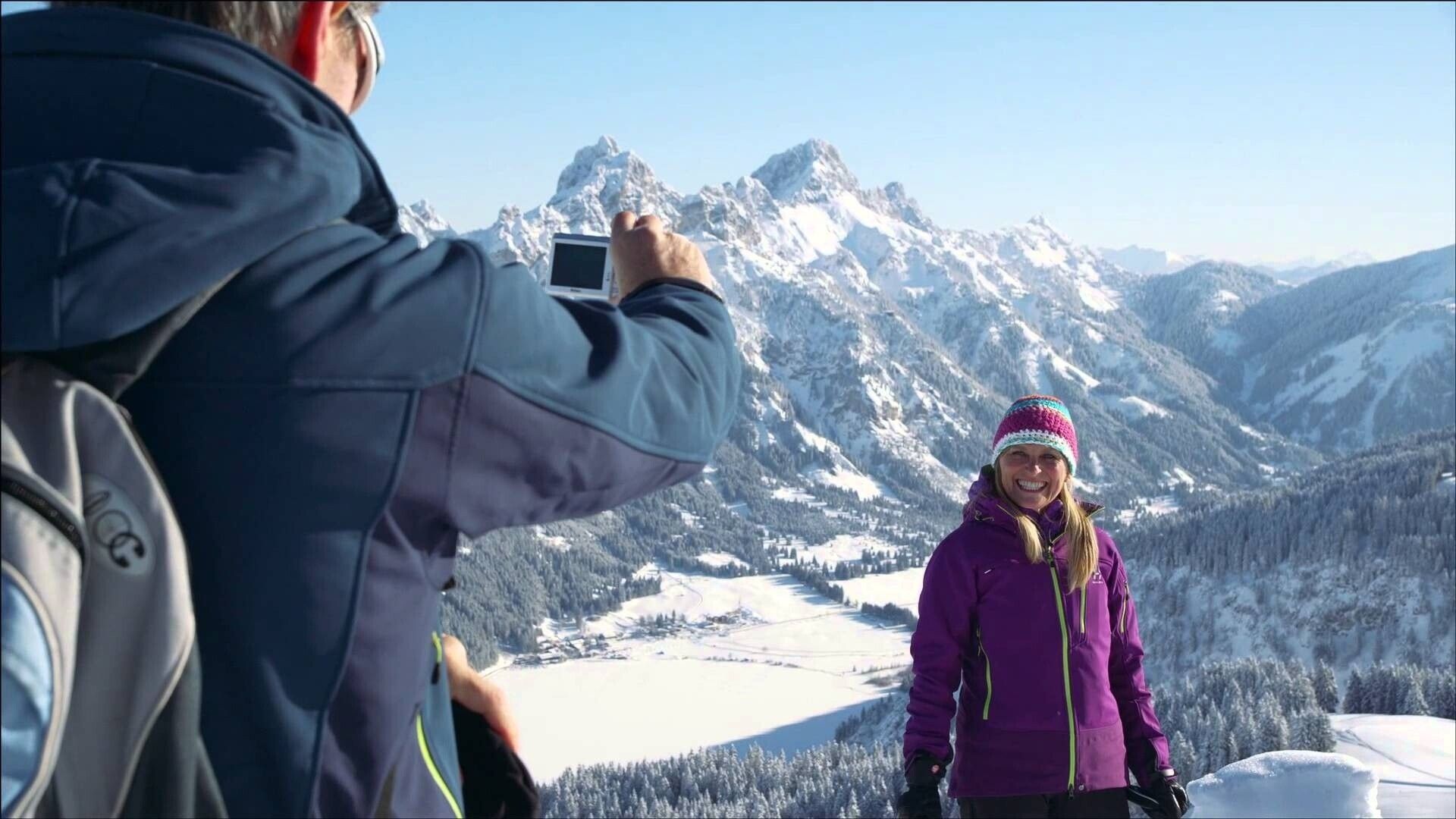
Directions:From the mountain station of the 8-person gondola Neunerköpfle in Tannheim, the path first leads a short stretch along the edge of the ski slope upwards. Then it continues to the right to the paragliders' launch site. An unforgettable experience to watch the pilots at takeoff. Now the path goes slightly downhill. Before us is an impressive winter landscape with the deeply snow-covered peaks of Geißhorn, Rauhorn, and Kugelhorn. Idyllically to the left below us lies the village of Tannheim. After a short climb, we reach a saddle. On the left, we see the Usseralpe and on the lower right the Strindenalpe. The turning point of the winter hiking trail is now reached. On the higher return path, we already see the summit of Neunerköpfle ahead. Just below the summit is also the largest summit register in the Alps, measuring 3 meters in height and 2 pages each 2.3 meters wide. Besides the overwhelming view over the entire valley and an almost limitless panorama, the summit cross with a wooden corpus is also particularly worth seeing. Alpine choughs above us and skiers on the slopes below let the heart beat a little faster. The descent to the mountain station proceeds along the flank of Neunerköpfle, partly with a railing on the valley side, and gives us another chance to see the Tannheimer Tal from above. Should hunger or thirst strike before the descent by gondola, there is also provision for refreshments at this altitude.
Tip:The themed path is relatively easy to walk and, where necessary, well secured. The entire path is covered with gravel; caution is advised in steeper sections. In winter, the path is cleared of snow and also gritted, but good footwear is urgently required. Always walk the path with the necessary caution.
Equipment:Tannheimer mountain railways
Gundhütte
.jpg")


