Route length:
6.4 km
Duration:
1:00 h
Tour information
- Length:
6.4 km
- Duration:
1:00 h
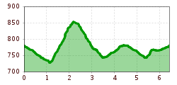
- Elevation uphill:196 hm
- Elevation downhill:199 hm
Elevation profile
Best time of year
- JanJanuary
- FebFebruary
- MarMarch
- AprApril
- MayMay
- JunJune
- JulJuly
- AugAugust
- SepSeptember
- OctOctober
- NovNovember
- DecDecember
Source: TVB Wildschönau
